|
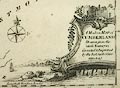
AA 1920s
|

|
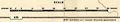
Road map, The Automobile Association Touring Map of
England and Wales, scale about 12 miles to 1 inch, published
for the AA by John Bartholomew and Sons, The Geographical
Institute, Duncan Street, Edinburgh, about 1920s.
|
|

|
|
|
|
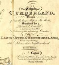
AA 1933
|
|
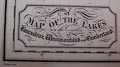
Road maps, Bartholomew's Quarter Inch to Mile Motoring
Map of Great Britain, scale about 4 miles to 1 inch,
produced for the Automobile Association, AA, by John
Bartholomew and Son, Edinburgh, 1933.
|

|

|
|
|
|
Abraham 1880s
|
|
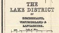
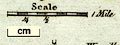
Relief map, Model of the Lake District, scale about 6 ins
to 1 mile, made by George Abraham, photographer, Keswick,
Cumberland, 1880s?
|
|
|
|
|
|
Adams 1677
|
|
Road map, thematic route map, Angliae Totius Tabula cum
Distantiis Notioribus in Itinerantium Usum Accommodata, Map
of England with Reputed Distances, by John Adams, 1677,
published in a later edition by Philip Lea, London.
|
|
|
|
|
|
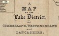
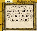
Adams 1852 map
|
|
Map of the Lake District, published by W J Adams, 59
Fleet Street, London, 1852.
|
|
|
|
|
|
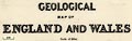
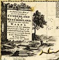
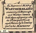
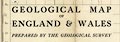
Agricultural Society
1852-68
|
|
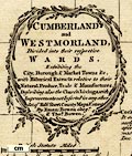
Geological Map of Westmorland, 1868, and Geological Map
of Cumberland, 1852, published for the Royal Agricultural
Society by J Murray, London, 1852-68.
|
|
|
|
|
|
Aikin 1790
|
|
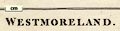
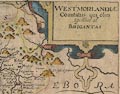
Maps, Westmoreland, scale about 8.5 miles to 1 inch, and
Cumberland, by John Aikin, London, 1790; published 1790 to
1803.
|

|
|
|
|
|
|
|
|
|
|
|
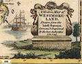
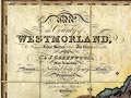
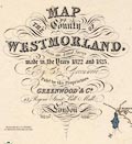
Allison 1834 map
|
|
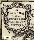
A New and Correct Map of the Lakes of Cumberland,
Westmoreland, and Lancashire, scale about 4 miles to 1 inch,
engraved by J Roy, Carlisle, published by J Allison,
Penrith, Cumberland, 1839.
|
|
|
|
|
|
Amalgamated Press 1930s
|
|
Road map, set of 31 map cards plus a general index map,
presented with the New Motoring Encyclopedia, published by
the Amalgamated Press, Fleetway House, London, perhaps
1930s.
|
|
|
|
|
|
Andrews 1797
|
|
Historical maps, Historical Atlas of England, published
by John Andrews, 211 Piccadilly, London, 1797.
|
|
|
|
|
|
Antonine Itineraries
|
|
Road map, the Antonine Itineraries, Itinerarium
Provinciarum Antonini Augusti, 255 routes in the Roman
Empire, perhaps 3rd century.
|
|
|
|
|
|
Arrow Games 1974
|
|
Jigsaw puzzle map, Our Counties, scale about 35 miles to
1 inch, new counties and regions for UK, made by Arrow
games, Eire, about 1974.
|
|
|
|
|
|
Arrowsmith 1825
|
|
Maps, Diocese of Carliol with the Diocese of Dunolm,
Carlisle and Durham, and Dioces of Cestr, Chester, in the
time of Henry VIII, 1535, scale about 6 miles to 1 inch, by
Aaron Arrowsmith, London, 1825.
|

|
|
|
|
|
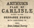
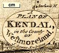
Arthur 1880
|
|
Town plan, Arthur's Plan of Carlisle, scale about 12.5
ins to 1 mile, published by A B Moss, 73 English Street,
Carlisle, Cumberland, 1880.
|
|
|
|
|
|
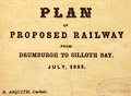
Asquith 1853
|
|
Railway map, Plan of proposed Railway from Drumburgh to
Silloth Bay, scale about 1 mile to 1 inch, by R Asquith,
printed by Hudson Scott, Carlisle, Cumberland, 1853.
|
|
|
|
|
|
Associated Newspapers 1930s
|
|
Road book, 3 Miles to 1 Inch Road Atlas, maps of England,
Scotland and Wales, scale about 1 to 190000, 3 miles to 1
inch, plus road strip maps and street maps, by W and A K
Johnston, Edinburgh, Lothian, published by Associated
Newspapers, London, 1930s?
|
|
|
|
|
|
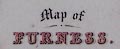
Atkinson 1840s-50s
|
|
Map of Furness, scale about 6 miles to 1 inch, engraved
by W H Lizars, Edinburgh, published by David Atkinson,
Ulverston, Lancashire now Cumbria, 1840s-50s.
|
|
|
|
|
|
Atkinson 1847 map
|
|
Map of the Lake District, scale about 4 miles to 1 inch,
by Thomas Hill, perhaps engraved by W H LIzars, published by
Thomas Atkinson, Kendal, Westmorland, 1847-53.
|
|
|
|
|
|
Backhouse 1773
|
|
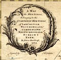
Map of the Meetings belonging to the Quarterly Meetings
of Lancaster, Westmorland, Cumberland, Northumberland,
Durham and York, scale about 9 miles to 1 inch, by James
Backhouse, engraved by Thomas Kitchin, published by James
Backhouse, Darlington, Durham, 1773.
|
|
|
|
|
|
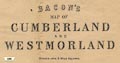
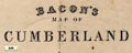
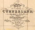
Bacon 1870s
|
|
Railway map, Bacon's Map of Cumberland and Westmorland,
scale about 2.5 miles to 1 inch, by Edward Weller, published
by George W Bacon and Co, London, 1870s?.
|
|
|
|
|
|
Bacon 1895
|
|
Maps, The Commercial and Library Atlas of the British
Isles from the Ordnance Survey, published by G W Bacon and
Co, Strand, London, 1895.
|
|
|
|
|
|
Bacon 1896-1902
|
|
Bacon's County Map and Guide, Bacon's Map of Cumberland
and Westmorland, scale about 3.5 miles to 1 inch, by George
W Bacon and Co, 127 Strand, London; published 1896-1902.
|
|
|
|
|
|
Bacon 1900s
|
|
Map, Cumberland and Westmorland Lake District, or
Waistcoat Pocket Map of Lake District, scale about 5 miles
to 1 inch, published by G W Bacon and Co, 127 Strand,
London, about 1900s?
|

|
|
|
|
|
Bacon 1910s
|
|
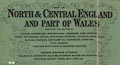
Map, North and Central England and Part of Wales, scale
about 5 miles to 1 inch, by G W Bacon and Co, Norwich
Street, Fetter Lane, London, published by British
Geographical Publishing Co, Royal London Buildings,
Manchester, 1910s?
|
|

|
|
|
|
Bacon 1910s B
|
|
Road book, road maps and itineraries, Bacon's Up-to-date
Cycling Pocket Road Book of England and Wales, published by
G W Bacon and Co, 127 Strand, London, 1900s.
|
|
|
|
|
|
Bacon 1910s B map
|
|
Road map, Cycling Road Map of England and Wales, scale
about 17 miles to 1 inch, published by G W Bacon and Co, 127
Strand, London, 1910s.
|

|
|
|
|
|
Bacon c1890s
|
|
Railway map, Bacon's Map of Cumberland, scale about 3.5
miles to 1 inch, by G W Bacon and Co, 127 Strand, London,
about 1890s?
|
|
|
|
|
|
Bacon c1907
|
|
Railway map and political map, colour printed, Cumberland
and Westmorland, scale about 3.5 miles to 1 inch, by G W
Bacon and Co, 127 Strand, London, about 1907.
|
|
|
|
|
|
Bacon c1920
|
|
Map of England and Wales, scale about 8 miles to 1 inch,
by G W Bacon and Co, Norwich Street, London, published by
The Chart Publishing Co, 7 St John Street, Oxford, about
1920.
|

|

|
|
|
|
Baddeley 1930s map
|
|
Maps, The Lake District, and other maps, by John
Bartholomew and Co, Edinburgh, published by Ward, Lock and
Co, Warwick House, Salisbury Square, London, 1930s.
|
|

|
|
|
|
Badeslade 1742
|
|
Maps, Westmorland North from London, scale about 10 miles
to 1 inch, and Cumberland North from London, scale about 11
miles to 1 inch, with descriptive text, by Thomas Badeslade,
London, engraved and published by William Henry Toms, Union
Court, Holborn, London, 1742; published 1742-49.
|

|

|
|
|
|
|
|
|
|
|
|
Baedeker 1927 map 1
|
|
Map, England and Wales, with railways, scale about 23
miles to 1 inch, by Wagner and Debes, Leipzig, Germany,
1927? based on the Ordnance Survey.
|
|
|
|
|
|
Baedeker 1927 map 2
|
|
Map, The Lake District, now Cumbria, scale about 3 miles
to 1 inch, by Wagner and Debes, Leipzig, Germany, 1927?
based on the Ordnance Survey.
|
|
|
|
|
|
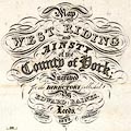
Baines 1822
|
|
Map of the West Riding and Ainsty of the County of York,
scale about 5.5 miles to 1 inch, by Alfred Smith, published
by Edward Baines, Leeds, Yorkshire, 1822.
|
|

|
|
|
|
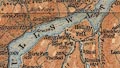
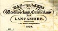
Baines 1829 map
|
|
Map of the Lakes of Westmoreland, Cumberland and
Lancashire, scale about 4 miles to 1 inch, by/for Edward
Baines, engraved by W H Lizars, Edinburgh, published by
Hurst, Chance and Co, London et al, 1830.
|
|
|
|
|
|
Baker 1791-95
|
|
Maps, Westmoreland, scale about 5.5 miles to 1 inch, and
Cumberland, scale about 8 miles to 1 inch, engraved by
Benjamin Baker, Islington, London, about 1795 and 1791.
|
|
|
|
|
|
Baker 1802
|
|
Perspective road map with sections in Lancashire,
Westmorland, and Cumberland, by J Baker, London 1802.
|
|
|
|
|
|
Balderston c1890 map
|
|
Map, the hills and caves in the Ingleton area, probably
by Robert R Balderston, engraved by Goodall and Suddick,
Leeds, West Yorkshire, about 1890.
|
|
|
|
|
|
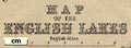
Barber 1873 map
|
|
Map of the English Lakes, parts of Lancashire, Cumberland
and Westmorland, now Cumbria, scale about 3.5 miles to 1
inch, published by The Graphotyping Co, 7 Garrick Street and
Simpkin, Marshall and Co, Stationers' Hall Court, London,
and by J Atkinson, King Street, Ulverston, Cumberland, about
1873.
|
|
|
|
|
|
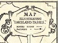
Barber and Atkinson 1927
map
|
|
Map Illustrating Lakeland Passes, scale about 5.5 miles
to 1 inch, published by James Atkinson, Caxton Printing
Works, Ulverston, Lancashire, 1928.
|
|
|
|
|
|
Barrow 1886 map
|
|
Map of Mountain Ascents in Cumberland and Westmorland, by
John Barrow, published by Sampson Low, London, 1886.
|
|
|
|
|
|
Barrow Herald 1865
|
|
Railway map, Furness Railway, Lancashire, scale about 1.5
inches to 1 mile, published by the Barrow Herald,
Barrow-in-Furness, Lancashire, 1865.
|

|

|
|
|
|
Bartholomew 1870s
|
|
Map, The Lake District, scale about 4 miles to 1 inch, by
J Bartholomew, Edinburgh, published by Simpkin, Marshall and
Co, Stationers' Hall Court, London and J Heywood, Deansgate,
Manchester, 1870s?
|

|
|
|
|
|
Bartholomew 1875-88
|
|
Maps, Westmorland, scale about 6 miles to 1 inch, and
Cumberland? by John Bartholomew, published by W and A K
Johnston, Edinburgh, 1875-88.
|
|
|
|
|
|
Bartholomew 1880s
|
|
Map of The Lake District, in Cumberland, Westmorland, and
Lancashire, scale about 4 miles to 1 inch, by John
Bartholomew and Co, Edinburgh, Lothian, Scotland, about
1880s?
|

|
|
|
|
|
|
|
|
|
|
|
Bartholomew 1880s-90s
|
|
Maps, 3 sheets, Lake District North Section, ... Central
Section, and ... South Section, Westmorland and Cumberland,
scale about 2 miles to 1 inch, published by John Bartholomew
and Son, Edinburgh, late 19th century?
|
|
|
|
|
|
Bartholomew 1899
|
|
Maps, The Royal Atlas of England and Wales, scale about 4
miles to 1 inch and other scales, by John Bartholomew,
Edinburgh, Lothian, 1899-1900.
|

|
|
|
|
|
Bartholomew 1900
|
|
General Map of the Lake District, scale about 3 miles to
1 inch, and associated part maps, by John Bartholomew and
Co, Edinburgh, Lothian, published by Adam and Charles Black,
London, 1900.
|

|

|
|
|
|
Bartholomew 1900s
|
|
Travelling Maps series, Reduced Ordnance Survey Maps,
various scales, by John Bartholomew and Co, Edinburgh,
published by W H Smith and Son, 186 Strand, London, about
1900s.
|

|
|
|
|
|
Bartholomew 1900s-20s
|
|
Map, Cumberland and Westmorland, scale about 4 miles to 1
inch, by John Bartholomew and Son, Edinburgh, early 20th
century?
|
|
|
|
|
|
Bartholomew 1920s
|
|
Tourist's Map of England and Wales, scale about 10.5
miles to 1 inch, published by John Bartholomew and Son, The
Geographical Institute, Duncan Street, Edinburgh, Lothian,
1920s?
|
|

|
|
|
|
Bartholomew 1920s m
|
|
Contour Motoring Map of the British Isles, scale about
15.5 miles to 1 inch, by John Bartholomew and Son, The
Edinburgh Geographical Institute, 12 Duncan Street,
Edinburgh, Lothian, about 1920.
|
|
|
|
|
|
Bartholomew 1930s
|
|
Map series, Bartholomew's Half Inch to Mile Map of
England and Wales, scale 2 miles to 1 inch, published by
John Bartholomew and Son, The Geographical Institue, Duncan
Street, Edinburgh, Scotland, about 1930s.
|
|
|
|
|
|
Bartholomew 1940s
|
|
Map series, Bartholomew's Half Inch Series, scale 2 miles
to 1 inch, published by John Bartholomew and Son, The
Geographical Institute, Duncan Street, Edinburgh, Scotland,
about 1940s-50s.
|
|
|
|
|
|
Bartholomew c1900
|
|
Geological Map of the British Isles, scale about miles 63
to 1 inch, by John Bartholomew, Edinburgh, about 1900?
|
|
|
|
|
|
Batty 1888
|
|
Map, Principal Mountains of Westmorland and Cumberland,
scale about 4.5 miles to 1 inch, by E C Batty, published by
Sampson Low, Marston, Searle, and Rivington, St Dunstan's
House, Fetter Lane, Fleet Street, London, 1888.
|
|
|
|
|
|
Bazaar 1890
|
|
Road map, The Tourist Route Map of England and Wales,
published by the Bazaar Exchange and Mart Office, 170
Strand, London, about 1890.
|
|

|
|
|
|
Beeching 1963
|
|
Series of maps, British Railways Distribution of
Passenger Traffic Station Receipts, British Railways
Proposed Withdrawl of Passenger Train Services, British
Railways Liner Train Routes and Terminals under
Construction, etc, published by British Railways Board and
HMSO, London, 1963.
|
|
|
|
|
|
Bell 1833
|
|
Maps, Westmoreland, scale about 5.5 miles to 1 inch, and
Cumberland, scale about 8 miles to 1 inch, by James Bell?
engraved by R Scott, published by Archibald Fullarton and
Co, Glasgow, Strathclyde, about 1833-34; published
1833-46.
|
|
|
|
|
|
|

|
|
|
|
|
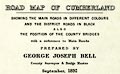
Bell 1892
|
|
Road Map of Cumberland, by George Joseph Bell, scale
about 2.5 miles to 1 inch, printed by Charles Thurnam and
Sons, Carlisle, Cumberland, 1892.
|
|
|
|
|
|
Berry 1679
|
|
Road map, diagram, The Grand Roads of England, engraved
by John Rich, made and published by William Berry, at the
Sign of the Globe, London, 1679.
|
|
|
|
|
|
Bickham 1753-54
|
|
Maps, A Map of Westmorland, 1753, and A Map of
Cumberland, 1754, by George Bickham, James Street, Bunhill
Fields, London; published 1750s-96.
|
|
|
|
|
|
|

|
|
|
|
|
Bill 1626
|
|
Maps, Westmor Land, scale about 17 miles to 1 inch, and
Cumberland? probably derived from the map by Peter Keer,
1599, by John Bill, London, 1626.
|
|
|
|
|
|
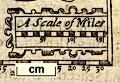
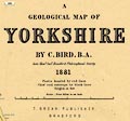
Bird 1881
|
|
Geological Map of Yorkshire, scale about 4 miles to 1
inch, by C Bird, printed by W and A K Johnston, Edinburgh,
published by T Brear, Bradford, Yorkshire, 1881.
|
|

|
|
|
|
Black 1841 map
|
|
Map, The Lake District of Cumberland, Westmorland and
Lancashire, ie Cumbria, scale about 3.5 miles to 1 inch,
inserted in Black's Picturesque Guide to the Lakes,
published by Adam and Charles Black, North Bridge,
Edinburgh, Lothian, 1841. And 4 small maps of parts of the
Lake District:- Derwent Water and Bassenthwaite; Buttermere,
Crummock and Lowes Water; Winandermere, Coniston and
Grasmere; and Ulles Water; each about 1.5 to 2.5 miles to 1
inch.
|
|
|
|
|
|
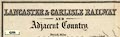
Black 1850 map
|
|
Map, Lancaster and Carlisle Railway and Adjacent Country,
through Lancashire, Westmorland and Cumberland, scale about
7.5 miles to 1 inch, by John Bartholomew, Edinburgh,
published by Adam and Charles Black, 27 North Bridge,
Edinburgh, Lothian, about 1850-52.
|
|
|
|
|
|
Black 1850s map
|
|
Map, Lake District of Cumberland, Westmorland and
Lancashire, scale about 5 miles to 1 inch, engraved by S
Hall, Bury Street, Bloomsbury, London, published by A and C
Black, Edinburgh, 1850s.
|
|
|
|
|
|
Black 1870s
|
|
Black's Road and Railway Travelling Map of England, scale
about 14 miles to 1 inch, engraved by S Hall, published by A
and C Black, Edinburgh, Lothian, early 1870s.
|
|
|
|
|
|
Black 1884 map
|
|
Series of small maps printed in the text of Black's Guide
to The Lakes, 1884.
|
|
|
|
|
|
Black 1892
|
|
Maps, Westmorland, scale about 6 miles to 1 inch,
Cumberland? and Lake District, scale about 3 miles to 1
inch, by John Bartholomew and Co, Edinburgh Geographical
Institute, published by A and C Black, London, 1892.
|

|
|
|
|
|
|
|

|
|
|
|
Black 1903
|
|
Map, England and Wales, Northern Part, published in an
atlas by Adam and Charles Black, Edinburgh, 1903.
|
|
|
|
|
|
Black 1905 map
|
|
Sketch Map of the English Lake District, by John
Bartholomew, Edinburgh, published by Adam and Charles Black,
London, 1905
|

|
|
|
|
|
Blaeu 1645
|
|
Maps, Westmoria Comitatus or Westmorland, scale about 2.5
miles to 1 inch, and Cumbria or Cumberland, scale about 3.5
miles to 1 inch, by Johann Blaeu, Amsterdam, Netherlands,
1645, published 1645-72.
|

|

|
|
|
|
|
|

|
|
|
|
Blair 1909 map
|
|
Map of the Roman Wall, in Cumberland and Northumberland,
scale about 2 miles to 1 inch, derived from a survey for the
Duke of Northumberland, 1853, by Robert Blair, 1909?
|
|
|
|
|
|
Blome 1673
|
|
Maps, Mapp of ye Countie of Westmorland, scale about 3
miles to 1 inch, and A Generall Mapp of the Countie of
Cumberland, scale about 4 miles to 1 inch, by Richard Blome,
probably engraved by Richard Palmer, published, London,
1673; published 1673-77.
|
|
|
|
|
|
|
|
|
|
|
|
|
|
|
|
|
|
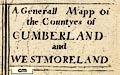
Blome 1681
|
|
Generall Mapp of the Countyes of Cumberland and
Westmoreland, scale about 4 miles to 1 inch, derived from
Speed 1611, by Richard Blome, engraved by Richard Palmer,
?1673, re-engraved? and published 1681; published
1681-1735.
|
|
|
|
|
|
Bowen 1720
|
|
Road book, Britannia Depicta Or Ogilby Improv'd,
including road strip maps with sections in Westmorland and
Cumberland, scale about 2 miles to 1 inch, derived from maps
by Ogilby, 1675, also a county map of Westmorland, scale
about 8 miles to 1 inch, and of Cumberland, scale about 16.5
miles to 1 inch, each with text, by John Owen, published by
Emanuel Bowen, London, 1720; published 1720-64.
|
|
|
|
|
|
|
|
|
|
|
|
Bowen 1762
|
|
Maps, Westmoreland, scale about 10 miles to 1 inch, and
Cumberland, scale about 11 miles to 1 inch, by Emanuel
Bowen, 1762, published by W Owen, Homer's Head, Fleet
Street, London, 1762 in a monthly series of county maps;
published 1762-63.
|
|
|
|
|
|
Bowen 1763
|
|
Map, Improved Map of the Counties of Cumberland and
Westmoreland, scale about 5.5 miles to 1 inch, derived from
a larger map by Bowen or Kitchin, by Emanuel Bowen, London,
about 1763; published 1763-1828.
|
|
|
|
|
|
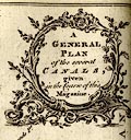
Bowen 1773
|
|
A General Plan of the Several Canals given in the Course
of this Magazine, engraved by Thomas Bowen, published by the
Gentleman's Magazine, 1773.
|
|
|
|
|
|
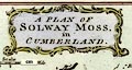
Bowen 1779
|
|
A Plan of Solway Moss, scale about 1 inch to 1 mile, by
Thomas Bowen, published by D Henry, St John's Gate, London,
February 1779.
|
|
|
|
|
|
Bowen and Bowen 1767
|
|
Map, Cumberland and Westmorland, scale about 9 miles to 1
inch, by Emanuel Bowen and Thomas Bowen, published by Thomas
Kitchin, 59 Holborn Hill, London, about 1767; published 1767
to 1793.
|
|
|
|
|
|
Bowen and Kitchin 1760
|
|
New Map of the Counties of Cumberland and Westmoreland,
scale about 4 miles to 1 inch, by Emanuel Bowen and Thomas
Kitchin, published by T Bowles, John Bowles and Son, Robert
Sayer, and John Tinney, 1760; published 1760-87.
|
|
|
|
|
|
Bowes 1590
|
|
Maps, on playing cards, ?Westmorland and ?Cumberland, by
William Bowes, probably engraved by Augustine Ryther, issued
1590.
|
|
|
|
|
|
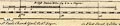
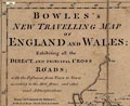
Bowles 1773
|
|
Road map, Bowles's New Travelling Map of England and
Wales, scale about 19 miles to 1 inch, by Carington Bowles,
69 St Paul's Churchyard, London, 1773.
|
|
|
|
|
|
Bowles 1782
|
|
Road book, strip maps with routes in Westmorland and
Cumberland etc, scale about 3 miles to 1 inch, derived from
maps by Ogilby, 1675, published by Carington Bowles, London,
1782.
|
|
|
|
|
|
Bowles 1785
|
|
Maps, Bowles's Reduced Map of Westmoreland, scale about
7.5 miles to 1 inch, and of Cumberland? by Carington Bowles,
69 St Paul's Churchyard, London, 1785.
|
|
|
|
|
|
BP 1950s
|
|
Pictorial map, The Lake District, scale about 3.5 miles
to 1 inch, by Goetz, published by BP, London, about
1950.
|

|
|
|
|
|
Brabant 1902 map
|
|
A Map of the Lake District, scale about 8 miles to 1
inch, by B C Boulter, published by Methuen and Co, 36 Essex
Street, Strand, London, 1902.
|

|
|
|
|
|
Bradley 1901 map
|
|
Map of Author's Route, in The Lakes, Westmorland,
Cumberland and Lancashire, scale about 8.5 miles to 1 inch,
drawn for A G Bradley, published by Macmillan and Co,
London, 1901.
|
|
|
|
|
|
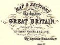
Bradshaw 1839
|
|
Map and Sections of the Railways of Great Britain,
published by George Bradshaw, 1839.
|
|
|
|
|
|
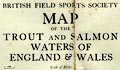
British Field Sports Society
1950s
|
|
Map of the Trout and Salmon Waters of England and Wales,
acessible to visitors, scale about 15 miles to 1 inch, by
Edward Standford, 12-14 Long Acre, published by the British
Field Sports Society, 3 St James's Square, London,
1950s?
|
|

|
|
|
|
British Railways 1950s
|
|
Railway map, colour printed, English Lake District
Resorts, issued by British Railways, 1950s.
|
|
|
|
|
|
British Railways 1950s B
|
|
Railway map, colour lithograph, British Railways, whole
of Great Britain, published by British Railways, BR, London,
1950s?
|

|
|
|
|
|
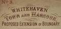
Brodie 1890
|
|
Town plan, Whitehaven Town and Harbour, Proposed
Extension, scale about 6 ins to 1 mile, by John S Brodie,
town surveyor, printed by Welsh, Moss and Co, Whitehaven,
Cumberland, 1890.
|
|
|
|
|
|
Brookes 1773 map
|
|
A New Map of England and Wales, scale about 60 miles to 1
inch, engraved by G Relles, inserted in Brookes's Gazetteer,
published London, 3rd edition, 1773.
|
|
|
|
|
|
Browne 1896
|
|
Map, The Roads of Applethwaite Common, scale about 2
inches to 1 mile, by Benjamin Browne, Boot, Eskdale, for
Windermere Urban District Council, Windermere, Westmorland,
1896.
|
|
|
|
|
|
Bulmer 1884 map
|
|
Cruchley's County Map of Cumberland, by G F Cruchley,
published by T Bulmer and Co, Manchester, Lancashire,
1884.
|
|
|
|
|
|
Burghley 1590
|
|
Map, ms ink on parchment, A Platt of the Opposete Borders
of Scotland to ye West Marches of England, scale about 2.5
miles to 1 inch, drawn for Lord Burghley, 1590.
|
|
|
|
|
|
Burrow 1920s
|
|
Road book, strip maps with parts in Westmorland,
Cumberland etc, irregular scales about 1.5 miles to 1 inch,
by E J Burrow and Co, Cheltenham, Gloucestershire,
1920s.
|

|
|
|
|
|
Burton 1894
|
|
Map of the Neighbourhood of Sedbergh, Yorkshire, scale
about 1 inch to 1 mile, by E Burton, published by Richard
Jackson, Commercial Street, Leeds, Yorkshire, 1894.
|

|
|
|
|
|
Butters 1803
|
|
Maps, Westmoreland, scale about 11.5 miles to 1 inch, and
Cumberland, by R Butters, 22 Fetter Lane, Fleet Street,
London, 1803.
|
|
|
|
|
|
Camden 1607 map
|
|
Maps, Westmorlandiae Comitatus, the County of
Westmorland, scale about 3.5 miles to 1 inch, and
Cumberlandia, Cumberland, scale about 5 miles to 1 inch, by
Christopher Saxton, 1576, engraved by William Kip, London,
1607; published 1607-1637.
|
|
|
|
|
|
|
|

|
|
|
|
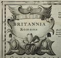
Camden 1695 map
|
|
Maps, Britannia Romana, and Britannia Saxonica, published
by A Swale, The Unicorn, St Paul's Churchyard, and by A and
J Churchil, The Black Swan, Paternoster Row, London,
1695.
|
|
|
|
|
|
|

|
|
|
|
|
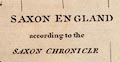
Camden 1789 map
|
|
Map, Saxon England according to the Saxon Chronicle,
engraved by John Sturt, London, 1695, reengraved edn
1789.
|
|
|
|
|
|
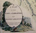
Carlyle 1791
|
|
Map, watercolour painting, A Plan of the City of Carlisle
and Places Adjacent, Cumberland, by Robert Carlyle snr,
1791.
|
|
|
|
|
|
Carr 1668
|
|
Road map, Description of all the Postroads in England,
scale about 40 miles to 1 inch? by Richard Carr from a draft
by James Hicks, chief clerk to the Post Office, engraved by
C Landts, London, 1668.
|
|
|
|
|
|
Cartwright 1799
|
|
Canal map, survey for the Lancaster Canal by William
Cartrwight, 1799.
|
|
|
|
|
|
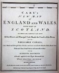
Cary 1787
|
|
Maps, Westmoreland, scale about 5 miles to 1 inch, and
Cumberland, scale about 6.5 miles to 1 inch, in Cary's New
and Correct English Atlas, by John Cary, 188 Strand, London,
1787; published as one part of a monthly series, 1787-89;
published 1787-93; and re-engraved from 1809.
|
|
|
|
|
|
|
|
|
|
|
|
Cary 1789
|
|
Maps, Map of Westmoreland, scale about 2.5 miles to 1
inch, and Map of Cumberland, scale about 3.5 miles to 1
inch, by John Cary, London, 1789; published 1789-1806.
|
|
|
|
|
|
|
|
|
|
|
|
Cary 1790
|
|
Maps, Westmoreland, scale about 11.5 miles to 1 inch,
Cumberland, scale about 15 miles to 1 inch, Lancashire,
scale about 18 miles to 1 inch, etc, by John Cary, 181
Strand, London, 1790; published 1790-1828.
|
|
|
|
|
|
Cary 1794
|
|
Maps, Westmorland, Cumberland, Lancashire etc on a New
Map of England and Wales, scale about 5 miles to 1 inch, by
John Cary, 181 Strand, London, 1794; published 1794-1824 and
later.
|
|

|
|
|
|
Cary 1796
|
|
Map, Cary's Reduction of his Large Map of England and
Wales, scale about 15 miles to 1 inch, published by John
Cary, 181 Strand, London, 1796.
|
|
|
|
|
|
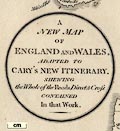
Cary 1798
|
|
Road book, Cary's New Itinerary, including a general map
and a map of the Environs of the Lakes, by John Cary,
published by G and J Cary, 86 St James's Street, London,
1798; published 1798-1828
|
|
|
|
|
|
Cary 1798 map 1
|
|
Road map, uncoloured engraving, A New Map of England and
Wales, scale about 20 miles to 1 inch, by John Cary,
published by G and J Cary, 86 St James's Street, London,
11th edn 1828.
|
|
|
|
|
|
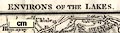
Cary 1798 map 2
|
|
Map, Environs of the Lakes, Westmorland, Cumberland etc,
scale about 5 miles to 1 inch, by John Cary, published by G
and J Cary, 86 St James's Street, London, 1798? 9th edn 1821
and 11th edn 1828.
|
|
|
|
|
|
Cary 1801
|
|
Maps, A New Map of Westmorland, and A New Map of
Cumberland, scale about 3.5 miles to 1 inch, by John Cary,
181 Strand, London, 1801, published 1809-34.
|
|
|
|
|
|
Cary 1809
|
|
Maps, Westmoreland, scale about 5 miles to 1 inch, and
Cumberland? by John Cary, 181 Strand, London, 1809 or later
edition.
|
|
|
|
|
|
|
|
|
|
|
|
Cary 1824
|
|
Maps, A New Map of Westmoreland, scale about 2.5 miles to
1 inch, and A New Map of Cumberland, scale about 3.5 miles
to 1 inch, 1824, published by John Cary, 86 St James's
Street, London, 1829.
|
|
|
|
|
|
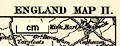
Cassell 1893
|
|
Map, England Map II and other sheets, scale about 7 miles
to 1 inch, by W and A K Johnston, Edinburgh and London, and
by Cassell and Co, London, 1893-98.
|
|
|
|
|
|
Census 1891 map
|
|
Maps, Division VIII North Western Counties, Lancashire
and Cheshire, and Division X, Northern Counties, showing
census registration areas for Durham, Northumberland,
Cumberland and Westmorland, for extracts from the Census
1891, scale about 12 miles to 1 inch, published by HMSO,
London, 1894.
|

|

|
|
|
|
Census 1901 map
|
|
Maps, Westmorland, Cumberland, and Lancashire, to
illustrate extracts from the Census 1901, scale about 4
miles to 1 inch, printed by the Ordnance Survey,
Southampton, Hampshire, published by HMSO, London, 1902.
|

|

|
|
|
|
Chambers 1890s
|
|
Map, England and Wales, published by W and R Chambers,
Edinburgh, Lothian, 1890s.
|

|
|
|
|
|
Children's Friend 1869
|
|
Maps, thumbnail size, Lancashire, and presumably
Westmorland and Cumberland, published in The Children's
Friend, by S W Partridge and Co, London, 1869..
|
|
|
|
|
|
Church Commission 1836
|
|
Diocesan map, proposed new Carlisle and Man Diocese, by
the Church Commissioners, scale about 10.5 miles to 1 inch,
lithographed by Samuel Arrowsmith, published by the House of
Commons, Westminster, London, 1836.
|
|
|
|
|
|
Clarendon Press 1964
|
|
Relief map, moulded plastic, Oxford Plastic Relief Maps
series 4 map 7, Lake District - Newcastle upon Tyne, scale
about 6 miles to 1 inch, based on OS mapping by the
Clarendon Press, Oxford, Oxfordshire, 1964.
|
|
|
|
|
|
Clark and Hughes 1890 map
|
|
Map of the Vale of Dent and Surrounding Country, Dent,
Yorkshire, scale about 1.5 miles to 1 inch, published by
Cambridge University Press, Cambridge, Cambridgeshire,
1890.
|
|
|
|
|
|
Clarke 1787 map
|
|
Maps, series issued in a guide book, A Survey of the
Lakes of Cumberland, Westmorland, and Lancashire, by James
Clarke, Penrith, Cumberland, engraved by S J Neele, 352
Strand, London, published 1787-89; and in Plans of the Lakes
... 1793.
|
|

|
|
|
|
Clarke and Collins 1852
|
|
Maps, Westmorland, scale about 3 miles to 1 inch, and
Cumberland, scale about 4.5 miles to 1 inch, by ?Benjamin
Clarke, published by Henry George Collins, Paternoster Row,
London, 1852.
|

|
|
|
|
|
Close 1805
|
|
A Map of Furness, Lancashire, scale about 4 miles to 1
inch, drawn by William Close, engraved by R Hixon, Strand,
London, published by George Ashburner, Ulverston,
Lancashire, 1805.
|
|
|
|
|
|
Cobbett 1832
|
|
Maps, Westmoreland, scale about 7 miles to 1 inch, and
Cumberland, scale about 20 miles to 1 inch, by William
Cobbett, 11 Bolt Court, Fleet street, London, 1832.
|
|
|
|
|
|
|
|
|
|
|
|
Cole and Roper 1805
|
|
Maps, Westmoreland, scale about 6 miles to 1 inch, and
Cumberland, scale about 8 miles to 1 inch, by G Cole, and
other counties, engraved by J Roper, published by Vernor,
Hood and Sharpe, Poultry, London, 1805; published
1805-58.
|
|
|
|
|
|
|
|
|
|
|
|
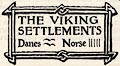
Collingwood 1899 map 1
|
|
Map, The Viking Settlements, scale roughly 21 miles to 1
inch, by W G Collingwood, published for the Cumberland and
Westmorland Antiquarian and Archaeological Society, by Titus
Wilson, Kendal, Westmorland, 1899.
|
|
|
|
|
|
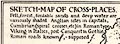
Collingwood 1899 map 2
|
|
Sketch Map of Cross Places, Westmorland, Cumberland and
surrounding areas, scale roughly 13.5 miles to 1 inch, by W
G Collingwood, published for the Cumberland and Westmorland
Antiquarian and Archaeological Society, by Titus Wilson,
Kendal, Westmorland, 1899.
|
|
|
|
|
|
Collins 1849-52
|
|
Maps, Westmorland, scale about 3 miles to 1 inch, and
Cumberland, scale about 4.5 miles to 1 inch, for The British
Gazetteer by Benjamin Clarke, published by Henry G Collins,
22 Paternoster Row, London, 1849-52.
|
|
|
|
|
|
Collins 1850
|
|
Maps, Westmoreland, scale about 8 miles to 1 inch, and
Cumberland, scale about 11.5 miles to 1 inch, published by
Henry G Collins, 22 Paternoster Row, London, 1850; published
1850-68.
|
|
|
|
|
|
Collins 1852
|
|
Railway maps, Collins' Pocket Ordnance Railway Atlas of
Great Britain, scale about 36 miles to 1 inch, published by
H G Collins, 22 Paternoster Row, London, 1852.
|
|
|
|
|
|
Collins 1870s map
|
|
Map or maps, Westmorland? and Cumberland? published by
William Collins, Sons and Co, Bridewell Place, New Bridge
Street, London, 1870s?
|
|
|
|
|
|
Cooke 1802
|
|
Maps, Westmoreland, scale about 12 miles to 1 inch, and
Cumberland, scale about 15.5 miles to 1 inch, Lancashire,
scale about 18 miles to 1 inch, and The Lakes, scale about
8.5 miles to 1 inch, by George Alexander Cooke, London,
1802-10; published 1802-24.
|
|
|
|
|
|
|
|
|
|
|
|
Cooper 1808
|
|
Maps, Westmoreland, scale about 9 miles to 1 inch, and
Cumberland, scale about 10.5 miles to 1 inch, by H Cooper,
1808, published by R Phillips, Bridge Street, Blackfriars,
London, 1808; published 1808-29.
|

|
|
|
|
|
|
|
|
|
|
|
Coppo 1520s
|
|
Map, woodcut, British Isles, by Pietro Coppo, Pirano?
1524-26? published by Augustino di Bindoni, Venice, Italy,
1528
|
|
|
|
|
|
Cowley 1743
|
|
Maps, Improved Map of Westmoreland, scale about 5.5 miles
to 1 inch, and Improver Map of Cumberland, by J Cowley,
London, 1743; published 1743-45.
|
|
|
|
|
|
Cox 1720-31
|
|
Maps, Magna Britannia et Hibernia, Antiqua et Nova, or A
New Survey of Great Britain, published by various people
including Thomas Cox, at The Lamb, Royal Exchange, Cornhill,
London, 1720-31?
|
|
|
|
|
|
Crabb 1819
|
|
Maps, Westmorland and Cumberland? in a set of playing
cards published by T Crabb, London, 1819.
|
|
|
|
|
|
Crawford 1804
|
|
Map of Dumfriesshire, scale about 1 inch to 1 mile, by
William Crawford, engraved by Kirkwood and Sons, Edinburgh,
fancy lettering designed by George Paton, published
1804.
|

|
|
|
|
|
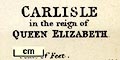
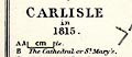
Creighton 1889 map
|
|
Maps, Carlisle in the reign of Queen Elizabeth, scale
about 17 inches to 1 mile, and Carlisle in 1815, scale about
10 inches to 1 mile, litho by E Weller, published by
Longmans and Co, London, 1889.
|
|
|
|
|
|
|
|
|
|
|
|
Crosby 1822 map
|
|
Maps, Westmorland and Cumberland? drawn and/or engraved
by J Cox or J Walker, published by John Bumpus, Holborn
Bars, London, 1822.
|
|
|
|
|
|
Crosthwaite 1783-94
|
|
Series of maps, An Accurate Map of the Matchless Lake of
Derwent, of the Grand Lake of Windermere, of the Beautiful
Lake of Ullswater, of Broadwater or Bassenthwaite Lake, of
Coniston Lake, of Buttermere, Crummock and Loweswater Lakes,
and Pocklington's Island, by Peter Crosthwaite, Kendal,
Cumberland now Cumbria, 1783 to 1794.
|
|
|
|
|
|
Crosthwaite 1860s
|
|
Railway map, Map of the Lake District of Cumberland,
Westmorland and Lancashire, or Tourists Map of ..., scale
about 10 miles to 1 inch, published by Crosthwaite and Co, 1
and 2 Market Place, Whitehaven, Cumberland, 1860s.
|
|
|
|
|
|
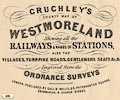
Cruchley 1856
|
|
Maps, Cruchley's County Map of Westmoreland, scale about
2.5 miles to 1 inch, and of Cumberland, scale about 6.5
miles to 1 inch, by George F Cruchley, 81 Fleet Street,
London, 1856; published 1856 to about 1885.
|
|
|
|
|
|
|
|
|
|
|
|
Cruchley 1858
|
|
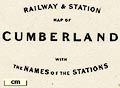
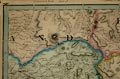
Railway maps, Cruchley's Complete Railway and Station Map
of England and Wales, scale about 2 miles to 1 inch,
published by G F Cruchley, 81 Fleet Street, London,
1858.
|
|
|
|
|
|
Cruchley 1862
|
|
Railway maps or map, Westmorland, Cumberland?
lithographic reproduction of the map by John Cary, 1790,
amended by George Frederick Cruchley, 81 Fleet Street,
London, published 1862.
|
|
|
|
|
|
Cruchley 1863
|
|
Map or maps, Westmorland, Cumberland? lithographic
reproduction of the map by John Cary, 1787, amended and
published by George Frederick Cruchley, 81 Fleet Street,
London, 1863; published 1863-75.
|
|
|
|
|
|
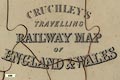
Cruchley 1870s
|
|
Railway map, Cruchley's Travelling Railway Map of England
and Wales, scale about 20 miles to 1 inch, by George F
Cruchley, published by Gall and Inglis, Edinburgh, Lothian,
1870s.
|
|
|
|
|
|
Cruchley c1870
|
|
Map, Westmorland and the Lake District, scale about 2.5
miles to 1 inch, by George F Cruchley, perhaps about
1870?
|

|

|
|
|
|
CTC 1899 map
|
|
Index map to accompany Cyclists' Touring Club British
Road Book, vol.3, Northen Counties, scale about 8.5 miles to
1 inch, drawn by R T Lang, 1897, published by E R Shipton,
47 Victoria Street, Westminster, London etc, 1899.
|

|

|
|
|
|
CTC 1911
|
|
Road Book, North West England, Cyclists' Touring Club
British Road Book new series vol.6, edited by F B Sandford,
Blencowe, Greystoke, Cumberland, published by Thomas Nelson
and Sons, London etc, 1911.
|
|
|
|
|
|
Dalziel and Stockdale 1990s
|
|
Pictorial map, Arthur Ransome in Lakeland, scale about
miles to 1 inch, by P Dalziel and M C Stockdale, published
by the Lake District Art Gallery and Museum Trust, Kendal,
Cumbria, 1990s?
|
|
|
|
|
|
Darton 1846
|
|
Map, The Circuit of the Lakes, in the Counties of
Cumberland, Westmoreland, and Lancashire, published by
Darton and Co, 58 Holborn Hill, London, 1846.
|
|
|
|
|
|
Davison 1800s-30s
|
|
Plan of the Mining District of Alston Moor, scale about 4
miles to 1 inch, engraved by W Collard, published by W
Davison, Alnwick, Northumberland, early 19th century?
|
|
|
|
|
|
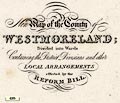
Dawson 1830s
|
|
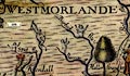
Political maps, Westmoreland, scale about 4 miles to 1
inch, and Cumberland, scale about 7.5 miles to 1 inch,
showing the proposed parliamentary divisions, and town maps
Carlisle, Kendal, Cockermouth, Whitehaven, Workington, at
larger scales, made for the Reform Bill 1832, by Lieut
Robert K Dawson RE, 1831.
|
|
|
|
|
|
|
|
|
|
|
|
Day and Son 1863
|
|
Map of England shewing the Lines of Railway Constructed
and in Course of Construction ..., engraved and published by
Day and Son, London, 1863.
|
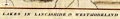
|
|
|
|
|
Dispatch 1863
|
|
Map, 2 sheets, Cumberland and Westmorland, scale about
3.5 miles to 1 inch, 1862, drawn and engraved by Edward
Weller, Duke Street, Bloomsbury, London, about 1863;
published 1863-1907.
|
|

|
|
|
|
Dix and Darton 1816
|
|
Maps, A New Map of the County of Westmoreland, and A New
Map of the County of Cumberland, scale about 4.5 miles to 1
inch, by Thomas Dix, North Walsham, Norfolk, published by
William Darton, 58 Holborn Hill, London, from 1816.
|
|
|
|
|
|
Doeg 1847
|
|
Map of the Railway between Carlisle and Lancaster, scale
about 4 miles to 1 inch, drawn by William Doeg, engraved and
published by Scott and Benson, Carlisle, Cumberland,
1847.
|
|
|
|
|
|
Donald 1774
|
|
Map, 3x2 sheets, The County of Cumberland, scale about 1
inch to 1 mile, by Thomas Donald, engraved and published by
Joseph Hodskinson, 29 Arundel Street, Strand, London,
1774.
|

|
|
|
|
|
Donald 1783
|
|
Map, The County of Cumberland, scale about 2 miles to 1
inch, surveyed by Thomas Donald, 1770-71, published by
Thomas Donald and Joseph Hodskinson, 35 Arundel Street,
Strand, London, 1783.
|
|

|
|
|
|
Dove Cottage 1981
|
|
Relief map, wood in layers, Wordsworth's Lake District,
scale nominally 1 inch to 1 mile, made about 1981?
|

|
|
|
|
|
Drayton 1612/1622
|
|
Map, Cumberlande and Westmorlande, by Michael Drayton in
part 2 of Polyolbion, probably engraved by William Hole;
published by John Marriott, John Grismand, and Thomas Dewe,
London, 1622.
|
|
|
|
|
|
Dugdale 1835
|
|
Maps, Westmoreland, scale about 5.5 miles to 1 inch, and
Cumberland, scale about 8.5 miles to 1 inch, by J Archer,
Pentonville, London, about 1835.
|

|
|
|
|
|
|

|
|
|
|
|
Duncan 1833
|
|
Maps, New Map of the County of Westmoreland, scale about
3 miles to 1 inch, and New Map of the County of Cumberland,
scale about 4 miles to 1 inch, by William Ebden, engraved by
Hoare and Reeves, published by James Duncan, Paternoster
Row, London, 1833; published 1833-45.
|
|
|
|
|
|
|

|
|
|
|
|
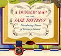
Dunlop 1950s
|
|
Pictorial map, A Dunlop Map of the Lake District, scale
about 4 miles to 1 inch, by J R Hart, published by Dunlop
Robber Co, about 1950?
|
|
|
|
|
|
Dury 1764
|
|
Map and chart of the coast of England on the Irish Sea,
part of Lancashire, Cumberland, and the coast of Scotland,
showing the Isle of Man, scale about 22 miles to 1 inch,
perhaps by John Rocque, published by Andrew Dury, Dukes
Court, London, 1764.
|
|
|
|
|
|
Ellis 1765
|
|
Maps, A Modern Map of Westmoreland, scale about 6 miles
to 1 inch, and of Cumberland, by John Ellis, London, 1765,
published by Carington Bowles, St Pauls Churchyard, and
Robert Sayer, Fleet Street, London, 1766.
|
|
|
|
|
|
|
|
|
|
|
|
Everybody's 1955
|
|
Map, The English Lakes, in a guide booklet, Everybody's
Pictorial Touring Maps, published by Everybody's magazine,
1955.
|

|
|
|
|
|
Faden 1810
|
|
Map, The County of Cumberland, and parts of Lancaster and
Westmorland making a map of The Lakes, scale about 2 miles
to 1 inch, surveyed by Thomas Donald, 1770-71, published by
William Faden, Charing Cross, London, 1810.
|
|
|
|
|
|
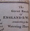
Feltham 1803 map 1
|
|
Map, The Great Roads of England and Wales, connecting the
watering places, scale about 61 miles to 1 inch, included in
A Guide to all the Watering and Sea Bathing Places, by John
Feltham, published by Richard Phillips, 71 St Paul's
Chuchyard, London, 1st edn 1803.
|
|
|
|
|
|
Feltham 1803 map 2
|
|
Map, The Lakes, parts of Westmorland, Cumberland, and
Lancashire, scale about 5 miles to 1 inch, by John Feltham?
1803.
|
|
|
|
|
|
Ferguson 1876
|
|
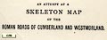
Road map, An Attempt at a Skeleton Map of the Roman Roads
of Cumberland and Westmorland, by R S Ferguson, published by
the Cumberland and Westmorland Archaeological and
Antiquarian Society, 1878.
|
|
|
|
|
|
Field 1956
|
|
Map of the Rivers of Great Britain, scale about 25 miles
to 1 inch, by Edward Stanford and Co, published for The
Field, London, 1956.
|
|
|
|
|
|
Fisher 1845
|
|
Maps, Westmorland, scale about 3.5 miles to 1 inch, and
Cumberland, scale about 5.5 miles to 1 inch, published by
Fisher, Son and Co, Caxton Press, Angel Street, St Martin's
le Grand, London, about 1845.
|
|
|
|
|
|
|
|

|
|
|
|
Flintoft 1834
|
|
Relief map, Model of the Lake District, scale about 3 ins
to 1 mile, made by Jospeh Flintoft, Keswick, Cumberland,
1834.
|
|
|
|
|
|
Ford 1839 map
|
|
Map of the Lake District of Cumberland, Westmoreland and
Lancashire, scale about 3.5 miles to 1 inch, published by
Charles Thurnam, Carlisle, and by R Groombridge, Paternoster
Row, London, and others, 1839; published 1839-52.
|
|

|
|
|
|
Fothergill 1900s
|
|
Road maps, Finger Post Strip Maps, or Finger Post Guides
to Road Junctions, a series perhaps including roads across
Westmorand or Cumberland? by Gerald Fothergill, published by
George Philip and Son, 32 Fleet Street, London, about
1900s.
|
|
|
|
|
|
Fryer 1814
|
|
Geological map of Cumberland, coloured on the county map
Cary 1787 edition of 1793, attributed to Joseph Fryer, about
1814.
|
|
|
|
|
|
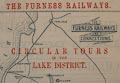
Furness Railway 1870s
|
|
Railway map, Furness Railways and Connections, scale
about 6 miles to 1 inch, printed for the Furness Railway by
Waddington and Co, Herald Office, Church Street,
Barrow-in-Furness, Lancashire, 1870s?
|
|
|
|
|
|
Furness Railway 1900s
|
|
Map of the Furness Railway and Connections, scale about 7
miles to 1 inch? by the Funress Railway, Cumbria, early 20th
century.
|
|
|
|
|
|
Gall and Inglis 1900s
|
|
Road maps, Inglis' New Graded Maps series, including
sheet 52, The Lake District, scale about 2 miles to 1 inch,
published by Gall and Inglis, 12 Newington Road, Edinburgh,
about 1900.
|
|

|
|
|
|
Garcke 1907
|
|
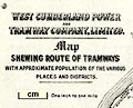
Tramway map, West Cumberland Power and Tramway Company,
reduced from one inch to one mile scale, editor Emile
Garcke, published by the Electrical Press, 37-38 Strand,
London, 1907
|
|
|
|
|
|
Gardner 1719
|
|
Road strip maps with sections in Westmorland and
Cumberland etc, scales about 2 miles to 1 inch, reduced from
maps by Ogilby, 1675, by Thomas Gardner, published by J
Tonson, Strand and by J Watts, Wild Court, London, 1719.
|
|
|
|
|
|
Garnett 1850s-60s B
|
|
Map of the English Lake District, scale about 3.5 miles
to 1 inch, published by J Garnett, Windermere, Westmorland,
1850s-60s?
|
|
|
|
|
|
Garnett 1850s-60s C
|
|
Maps, 4 sectional maps of The Lakes - Keswick Section,
Ambleside and Ullswater Section, Wastwater Section,
Windermere and Coniston Section, scales about 1.5 and 2
miles to 1 inch, engraved by William Banks, Edinburgh,
published by John Garnett, Windermere, Westmorland, and by
Simpkin, Marshall and Co, London, 2nd edn 1860s?
|

|

|
|
|
|
Garnett 1850s-60s D
|
|
New Section Maps of the Lakes - Windermere and Coniston
Section, Ullswater Section, Wastwater and the Duddon
Section, and? , scale about 2 miles to 1 inch, by John
Bartholomew, Edinburgh, published by J Garnett, Windermere,
Westmorland now Cumbria, 1850s-60s?
|
|

|
|
|
|
Garnett 1850s-60s G
|
|
Garnett's Map of the Lake District of Westmorland and
North Lancashire, scale about 2 miles to 1 inch, by John
Bartholomew, Edinburgh, published by J Garnett, Windermere,
Westmorland, and by Simpkin, Marshall and Co, London,
1850s-60s.
|
|
|
|
|
|
Garnett 1850s-60s H
|
|
Map of the English Lakes, in Cumberland, Westmorland and
Lancashire, scale about 3.5 miles to 1 inch, published by
John Garnett, Windermere, Westmorland, 1850s-60s.
|

|
|
|
|
|
Garnett 1850s-60s J
|
|
Map, Lake District, scale about 2 miles to 1 inch, by J
Bartholomew, Edinburgh, published by John Garnett,
Windermere, Westmorland, and by Simpkin, Marshall and Co,
London, 1865.
|

|

|
|
|
|
Garnett 1850s-60s K
|
|
Geological Map of the Lake District, scale about 6 miles
to 1 inch, reduced from John Ruthven's map etc, by J
Bartholomew, Edinburgh, published by John Garnett,
Windermere, Westmorland, and by Simpkin, Marshall and Co,
London, 1865.
|

|
|
|
|
|
Garnett 1871
|
|
Town plans, Plan of Windermere and Environs, Bowness on
Winander Mere, Plan of Ambleside and Environs, and Plan of
Keswick and Environs, scales about 6 inches to 1 mile,
engraved by J Bartholomew, published by John Garnett,
Windermere, Westmorland, 1871.
|

|
|
|
|
|
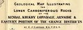
Garwood 1913
|
|
Geological Map Illustrating the Lower Carboniferous Rocks
of the Kendal, Kirkby Lonsdale, Arnside and Eastern Portion
of the Grange Districts, by E J Garwood, engraved by Weller
and Graham, published by the Geological Society of London,
1913.
|
|

|
|
|
|
Geikie 1879
|
|
Geological map, colour lithograph, Geological Map of the
British Isles, by Archibald Geikie, published by W and A K
Johnston, Edinburgh and London, 1879.
|
|
|
|
|
|
Geographia 1925
|
|
Road book, with road strip maps and gradient diagrams,
Premier Road Book of Great Britain, by Alexander Gross and F
Waite-Browne, published by Geographia, 55 Fleet Street,
London, about 1925?
|
|
|
|
|
|
Geological Survey 1948 Ten
Inch
|
|
Geological map, 2 sheets, The Geological Survey Ten Mile
Map, Geological Map of Scotland and the North of England,
and Geological Map of England and Wales, scale about 10
miles to 1 inch, by the Geological Survey on outline maps by
the Ordnance Survey, 1948.
|
|
|
|
|
|
Geological Survey, One Inch
|
|
Geological map series, Westmorland and Cumberland, etc,
The Lakes in Cumbria, published by the Ordnance Survey
and/or Geological Survey, 1830s-1900s.
|
|
|
|
|
|
Gibson 1759
|
|
Maps, Westmoreland, scale about 10.5 miles to 1 inch, and
Cumberland? by John Gibson, published by J Newberry, St
Paul's Churchyard, London, 1759; published 1759-1779.
|
|
|
|
|
|
Gibson 1766
|
|
Road strip map, 2 roads, The Correct Map of the Road from
London to Carlisle, and The Road from Carlisle to Berwick,
about 2 miles to 1 inch? drawn and engraved by J Gibson,
published in the Gentleman's Magazine, 1766.
|

|
|
|
|
|
Giles 1837
|
|
Railway map, Map of the Newcastle and Carlisle Railway,
and Maryport and Carlisle Railway, scale about 6.5 miles to
1 inch, by Francis Giles, engineer, published by Hudson
Scott, Carlisle, Cumberland, and by Currie and Bowman,
Newcastle upon Tyne, Northumberland, 1837.
|
|

|
|
|
|
Gilpin 1786 map
|
|
Sketch maps, Windermere lake, Keswick Lake ie Derwent
Water, and Ulleswater, Westmorland and Cumberland, by
William Gilpin, 1772-74, published by R Blamire, Strand,
London, 1786.
|
|
|
|
|
|
Goodchild 1875
|
|
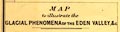
Map, Glacial Phenonema of the Eden Valley, scale about 3
miles to 1 inch, by J G Goodchild, engraved by Dangerfield,
22 Bedford Street, Covent Garden, London, published by the
Geological Society, 1875.
|
|
|
|
|
|
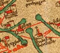
Gough 1350s-60s
|
|
Reproduction of the Gough Map of Great Britain, reduced
size, published by the Ordnance Survey, Southampton,
Hampshire, 1875; and a full size line reproduction, with
added transcriptions of placenames, 1935.
|
|
|
|
|
|
Gray 1822
|
|
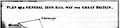
Railway map, plan of a General Iron Railway for Great
Britain, by Thomas Gray, published by Baldwin, Cradock and
Joy, London, 1822.
|
|
|
|
|
|
Gray 1824
|
|
Itineraries in Westmorland, Cumberland etc, by George
Carrington Gray, published by Sherwood, Jones and Co,
Paternoster Road, London, 1824.
|
|
|
|
|
|
Green 1902
|
|
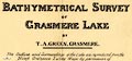
Map, Bathymetrical Survey of Grasmere Lake, scale about
25 ins to 1 mile, by T A Green, Grasmere, Westmorland,
1902.
|
|
|
|
|
|
Green 1910s-20s map
|
|
Geological Map of the Eastern Part of the Lake District,
scale about 2 inches to 1 mile, by J Frederick N Green,
engraved by The Watford Egraving Co, 5 Lamb's Conduit
Street, Holborn, London, published in the Proceeding of the
Geologists' Association, vol.26, about 1915.
|

|
|
|
|
|
Greenwood 1824
|
|
Maps, Map of the County of Westmorland, scale about 1
inch to 1 mile, and Map of the County of Cumberland, scale
about 1 inch to 1 mile, etc, by C and J Greenwood, published
by George Pringle jnr, 70 Queen Street, Cheapside, London,
1823 and 1824 respectively.
|
|

|
|
|
|
|
|

|
|
|
|
Greenwood 1834
|
|
Maps, Map of the County of Westmorland, and Map of the
County of Cumberland, both scale about 3 miles to 1 inch, by
C and J Greenwood, 1822-23, engraved by J and C Walker,
1830, published by Greenwood and Co, Burleigh Street,
Strand, London, 1834.
|
|
|
|
|
|
|
|
|
|
|
|
Gregson 1821
|
|
Map, one of a set of prints, Fragments of the History of
Lancashire, edited by Matthew Gregson, published Liverpool,
Lancashire, 1821.
|
|
|
|
|
|
Haine 1796
|
|
A New and Correct Map of England and Wales, scale about
16 miles to 1 inch, published by Haine and Son, 10 Rolls
Buildings, Fetter Lane, London, 1796.
|
|
|
|
|
|
Hall 1820
|
|
Maps, Westmoreland, scale about 14.5 miles to 1 inch, and
Cumberland, scale about 21 miles to 1 inch, by Sidney Hall,
London, 1820, published by Samuel Leigh, 18 Strand, London,
1820; published 1820-42.
|
|
|
|
|
|
|
|
|
|
|
|
Hall 1822
|
|
Map of the Lakes of Cumberland, Westmorland and
Lancashire, scale about 5.5 miles to 1 inch, by Sidney Hall,
Bury Street, Bloomsbury, London, published by Longman,
Hurst, Rees, Orme, and Brown, Paternoster Row, London, 1822;
published 1822-49.
|

|
|
|
|
|
Hall 1833
|
|
Maps, Westmoreland, scale about 5 miles to 1 inch, and
Cumberland, scale about 8 miles to 1 inch, by Sidney Hall,
London, published by Chapman and Hall, Strand, London, 1833;
published 1833-80.
|
|
|
|
|
|
|
|
|
|
|
|
Hall 1860
|
|
Maps, Westmorland and Cumberland? by Sidney Hall,
published by Chapman and Hall, 193 Piccadilly, London,
1860.
|
|
|
|
|
|
Hansard 1858
|
|
Railway map, Outline Map of England Shewing by Colours
the Lines of Railway at Present ...,published for the House
of Commons, by Henry Hansard, London, 1858.
|
|
|
|
|
|
Harrison 1790
|
|
Map, Cumberland and Westmoreland, scale about 6 miles to
1 inch, drafted by Haywood, engraved by Sudlow, 1790
published by John Harrison, 115 Newgate Street, London,
1791; published 1791-92.
|
|
|
|
|
|
Harwood 1895 map
|
|
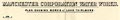
Map, colour lithograph, Manchester Corporation Water
Works, plan showing Works at Lake Thirlmere, Cumberland,
scale about 3 inches to 1 mile, and a map of the Line of
Aqueduct from Thirlmere, Cumberland to Manchester,
Lancashire, scale about 5 inches to 1 mile, published by
Henry Blacklock and Co, Albert Square, Manchester, 1895.
|
|
|
|
|
|
Haughan 1950s
|
|
Map, The County of Cumberland, scale about 5.5 miles to 1
inch, by John H Haughan, 1950s?
|
|
|
|
|
|
Haywood 1787
|
|
Maps, Westmorland? amd Cumberland? by James Haywood,
1787; published 1787-91.
|
|
|
|
|
|
Haywood 1789
|
|
Map, Ten Miles Round Keswick, scale about 1 inch to 1
mile, engraved by J Haywood, published by William Faden,
London, 1789.
|
|
|
|
|
|
Hebert 1816
|
|
Map of the Lakes in the Counties of Lancashire,
Westmoreland and Cumberland, scale about 3 miles to 1 inch,
drawn by Hebert, engraved by H Mutlow, published by T
Cadell, and W Davies, Strand, London, 1816.
|
|
|
|
|
|
Hemans and Hassard 1866
|
|
Map of part of the Lake District of Westmorland,
Cumberland illustrative of the project for supplying London
and other places with water, scale about 1 inch to 1 mile,
by G W Hemans and R Hassard, 1866.
|
|
|
|
|
|
Hennet 1830
|
|
A Map of the County Palatine of Lancaster, scale about
1.5 miles to 1 inch, by G Hennet, engraved by James Bingley,
57 Charles Street, City Road, published by Henry Teesdale
and Co, 302 Holborn, London, 1830.
|

|

|
|
|
|
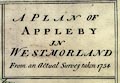
Hill 1754
|
|
Town plan, A Plan of Appleby in Westmorland, scale about
32 ins to 1 mile, engraved by Nathaniel Hill, 1754.
|
|

|
|
|
|
Hill c1751
|
|
Road map, Survey of the Country between Newcastle and
Carlisle, in Northumberland and Cumberland, scale about 1.5
miles to 1 inch, for a new military road, by N Hill, about
1751.
|
|
|
|
|
|
Hinton 1748
|
|
Maps, Correct Map of Cumberland, scale about 9 miles to 1
inch, and of Westmorland? by Emanuel Bowen or Thomas
Kitchin, London, 1748.
|
|
|
|
|
|
Hinton 1765
|
|
Road strip maps with sections in Westmorland, Cumberland
etc, scales about 2 -2.5 miles to 1 inch, derived from maps
by Ogilby, 1675 onwards, for the Universal Magazine,
published by John Hinton, St Paul's Churchyard, London,
1765-73.
|
|
|
|
|
|
Hobson 1850
|
|
Maps, Westmorland, scale about 3 miles to 1 inch, and
Cumberland, scale about 4.5 miles to 1 inch, reproductions
of the maps by J and C Walker, 1837, with fox hunting
additions by Hobson, published by John and Charles Walker, 9
Castle Street, Holborn, London, 1850.
|
|
|
|
|
|
Hodgson 1828
|
|
Map, 4 sheets, Plan of the County of Westmorland, scale
about 1 1/3 inches to 1 mile, by Thomas Hodgson, 1823-25,
engraved by W R Gardner, Harpur Street, London, published by
Thomas Hodgson, Lancaster, and perhaps by C Smith, 172
Strand, London,1828.
|
|
|
|
|
|
Hogg 1784
|
|
New Map of Cumberland and Westmoreland, scale about 12
miles to 1 inch, on a plate together with Northumberland,
engraved by T Conder, published by Alexander Hogg, London,
1784; published 1784-94.
|
|
|
|
|
|
Hogg 1787-89
|
|
A New Map of the Southern Part of Scotland, scale about
13 miles to 1 inch, engraved by T Conder, published by
Alexander Hogg, the Kings Arms, 16 Paternoster Row, London,
1787-89.
|
|
|
|
|
|
Hoggarth 1853
|
|
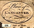
Town plan, Plan of the Town of Kendal, Westmorland, about
26 inches to 1 mile, by Henry Hoggarth, engraved by Waterlow
and Sons, London, published by Henry Hoggarth, 1853.
|
|
|
|
|
|
Hollar 1644
|
|
Map, Bishop-ricke of Durram and Cumberland, Westmoreland,
Yorke-shire, Lancast-shire, and parte of Lincolnshire, scale
about 5.5 miles to 1 inch, by Wenceslaus Hollar, published
by Thomas Jenner, London, 1644; published 1644-1759.
|

|
|
|
|
|
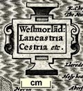
Hondius 1607
|
|
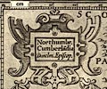
Maps, table 3 - Westmorland, Castria, Cestria etc, and
table 2 - Northumbria, Cumberlandia, Dunelm Episcopi, scales
roughly 20 miles to 1 inch, engraved in reduced versions by
Jodocus Hondius about 1607 from the maps of Gerard Mercator
1595; published 1608-1621, re-engravd by Peter Keer,
published 1620s-40s.
|
|
|
|
|
|
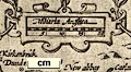
Hondius 1616
|
|
Map, Westmorlandia, Lancastria, Cestria etc, scale about
45 miles to 1 inch, and Northumbria, Cumberlandia, Dunelm
Episcopi, by Jodocus Hondius the younger, 1616.
|
|

|
|
|
|
Hope 1920s
|
|
Postcard map, English Lake District, scale about 9 miles
to 1 inch, published by LtCol P M Hope, Keswick, Cumberland,
perhaps 1920s?
|

|
|
|
|
|
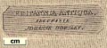
Horsley 1732
|
|
Map, Britannia Antiqua, roman Britain, scale about 50
miles to 1 inch, by John Horsley, perhaps 1732.
|
|
|
|
|
|
Horsley 1794
|
|
Map, Britanniae Antiquae Tabula Geographica, or
Geographical Map of Ancient Britain, roman antiquities, by
John Horsley, published by Laurie and Whittle, 53 Fleet
Street, London, 1794.
|
|
|
|
|
|
Houghton 1948
|
|
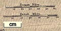
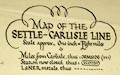
Railway map, Map of the Settle Carlisle Line, scale about
8 miles to 1 inch, by Frederick W Houghton, published by
Norman Arch Publications, Bradford, Yorkshire, 1948.
|
|
|
|
|
|
Housman 1800 map 1
|
|
Soil map, Lancashire, Westmoreland, Cumberland and a Part
of Yorkshire, with a Sketch of the Soils, Canals, etc, scale
about 8.5 miles to 1 inch, engraved by J Lowes, published by
F Jollie, Carisle, Cumberland, and C Law, Ave Maria Lane,
London, 1800.
|
|
|
|
|
|
Housman 1800 map 2
|
|
Town plan, Plan of Kendal, Westmorland, engraved by J
Lowes, 1798, published by F Jollie, Carisle, Cumberland, and
C Law, Ave Maria Lane, London, 1800.
|
|
|
|
|
|
Housman 1800 map 3
|
|
Town plan, Plan of Lancaster, Lancashire, scale about 5.5
inches to 1 mile, engraved by McIntyre, published by F
Jollie, Carlisle, Cumberland, 1800.
|
|
|
|
|
|
Housman 1800 map 4
|
|
Maps, Lakes in Lancashire and Westmorland, 7 lakes on one
sheet, engraved by McIntyre, Edinburgh, published by F
Jollie, Carisle, Cumberland, and C Law, Ave Maria Lane,
London, 1800.
|
|
|
|
|
|
Howard 1790s
|
|
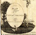
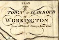
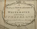
Town plans, Plan of the Town and Harbour of Whitehaven,
scale about 26 inches to 1 mile, Plan of the Town and
Harbour of Workington, scale about 16 inches to 1 mile, and
Plan of the City of Carlisle and Places Adjacent, scale
about 19 inches to 1 mile, published by F Jollie, Carlisle,
Cumberland, 1794.
|
|
|
|
|
|
|
|
|
|
|
|
|
|
|
|
|
|
Hudson 1842 map
|
|
Map of the Lakes of Cumberland, Westmoreland and
Lancashire, scale about 3.5 miles to 1 inch, and other maps,
engraved by William Banks, Edinburgh, published by John
Hudson, Kendal, Westmorland, 1853.
|
|
|
|
|
|
Hudson and Nicholson 1841
map
|
|
Map of the Lakes of Cumberland, Westmorland, and
Lancashire, scale about 4 miles to 1 inch, published by
Hudson and Nicholson, Kendal, Westmorland, and by Whittaker
and Co, Ave Maria Lane, London, 1841; perhaps published
about 1841-73.
|
|
|
|
|
|
Hughes 1868
|
|
Maps, Westmoreland, scale about 4 miles to 1 inch, and
Cumberland, scale about 6 miles to 1 inch, by William
Hughes, published by Virtue, James S and Co, City Road and
Ivy Lane, London, 1868.
|

|
|
|
|
|
|

|
|
|
|
|
Hutchinson 1748
|
|
Maps, Correct Map of Westmorland, scale about 7 miles to
1 inch, and of Cumberland? possibly by Thomas Hutchinson,
published by T Osborne et al, 1748; published 1748-50.
|
|

|
|
|
|
Hutchinson 1794 map
|
|
Maps, some of the maps and plans included in The History
of the County of Cumberland by William Hutchinson, published
by F Jollie, Carlisle, Cumberland, 1794.
|
|
|
|
|
|
Inglis 1898
|
|
Road books, series, The Contour Road Book of England in
whole or part, and of Scotland, by Harry R G Inglis,
published by Gall and Inglis, 25 Paternoster Square, London
and Edinburgh, 1890s-1900s.
|
|
|
|
|
|
Jackson 1845 map
|
|
Map of the Lakes, scale about 4.5 miles to 1 inch, drawn
and engraved by W H Lizars, Edinburgh, published by J
Jackson, Market Place, Ulverston, Lancashire, 1845;
published 1845-51.
|
|
|
|
|
|
James 1868
|
|
Town plan, Carlisle, Cumberland, proposed boundaries etc,
scale 3 inches to 1 mile, by Colonel Sir Henry James,
printed by the Ordnance Survey, Southampton, Hampshire,
1868.
|
|

|
|
|
|
Jansson 1646
|
|
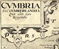
Map, Cumbria et Westmoria, or Cumberland and Westmorland,
scale about 3.5 miles to 1 inch, by John Jansson, Amsterdam,
Netherlands, 1646; published 1646-1724.
|
|

|
|
|
|
Jefferys 1757
|
|
New Map of England and Wales, scale about 25 miles to 1
inch, by Thomas Jefferys for the Gentleman's Magazine,
London, 1757.
|
|

|
|
|
|
Jefferys 1760s
|
|
Jigsaw puzzle map, A Map of the Roads of England and
Wales, scale about 25 miles to 1 inch, by Thomas Jefferys,
published by Francis Newberry, 20 Ludgate Street, London,
late 18th century.
|
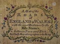
|
|
|
|
|
Jefferys 1770
|
|
Map, 2x2 sheets, The County of Westmoreland, scale 1 inch
to 1 mile, surveyed 1768, and engraved and published by
Thomas Jefferys, London, 1770.
|
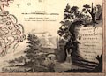
|
|
|
|
|
Jefferys 1771
|
|
Map, A Topographical Survey of the County of York, scale
about 1 inch to 1 mile, by Thomas Jefferys, 1767-1771,
published by Robert Sayer and John Bennett, 53 Fleet Street,
London, 1775.
|

|
|
|
|
|
Jefferys 1775
|
|
Road strip maps with sections in Westmorland, Cumberland
etc, scales about 1.5 miles to 1 inch? derived from maps by
Ogilby, 1675, and by John Senex, 1719 and 1757, by Thomas
Jeffery, London, 1775.
|
|
|
|
|
|
Jenkinson 1875 map 1
|
|
Map of the English Lake District, Westmorland, Cumberland
and Lancashire, scale about 4 miles to 1 inch, by Stanford's
Geographical Establishment, before 1875.
|
|

|
|
|
|
Jenkinson 1875 map 2
|
|
Geological Map of the English Lake District, Westmorland,
Cumberland and Lancashire, now Cumbria, scale about 11.5
miles to 1 inch, published by Edward Stanford, Stanford's
Geographical Establishment, 55 Charing Cross, London, before
1875.
|
|
|
|
|
|
Jenner 1643
|
|
Table of distances with a map, Westmerland, scale about
16 miles to 1 inch, and Cumberland, scale about 21 miles to
1 inch, published by Thomas Jenner, London, 1643; published
1643-80.
|
|
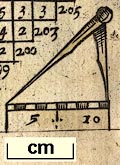
|
|
|
|
|
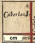
|
|
|
|
|
Johnson 1832
|
|
Town plan, Plan of Kendal, Westmorland, scale about 7.5
miles to 1 inch, drawn by G H Johnson, engraved by Franks
and Johnson, Wakefield, Yorkshire, published by Hudson and
Nicholson, Kendal, Westmorland, 1832.
|
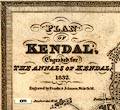
|
|
|
|
|
Johnson 1847
|
|
Maps, Westmoreland, scale about 6 miles to 1 inch, and
Cumberland? engraved by Lizars, Edinburgh, published by
Thomas Johnson, Manchester, 1847.
|

|
|
|
|
|
Johnson 1908
|
|
Road book, itineraries and index map, Roads Made Easy by
Picture and Pen, vol.3 northern roads, by Claude Johnson,
edited by Lord Montagu, published by The Car Illustrated,
168 Piccadilly, London, 1908.
|
|
|
|
|
|
Johnston 1900s
|
|
Cycling Map of District around Kendal, Westmorland, scale
about 3 ins to 1 mile, by W and A Johnston, Edinburgh,
Lothian and London, 1900s?
|
|
|
|
|
|
Johnston 1900s-10s
|
|
Railway Map of England and Wales, or Map of the Railway
Systems of England and Wales, scale about 8 miles to 1 inch,
published by W and A K Johnston, Edina Works and 20 South
Saint Andrew Street, Edinburgh, Lothian and London,
1900s-10s?
|
|
|
|
|
|
Johnstone 1820
|
|
Map, Skirmish at Clifton Hall, 18th December, 1745,
engraved by Sidney Hall, Bury Street, Bloomsbury, published
by Longman, Hurst, Rees, Orme and Brown, Paternoster Row,
London, 1820.
|
|
|
|
|
|
Jollie 1794
|
|
A Map of Cumberland, scale about 3.5 miles to 1 inch,
engraved by James Kennedy, published by F Jollie, Carlisle,
Cumberland, 1794.
|
|
|
|
|
|
Jopling 1843 map
|
|
A Map of Furness and Cartmel, Lancashire, and A
Geological Map of Furness and Cartmel, litho by Maclure,
Macdonald and Macgregor, Liverpool, published by Whittaker
and Co, Ave Maria Lane, London and by Stephen Soulby,
Ulverston, Cumberland, 1843.
|
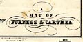
|
|
|
|
|
|
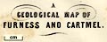
|
|
|
|
|
Keer 1604
|
|
Map, Angliae, Scotiae, et Hiberniae or Britannicarum
Insularum Description, Description of England, Scotland, and
Ireland or the British Isles, by Peter Keer, 1604, published
by Johannes Jansson, Amsterdam, 1621.
|
|
|
|
|
|
Keer 1605
|
|
Map, Westmorlandia et Comberlandia, ie Westmorland and
Cumberland now Cumbria, scale about 16 miles to 1 inch,
probably by Pieter van den Keere, or Peter Keer, about 1605,
published about 1605 to 1676.
|
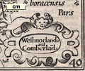
|
|
|
|
|
Kelly 1873 map
|
|
Post Office Map of Cumberland, scale about 6 miles to 1
inch, drawn and engraved by B R Davies, published by Kelly
and Co, Post Office Directory Offices, 51 Great Queen
Street, London, 1873.
|
|
|
|
|
|
Kelly 1897 map
|
|
Kelly's Map of Westmorland, scale about 3 miles to 1
inch, made and published by Kelly and Co, Directory Offices,
182-184 High Holborn, London, 1897.
|

|

|
|
|
|
Kelly 1920s map
|
|
Kelly's Maps of Westmorland with town plan of Kendal, and
Cumberland with town plan of Carlisle, published by Kelly's
Directories, London, 1920s.
|
|
|
|
|
|
Kelly 1929 map
|
|
Kelly's Map of Westmorland, scale about 3.5 miles to 1
inch, published by Kelly's Directories, 186 Strand, London,
1929.
|
|
|
|
|
|
Kendal Times 1864
|
|
Railway map, Plan of a Proposed Railway to the Lakes,
from Meathop Point to Bowness-on-Windermere, Westmorland,
published by the Kendal Times, Westmorland, 12 November
1864.
|

|
|
|
|
|
Kirkby 1914 map
|
|
Map Illustrating A Wander Week in Westmorland, scale
about 9 miles to 1 inch, published by J W Braithwaite,
Market Square, Kirkby Stephen, Westmorland, 1914.
|

|

|
|
|
|
Kitchin 1750s
|
|
Maps, Westmoreland, scale about 8 miles to 1 inch, 1753,
and Cumberland, scale about 10.5 miles to 1 inch, 1750, by
Thomas Kitchin, in a monthly series of county maps, London,
1747-60; published 1750s-98.
|
|
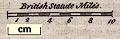
|
|
|
|
|
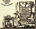
|
|
|
|
|
Kitchin 1763
|
|
Maps, Westmoreland, scale about 5.5 miles to 1 inch, and
Cumberland, scale about 8 miles to 1 inch, by Thomas
Kitchin, published by R and J Dodsley, Pall Mall, London,
1763-64.
|
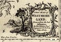
|
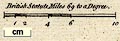
|
|
|
|
|
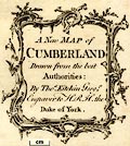
|
|
|
|
|
Kitchin 1767
|
|
Road book, Kitchin's Post Chaise Companion, including
road strip map sections in Westmorland, Cumberland etc,
scales about 2.5 miles to 1 inch, derived from maps by
Ogilby, 1675, by John Senex, 1719 and 1757, then amended by
Thomas Kitchin, London, 1767, published also in France;
published 1767-1780?
|
|
|
|
|
|
Kitchin 1769
|
|
Maps, Westmoreland, and Cumberland, both scales about 7
miles to 1 inch, by Thomas Kitchin, London, 1769.
|
|
|
|
|
|
Kitchin 1771
|
|
Road strip maps, with sections in Westmorland, Cumberland
etc, derived from maps by John Ogilby, 1675, published by
Thomas Kitchin, 59 Holborn Hill, London, 1771.
|
|
|
|
|
|
Kitchin 1777
|
|
Maps, Westmorland Divided into its Wards, scale about 4
miles to 1 inch, and Cumberland, Divided into its Wards,
scale about 5.5 miles to 1 inch, by Thomas Kitchin,
published by W Strahan and T Cadell, Strand, London,
1777.
|
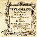
|
|
|
|
|
|
|
|
|
|
|
Kitchin 1784
|
|
Map of Great Britain, England and Wales, scale about 27
miles to 1 inch, surveyed by Thomas Kitchin, published in
the New and Complete British Traveller, Walpoole, 1784.
|
|
|
|
|
|
Kitchin and Jefferys 1748
|
|
Map of Westmoreland, scale about 9 miles to 1 inch, and
Cumberland? by Thomas Kitchin and Thomas Jefferys, 1748,
published 1748-85.
|
|
|
|
|
|
Knipe 1843
|
|
Geological Map of the British Isles and Part of France,
about 12.5 miles to 1 inch, by James Alexander Knipe,
published by H Bailliere, 219 Regent Street and W Wheeler,
Wine Office Court, Fleet Street, London, 1843; published
1843-80.
|
|
|
|
|
|
Knipe 1860
|
|
Geological map, a Sketch Map of the Geology and
Mineralogy of the North of England, scale about 12 miles to
1 ich, by James Alexander Knipe, published
Newcastle-upon-Tyne, Northumberland, 1860.
|
|
|
|
|
|
Lackington 1819 map
|
|
Map of the Country in the Vicinity of the Lakes, scale
about 6 miles to 1 inch, engraved by Neele and Son, 352
Strand, published by Lackington and Co, Finsbury Square,
London, 1819.
|
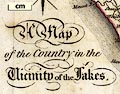
|
|
|
|
|
Land Utilisation Survey
1932-35
|
|
Map series, Land Utilisation Survey series, scale 1 inch
to 1 mile, by the Land Utilisation Survey of Britain,
directed by L Dudley Stamp, London School of Economics,
published by the Ordnance Survey, Southampton, Hampshire,
1932-35.
|

|
|
|
|
|
Langley 1818
|
|
Maps, Langley's New Map of Westmoreland, scale about 6
miles to 1 inch, and Cumberland, scale about 8.5 miles to 1
inch, by Edward Langley, 173 High Street, Borough, London,
1817; published 1818-20.
|
|
|
|
|
|
|
|
|
|
|
|
Laurie and Whittle 1806
|
|
Road book, New Traveller's Companion, including two road
maps with segments in Westmorland, Cumberland etc, by
Nathaniel Coltman, published by Robert H Laurie and James
Whittle, 53 Fleet Street, London, 1806; published
1806-34.
|

|
|
|
|
|
Lea 1687
|
|
Road map, England and Wales, by Phillip Lea, Cheapside,
London, engraved by Sutton Nichols, published London,
1687.
|
|
|
|
|
|
Lea 1689
|
|
Map, Comberland and Westmorland, scale about 4 miles to 1
inch, altered from the map by Christopher Saxton, 1576,
amended and published by Philip Lea, London, about 1689 and
1693, then Willdey about 1732, Jefferys about 1749, Dicey
about 1772.
|
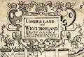
|
|
|
|
|
Leigh 1830 map
|
|
A New Map of the Lakes in Westmoreland Cumberland Etc,
scale about 4 miles to 1 inch, inserted in Leigh's Guide to
the Lakes and Mountains of Cumberland, Westmorland and
Lancashire, by M A Leigh, 3rd edn published by Leigh and
Son, 421 Strand, London, 1835.
|
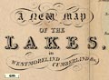
|
|
|
|
|
Lenthall 1717
|
|
Maps, Westmorland the ace of clubs, and Cumberland the
two of clubs, in a set of playing cards published by John
Lenthall, London, 1717.
|
|
|
|
|
|
Letts 1884
|
|
Maps, Westmoreland, scale about 3 miles to 1 inch, and
Cumberland? published by Letts, Son and Co, London Bridge,
London, 1884.
|
|

|
|
|
|
Lewis 1831
|
|
Maps, Westmorland, scale about 6 miles to 1 inch, and
Cumberland, scale about 6.5 miles to 1 inch, drawn by R
Creighton, engraved by John and Charles Walker, published by
Samuel Lewis and Co, 87 Aldersgate Street, London, 1831;
published 1831-49.
|

|
|
|
|
|
|

|
|
|
|
|
Lewis 1835
|
|
Political maps, Westmorland, scale about 6 miles to 1
inch, and Cumberland, scale about 7 miles to 1 inch, etc,
drawn by R Creighton, engraved by J and C Walker, published
by S Lewis and Co, 87 Aldersgate Street, London, 1835.
|
|
|
|
|
|
|

|
|
|
|
|
Lily 1546
|
|
Map, Britanniae Insulae, British Isles, scale roughly 30
miles to 1 inch? by George Lily, Rome, Italy, 1546.
|
|
|
|
|
|
Linton 1852 map
|
|
Railway map, Map of the Lake District and the West
Cumberland and West Coast Railways, scale about 6 miles to 1
inch, by ?John Linton, engraved by W H Lizars, Edinburgh,
Scotland, published by Whittaker and Co, London, and by R
Gibson and Son and by Callander and Dixon, Whitehave,
Cumberland, 1852.
|
|

|
|
|
|
Linton 1864 map
|
|
Map, The English Lake Country, scale about 5 miles to 1
inch, by J Bartholomew, Edinburgh, published by Smith, Elder
and Co, 65 Cornhill, London, 1864.
|
|
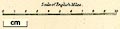
|
|
|
|
Lloyd 1573
|
|
Map, Angliae Regni Florentissimi Nova Descriptio, England
and Wales, scale about 24 miles to 1 inch, by Humphrey
Lloyd, Denbigh, published by Abraham Ortelius, Netherlands,
1573.
|
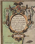
|

|
|
|
|
LMS 1920s maps
|
|
Railway strip maps, The Journey in Brief, the Route
London to Carlisle, with sections in Westmorland, Cumberland
etc, published by the London Midland and Scottish Railway,
LMS, 1920s.
|
|
|
|
|
|
LMS 1930s
|
|
Railway map, LMS Map of the Lake District, scale about 4
miles to 1 inch, published for the London Midand and
Scottish Railway, LMS, by John Bartholomew and Son, The
Edinburgh Geographical Institute, Edinburgh, 1930s?
|

|

|
|
|
|
LMS 1939 map
|
|
Map, The English Lakes, published by the London Midland
and Scottish Railway, LMS, 1939.
|

|
|
|
|
|
LNWR 1887
|
|
Railway map, General Sketch Map of the LNWR and its
Communications, by John Bartholomew, Edinburgh, published by
The London and NOrth Western Railway, London, 1887.
|
|
|
|
|
|
LNWR 1910 map
|
|
Map of the Lake District, scale about 7 miles to 1 inch,
engraved by McCorquodale and Co, Edinburgh, published by the
London and North Western Railway, LNWR, about 1910.
|
|
|
|
|
|
Locke 1845
|
|
Railway map and sections, 7 pages of Plans and Sections
of the Ulverstone, Furness, and Lancaster and Carlisle
Railway, scale about 7.5 inches to 1 mile, with enlarged
parts scale about 16 inches to 1 mile, by Joseph Lock and J
E Errington, engineers, 1845.
|
|
|
|
|
|
Lodge 1788-90
|
|
Maps, New Map of Westmorland, scale about 4.5 miles to 1
inch, by John Lodge, London, published by R Butters et al,
1790; published 1790-95, and A Map of Cumberland, scale
about 6 miles to 1 inch, by John Lodge, published by J
Murray, London, 1788; published 1788-95.
|
|
|
|
|
|
Lowes 1790s
|
|
Maps, Lakes in Cumberland, 9 lakes on one sheet, engraved
by J Lowes, published by F Jollie, Carisle, Cumberland, and
C Law, Ave Maria Lane, London, 1790s.
|
|
|
|
|
|
Lowes c1800
|
|
Map of the Lakes in Cumberland, Westmorland and
Lancashire, engraved by J Lowes, scale about 7.5 miles to 1
inch, probably about 1800.
|
|
|
|
|
|
Luffman 1803
|
|
Maps, Westmoreland, scale about 37 miles to 1 inch, and
Cumberland? by John Luffman, 28 Little Bell Alley, Coleman
Street, London, 1803; published 1803-06.
|
|
|
|
|
|
Lyne 1741
|
|
Road map, England Described or Ogilby Improved, Ogilby
and Morgan's Pocket Map of the Roads, based on the mapping
of John Ogilby and William Morgan, published by S Lyne,
Newgate Street, London, 1741.
|
|
|
|
|
|
MacKenzie 1893
|
|
Maps, Westmorland, scale about 4.5 miles to 1 inch, and
Cumberland, scale about 6.5 miles to 1 inch, by F S Weller,
published by William MacKenzie, London, etc, about 1893.
|

|

|
|
|
|
|

|
|
|
|
|
Maitland 1962
|
|
Tramway map, routes in Carlisle, Cumberland, scale about
4 inches to 1 mile, drawn by F W Maitland, 1962.
|
|
|
|
|
|
Marmocchi 1839
|
|
Map, Parte Settentrionale dell' Inghilterra, the North
Part of England, scale about 21 miles to 1 inch, by
Marmocchie, Florence, Italy, 1839 edn 1842.
|

|
|
|
|
|
Marr 1909-12 map
|
|
Maps, physical and geological maps of Westmorland,
Cumberland, North Lancashire, scale about 7-10 miles to 1
inch, by George Philip and Son, The London Geographical
Institute, Published by Cambridge University Press,
Cambridge, Cambridgeshire, 1909.
|
|
|
|
|
|
|

|
|
|
|
|
Marr 1916 map
|
|
Geological map series, illustrating various features of
The Lake District, in a book, The Geology of the Lake
District, by J E Marr and Alfred Harker, published by
Cambridge University Press, Cambridge, Cambridgeshire,
1916.
|
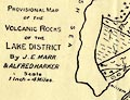
|
|
|
|
|
Marshall 1808 map
|
|
Map, Sketch of the Northern Department of England, by
William Marshall? engraved by Mutlow, Russell Court,
published by Longman, Hurst, Rees and Orme, Paternoster Row,
London, about 1808.
|
|
|
|
|
|
Martin 1784
|
|
New and Exact Map of the Beautiful Vale of Keswick in
Cumberland, by T Martin, 1784.
|
|
|
|
|
|
Martindale 1888
|
|
Map, Westmorland with Furness, vice county 69 divided
into river basins, scale about 4 miles to 1 inch, by J A
Martindale, printed? by J Bartholomew, Edinburgh, about
1888.
|
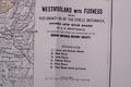
|
|
|
|
|
Maryport and Carlisle Railway
1910s
|
|
Railway map, colour printed poster, Maryport and Carlisle
Railway, 1910s-20s?
|
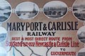
|
|
|
|
|
Maude 1831 map
|
|
Map of the Lakes of Cumberland, Westmoreland and
Lancashire, drawn by Gideon Michael Angelo Maude, published
by Thomas Inchbold, Leeds, Yorkshire, 1831.
|
|
|
|
|
|
Mawman 1805 map
|
|
Map, Sketch of the Excursion between London and Inverary,
scale about 23 miles to 1 inch, engraved by J Bye, published
by Joseph Mawman, Poultry, London, 1805.
|
|
|
|
|
|
Mawson 1890s
|
|
Road book, strip maps and descriptive text, Itinerary of
the Great North Road, with sections in Westmorland,
Cumberland etc, published by Mawson, Swan, and Morgan,
Newcastle upon Tyne, Northumberland, late 1890s.
|

|
|
|
|
|
Mayson 1880s
|
|
Relief model, map, Ordnance Model of the Lake District,
scale about 6 ins to 1 mile, made by Henry Mayson,
photographer, Lake District Repository, Lake Road, Keswick,
Cumberland, early 1880s.
|
|
|
|
|
|
McKie 1888
|
|
Town plan, Map of Carlisle showing the Electoral
Divisions under the Local Government Act 1888, scale about 6
inches to 1 mile, by H U McKie, Carlisle, Cumberland,
1888.
|
|
|
|
|
|
McMechan 1910s
|
|
Railway map, Map to McMechan's Railway Guide, N of
England and S of Scotland, scale about 22.5 miles to 1 inch,
published by T McMechan, Wigton, Cumberland, 1910s?
|
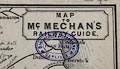
|
|
|
|
|
Mercator 1564
|
|
Map, Angliae, Scotiae et Hiberniae Nova Descriptio, scale
about 14 miles to 1 inch, by Gerard Mercator, Duisberg,
Germany, 1564.
|
|
|
|
|
|
Mercator 1595
|
|
Maps, table 3 - Westmorlandia, Lancastria, Cestria etc,
and table 2 - Northumbria, Cumberlandia, Dunelm Episcopi,
scales roughly 10 miles to 1 inch, by Gerard Mercator,
Duisberg, Germany, 1595; published 1590s-1640s.
|

|

|
|
|
|
Merryweather 1823
|
|
Town plan, Township of Ulverston, scale about 1 to 4800,
subscriptions requested by H Merryweather, Millwood, by
Ulverston, Lancashire, 1823.
|
|
|
|
|
|
Midland Railway 1870s
|
|
Railway map, Midland Railway, The Lake District, scale
about 8 miles to 1 inch, published by the Midland Railway,
1870s?
|
|

|
|
|
|
Mill and Heawood 1895
|
|
Series of maps of the English Lakes - Derwentwater;
Bassenthwaite Lake; Buttermere, Crummock Water, and
Ennerdale Water; Wastwater; Coniston Water; Ullswater and
Haweswater; and Windermere, scales about 2 inches to 1 mile,
with soundings by Hugh Robert Mill and Edward Heawood, by
Bartholomew, Edinburgh, Scotland, published by George Philip
and Son, 32 Fleet Street, London, etc, 1895.
|
|
|
|
|
|
Miller 1810
|
|
Maps, Westmoreland, scale about 14 miles to 1 inch, and
Cumberland? by Robert Miller, London, 1810; published
1810-25.
|
|
|
|
|
|
Millward and Dickinson 1737
|
|
Road map, photocopy, diagram, A New and Correct Map of
Roads of England, probably published by T Millward and B
Dickinson, Inigo Jones's Head, Fleet Street, London,
1737.
|
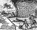
|
|
|
|
|
Ministry of Agriculture
1971
|
|
Map, Types of Farm in the Northern Regions, scale about 4
miles to 1 inch, 1968 data, published by the Ministry of
Agriculture, Fisheries and Food, 1971.
|
|

|
|
|
|
Mogg 1814
|
|
Road strip maps, High Roads of England and Wales,
advertised with sections in Westmorland, Cumberland, etc,
scales about 1 inch to 1 mile, probably published by Edward
Mogg, London, 1814; published 1814 to 1833.
|
|
|
|
|
|
Mogg 1822
|
|
Road book, strip maps and itineraries, Paterson's Roads,
published by Edward Mogg, Charing Cross, London, 16th edn
1822; published 1822-32.
|
|
|
|
|
|
Mogg 1822 map
|
|
Map of the Lakes of Cumberland, Westmorland, and
Lancashire, scale about 3.5 miles to 1 inch, perhaps by
Edward Mogg, Charing Cross, London, 1822.
|
|
|
|
|
|
Moll 1717
|
|
Map, two sheets, New Map of Great Britain, scale about 15
miles to 1 inch, by Herman Moll, Devereux Court? Strand,
London, 1717.
|
|
|
|
|
|
Moll 1717 b
|
|
Road map, A Pocket Companion of ye Roads of ye South Part
of Great Britain called England and Wales, scale about 33
miles to 1 inch, by Herman Moll, 1717.
|
|
|
|
|
|
Moll 1718
|
|
Road strip maps for a road book, an abandoned project? by
Herman Moll, about 1718.
|
|
|
|
|
|
Moll 1724
|
|
Maps, Westmorland, scale about 5.5 miles to 1 inch, and
Cumberland, scale about 7 miles to 1 inch, by Herman Moll,
London, 1724; published 1724-53.
|
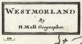
|
|
|
|
|
|
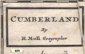
|
|
|
|
|
Moll 1747
|
|
Map or maps, Westmorland and Cumberland? by Herman Moll,
1747.
|
|
|
|
|
|
Morden 1676
|
|
Maps, on playing cards - Westmorland, ace of clubs;
Cumberland, 2 of clubs; and Lancashire, 3 of clubs, by
Robert Morden, 1676; published 1676-80 and 1760s-80s.
|

|
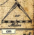
|
|
|
|
Morden 1690
|
|
Road map, Itinerarium Angliae or Map of Roads of England
and Wales, scale about 19 miles to 1 inch, by Robert Morden,
The Atlas, Cornhill, published by him and Joseph Pask, Three
Ink Bottles, Castle Alley, Royal Exchange, London, about
1690.
|
|
|
|
|
|
Morden 1695
|
|
Maps, Westmorland, scale about 2.5 miles to 1 inch, and
Cumberland, scale about 4 miles to 1 inch, now Cumbria, by
Robert Morden, 1695; published 1695-1772.
|
|
|
|
|
|
|
|
|
|
|
|
Morden 1701
|
|
Maps, Westmorland, scale about 4.5 miles to 1 inch,
Cumberland, scale about 7.5 miles to 1 inch, by Robert
Morden, 1701; published 1701-04.
|
|
|
|
|
|
Morden 1708
|
|
Maps, Westmorland, scale about 4.5 miles to 1 inch,
Cumberland, scale about 7.5 miles to 1 inch, by Robert
Morden, 1701 amended by Herman Moll, 1708; published
1708-46?
|
|
|
|
|
|
|
|
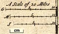
|
|
|
|
Moule 1836
|
|
Maps, Westmoreland, scale about 5 miles to 1 inch, and
Cumberland, scale about 7.5 miles to 1 inch, by Thomas
Moule, published by George Virtue, Ivy Lane, Paternoster
Row, London, 1836; published 1836-37.
|
|
|
|
|
|
|
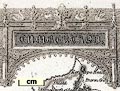
|
|
|
|
|
Mullins 1973
|
|
Map, card jigsaw puzzle, Heraldic Scroll of England and
Wales, with and civic and family coats of arms, drawn by
Dick Kelly, made by Mullins of London, London, about
1973.
|

|
|
|
|
|
Murray 1830
|
|
Maps, Westmorland, scale about 3 miles to 1 inch, and
Cumberland, scale about 4.5 miles to 1 inch, by T L Murray
by order of the Board of Ordnance, engraved by Hoare and
Reeves, London, 1831.
|

|
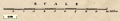
|
|
|
|
Murray 1889 map
|
|
Map, 2 sheets, A New Map of the Lake District of
Cumberland, Westmoreland and Lancashire, scale about 2 miles
to 1 inch, by Stanford's Geographical Establishment from
Ordnance Survey data, published by John Murray, Albemarle
Street, London, edn 1889.
|
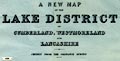
|

|
|
|
|
Mutlow 1815
|
|
Town plan, Plan of the City of Carlisle, Cumberland,
scale about 12.5 ins to 1 mile, engraved by Mutlow,
published by T Cadell and W Davies, Strand, London,
1815.
|
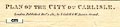
|
|
|
|
|
M'Leod 1861
|
|
Map or maps, Westmorland Cumberland area? by Walter
M'Leod, Model School, Royal Military Asylum, Chelsea,
London, engraved by Edward Weller, published by Longman,
Green, Longman and Roberts, London, 1861.
|
|
|
|
|
|
Nelson 1859 map
|
|
Map of the English Lake District, scale about 3.5 miles
to 1 inch, drawn and engraved by J Batholomew and Son,
Edinburgh, published by T Nelson and Sons, Paternoster Row,
London, and Edinburgh and New York, United States, 1859.
|

|

|
|
|
|
Nelson 1880s
|
|
Map of the English Lakes, published by Thomas Nelson and
Sons, London, 1880s?
|
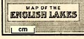
|
|
|
|
|
Norden 1625
|
|
Tables of distances for Westmorland, Cumberland etc, an
Intended Guyde, for English Travailers, by John Norden,
1625.
|
|
|
|
|
|
|
|
|
|
|
|
Norgate 2009
|
|
Relief map, digital image, Cumbria Relief Map, data
downloaded from NASA, processed by Jean M Norgate,
Longsleddale, Cumbria, 2009.
|

|
|
|
|
|
North Eastern Railway 1900s
|
|
Railway map, Map of the North Eastern Railway and
Connections, scale about 15 miles to 1 inch, published by
the NER about 1900s?
|
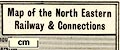
|
|
|
|
|
North Eastern Railway c1900
|
|
Railway map, station wall map of coloured ceramic tiles,
North Eastern Railway, with parts in Westmorland, Cumberland
etc, scale about 2.5 miles to 1 inch, made by Craven,
Dunnill and Co, Jackfield, Shropshire, about 1900.
|

|
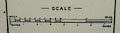
|
|
|
|
Nowell 1564
|
|
Map, manuscript, A General Description of England and
Ireland, drawn by Laurence Nowell, for William Cecil later
Lord Burghley, about 1564.
|
|
|
|
|
|
Nurse 1918
|
|
Diocesan map, The Diocese of Carlisle, Cumberland,
Westmorland, and Lancashire North of the Sands, scale about
4 miles to 1 inch, by Rev Euston J Nurse, published by
Charles Thurnam and Sons, 11 English Street, Carlisle,
Cumberland, 1918.
|
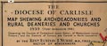
|
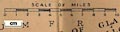
|
|
|
|
Nurse 1930
|
|
Map, manuscript, Map of the Boundaries of St Martin's
Parish, Windermere, by Euston J Nurse, incumbent of St
Martin's Church, Bowness-on-Windermere, Windermere,
Westmorland, 1930.
|
|
|
|
|
|
Odhams 1948 map
|
|
Pictorial map, halftone print, Cumberland, Furness and
Westmorland, including The Lakes, scale about 7.5 miles to 1
inch, published by Odhams Press, Long Acre, London,
1948.
|

|

|
|
|
|
Ogdens 1910
|
|
Map, cigarette card no.9 of 50 in the Sectional Cycling
Map series, showing the Westmorland area, scale about miles
to 1 inch, issued with Ogden's Cigarettes, by the Imperial
Tobacco Co, Nottingham, Nottinghamshire, about 1910.
|
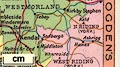
|
|
|
|
|
Ogilby 1675
|
|
Road maps, strip maps, scale about 1 inch to 1 mile,
including 4 plates with routes in Westmorland, Cumberland
etc, by John Ogilby, London, 1675.
|
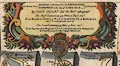
|
|
|
|
|
Ogilby 1699
|
|
Road book, itineraries and map, The Traveller's Guide, by
John Ogilby, published by Abel Swall, Tim Child, White Hart,
and R Knaplock, the Angel and Crown, St Paul's Churchyard,
London, 1699.
|
|
|
|
|
|
Ogilby 1699 map
|
|
Road map, a New Mapp of the Roads of England, by John
Ogilby, published by Abel Swall, Tim Child, White Hart, and
R Knaplock, the Angel and Crown, St Paul's Churchyard,
London, 1699.
|
|
|
|
|
|
Ogilby 1930
|
|
A Map of XVII Century England, including Westmorland,
Cumberland etc, in particular showing the routes mapped by
John Ogilby, 1675, scale about 16 miles to 1 inch, published
by the Ordnance Survey, Southampton, Hampshire, 1930.
|
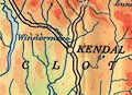
|
|
|
|
|
OS 1840s-60s Old Series
|
|
Map series, parts of Westmorland, Cumberland etc, Old
Series 1 inch maps of England, scale 1 inch to 1 mile,
published by the Ordnance Survey, London, 1840s-60s.
|
|

|
|
|
|
OS 1870
|
|
Map of Lake District of Cumberland and Westmorland,
assembled from Old Series 1 inch maps of England, scale 1
inch to 1 mile, published by the Ordnance Survey, London,
about 1870.
|
|
|
|
|
|
OS 1881-82 New Series
|
|
Maps, parts of Westmorland, Cumberland etc, New Series 1
inch maps of England, scale 1 inch to 1 mile, published by
the Ordnance Survey, London, 1881-82.
|
|
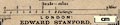
|
|
|
|
OS 1899 Quarter Inch
|
|
Map series, Quarter Inch series, scale 4 miles to 1 inch,
published by the Ordnance Survey, from 1899.
|
|
|
|
|
|
OS 1900
|
|
Map, The Lake District, scale 1 mile to 1 inch, published
by the Ordnance Survey, Southampton, Hampshire, 1900.
|

|

|
|
|
|
OS 1900s Half Inch
|
|
Map series, Half Inch series, with or without index grid,
hill shading series or layer colouring series, scale 2 miles
to 1 inch, published by the Ordnance Survey, from 1906.
|
|
|
|
|
|
OS 1904
|
|
Map, England and Wales, relief, roads and railways, scale
about 10 miles to 1 inch, by Ordnance Survey, Southampton,
Hampshire, 1904.
|
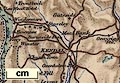
|
|
|
|
|
OS 1907 3rd edn large sheet
|
|
Maps, One Inch 3rd edition large sheet maps of Great
Britain, scale 1 inch to 1 mile, published by the Ordnance
Survey, Southampton, Hampshire, 1907-13.
|
|
|
|
|
|
OS 1918 Popular Edition
|
|
Map series, One Inch Popular edition maps of Great
Britain, scale 1 inch to 1 mile, published by the Ordnance
Survey, Southampton, Hampshire, from about 1918 onwards.
|
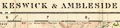
|

|
|
|
|
OS 1922
|
|
Maps, Ordnance Survey Atlas of England and Wales, Quarter
Inch series, scale 4 miles to 1 inch, published by the
Ordnance Survey, Southampton, Hampshire, 1922.
|
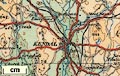
|
|
|
|
|
OS 1922 relief
|
|
Map, Physical map of England and Wales, scale about 16
miles to 1 inch, published by the Ordnance Survey,
Southampton, Hampshire, 1922.
|

|
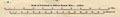
|
|
|
|
OS 1925
|
|
Map, Ordnance Survey Tourist Map of The Lake District,
Westmorland, Cumberland etc, One Inch map, scale 1 inch to 1
mile, published by the Ordnance Survey, Southampton,
Hampshire, about 1925; published 1925-38 perhaps later?
|

|
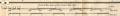
|
|
|
|
OS 1934 Quarter Inch
|
|
Map series, Quarter Inch Map of Great Britain, 4th edn
with 10000 yard grid, scale 4 miles to 1 inch, published by
the Ordnance Survey, Southampton, Hampshire 1934-35.
|
|
|
|
|
|
OS 1936 Ten Inch
|
|
Map series, Ten Inch Map of Great Britain, with National
Yard Grid, scale 10 miles to 1 inch, published by the
Ordnance Survey, Southampton, Hampshire 1936-37.
|
|
|
|
|
|
OS 1940s New Popular
Edition
|
|
Map series, One Inch 6th edn maps of Great Britain, scale
1 inch to 1 mile, published by the Ordnance Survey,
Southampton, Hampshire, from about 1947.
|
|
|
|
|
|
OS 1946 Quarter Inch
|
|
Map series, Quarter Inch Map of Great Britain, 4th edn
with National Grid, Quarter Inch series, scale 4 miles to 1
inch, published by the Ordnance Survey, Southampton,
Hampshire 1946.
|

|
|
|
|
|
OS 1950s Seventh Series
|
|
Map series, One Inch 7th Series maps of Great Britain,
scale 1 inch to 1 mile, published by the Ordnance Survey,
Southampton, Hampshire, from about 1952 to 1972.
|
|
|
|
|
|
OS 1970s Landranger
|
|
Map series, Landranger series maps of Great Britain, 'One
Inch' maps metricated, scale 1 1/4 inches to 1 mile,
published by the Ordnance Survey, Southampton, Hampshire,
from about 1976.
|
|
|
|
|
|
OS 1974 Admin Areas
|
|
Maps, Administrative Areas Diagram, Cumbria, north and
south sheets, scale about 1.5 miles to 1 inch, published by
the Ordnance Survey, Southampton, Hampshire, about 1974;
published 1974-92?
|
|
|
|
|
|
OS 2000s Explorer
|
|
Map series, Explorer and Outdoor Leisure series, Great
Britain, scale 2.5 inches to 1 mile, published by the
Ordnance Survey, Southampton, Hampshire, from about
2002.
|
|
|
|
|
|
OS County Series
|
|
Maps, County Series maps of Great Britain, scales 6 and
25 inches to 1 mile, published by the Ordnance Survey,
Southampton, Hampshire, from about 1863 to 1948.
|
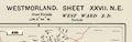
|

|
|
|
|
OS Six Inch
|
|
Map series, various editions with the national grid,
scale about 6 inches to 1 mile, published by the Ordnance
Survey, Southampton, Hampshire, scale 1 to 10560 from 1950s
to 1960s, then 1 to 10000 from 1960s to 2000s, superseded by
print on demand from digital data.
|
|
|
|
|
|
OS Twenty Five Inch
|
|
Map series, various editions with the national grid,
scale about 25 inches to 1 mile, published by the Ordnance
Survey, Southampton, Hampshire, scale 1 to 2500 up to the
2000s, superseded by print on demand from digital data.
|
|
|
|
|
|
Otley 1818
|
|
A New Map of the District of the Lakes, by Jonathan
Otley, 1817, engraved by J and G Menzies, Edinburgh,
Lothian, Scotland, published by Jonathan Otley, Keswick,
Cumberland, 1818; published 1818-50.
|
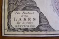
|
|
|
|
|
Otley 1820s map
|
|
Geological Map of the Lakes? perhaps coloured on his own
topographical map by Jonathan Otley, Keswick, Cumberland,
about 1828?
|
|
|
|
|
|
Otley 1830s
|
|
Geological map, 4 sheets, engraving, hand coloured to
show geology, Plan of the County of Westmorland, scale about
1 1/4 inches to 1 mile, surveyed 1823-25 by Thomas Hodgson,
engraved by W Gardner, Harpur Street, London, published by
Thomas Hodgson, Lancaster, Lancashire, 1828; geologically
coloured probably by Jonathan Otley, after 1835.
|
|
|
|
|
|
Our Own Country 1900s
|
|
Town plan, street map, Map of Carlisle, Cumberland, scale
about 2 inches to 1 mile, engraved by Walker and Boutall,
published 1900s?
|
|
|
|
|
|
Overton 1708
|
|
Map, two sheets, New and Exact Map of Great Britain,
scale about 20 miles to 1 inch, by Henry Overton, the White
Horse, without Newgate, London, 1708, edited and published
1743.
|
|
|
|
|
|
Owen-Jones 1885
|
|
Maps, Westmorland, New Divisions of County, and for
Cumberland, scale about 4 miles to 1 inch, by LtCol Robert
Owen-Jones, printed by the Ordnance Survey, Southampton,
Hampshire, 1885.
|
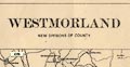
|

|
|
|
|
|

|
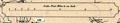
|
|
|
|
Paris 1240s
|
|
Maps, 4 manuscripts, of Great Britain by Matthew Paris,
St Albans, drawn in the mid 13th century.
|
|
|
|
|
|
Parliamentary Plans
|
|
Parliamentary plans, railway maps and sections, usually a
large scale, with an associated book of reference, to
accompany a bill in Parliament, early 19th century
onwards.
|
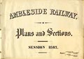
|
|
|
|
|
Paterson 1766
|
|
Table of distances, A Scale of Distances of the Principal
Cities and Towns in England, by Daniel Paterson, published
London, 1766
|
|
|
|
|
|
Paterson 1785
|
|
Road book, Paterson's British Itinerary, road strip maps
and itineraries with sections in Westmorland, Cumberland
etc, scales about 2.5-3 miles to 1 inch, by Capt Daniel
Paterson, London, 1785; published 1785-1807.
|
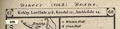
|
|
|
|
|
Pearson 1900s map
|
|
Pearson's Map to the Lake District, two sheets, Northern
Section and Southern Section, Westmorland, Cumberland etc,
scale about 4 miles to 1 inch, by George Philip and Son,
London, published by C Arthur Pearson, Henrietta Street,
London, 1900s.
|

|
|
|
|
|
Pennant 1777
|
|
A Map of Scotland, Hebrides and Part of England, drawn
for Thomas Pennant, engraved by J Bayly, published by
Benjamin White, London, 1777.
|
|
|
|
|
|
Perrot 1823
|
|
Map, Cumberland, Westmoreland, scale about 38 miles to 1
inch, by Aristide Michel Perrot, engraved by Migneret, 1823,
published by Etienne Ledoux, 9 Rue Guenegaud, Paris, France,
1824; published 1824-48.
|
|
|
|
|
|
Philip 1857
|
|
Maps, Westmorland, scale about 3 miles to 1 inch, and
Cumberland? by Edward Weller, about 1857, published by
George Philip and Son, Liverpool, Merseyside and London,
about 1857; published 1857-1904.
|

|
|
|
|
|
Philip 1900s
|
|
Map, jigsaw puzzle, England and Wales, scale about 17.5
miles to 1 inch, by George Philip and Son Ltd, The London
Geographical Institute, 1900s?
|
|
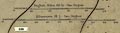
|
|
|
|
Philip 1920s
|
|
Road map, Philips' Cyclists' Map of the Lake District,
scale about 4 miles to 1 inch, by George Philip and Son, 32
Fleet Street, London, and Liverpool, Merseyside, 1920s?
|
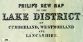
|
|
|
|
|
Pigot 1826
|
|
Maps, Westmoreland, scale about 4.5 miles to 1 inch, and
Cumberland, scale about 7 miles to 1 inch, by James Pigot
and Co, engraved by Pigot and Co, Manchester, published by
James Pigot and Co, Basing Lane, London, 1826-27.
|

|
|
|
|
|
Pigot 1835
|
|
Maps, Westmoreland, scale about 10 miles to 1 inch, and
Cumberland? engraved by Pigot and Slater, Manchester,
published by Pigot and Co, Manchester and London, about
1835; published 1835-42.
|

|

|
|
|
|
Pinnock 1833-34
|
|
Maps, Westmoreland, scale about 6 miles to 1 inch, and
Cumberland, scale about 8 miles to 1 inch, engraved by J
Archer, published by William Edwards, Ave Maria Lane,
London, 1833-34.
|

|
|
|
|
|
|

|
|
|
|
|
Post Office 1770
|
|
Map of the Post Roads of England and Wales, a General
Post Office Circulation Map for England and Wales, General
Post Office, London, 1770.
|
|
|
|
|
|
Post Office 1807
|
|
Post road map, engraving with manuscript details, General
Post Office Circulation Map for England and Wales, The
Circulation of Letters to and from ... 1807, prepared by J
Tucker, for the Post Office, London, 19 May 1807.
|
|
|
|
|
|
Post Office 1823
|
|
Post road map, The Circulation of Letters, a General Post
Office Circulation Map for England and Wales, General Post
Office, London, 1823.
|
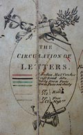
|
|
|
|
|
Post Office 1850s-1900s
|
|
Post road maps, General Post Office Circulation Map for
England and Wales, for the General Post Office, London,
1850s-1900s.
|
|

|
|
|
|
|
|
|
|
|
|
|
|
|
|
|
|
|
|
|
|
|
|
Post Office 1945
|
|
Railway strip map, booklet, London to Glasgow, including
the Lancaster and Carlisle Railway through Westmorland,
Cumberland, etc, showing the TPO, travelling post office
apparatus along the line, prepared by General Post Office,
London, 1945.
|
|
|
|
|
|
Postlethwaite 1877 map 1
|
|
Geological Map of the English Lake District, scale about
5 miles to 1 inch, by John Postlethwaite, 1877.
|

|
|
|
|
|
Postlethwaite 1877 map 2
|
|
Map of the Lake District Mining Field, scale about 5
miles to 1 inch, by John Postlethwaite, 1877.
|
|
|
|
|
|
Pratt 1905
|
|
Road book, Pratt's Road Atlas of England and Wales, road
maps, scale 6 miles to 1 inch, by George Philip and Son, 32
Fleet Street, London, 1905, published by Anglo-American Oil
Co, 36-38 Queen Anne's Gate, Westminster, London, 1915.
|
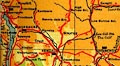
|
|
|
|
|
Prior 1850s map
|
|
Railway map, the Lakes, drawn for Herman Prior by John
Bartholomew, Edinburgh, published by John Garnett,
Windermere, Westmorland and Simpkin, Marshall and Co,
London, 1885.
|
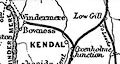
|
|
|
|
|
Prior 1874 map 1
|
|
Map, Winander Mere, scale about 2.5 miles to 1 inch,
published by John Garnett, Windermere, Westmorland,
1874.
|
|
|
|
|
|
Prior 1874 map 2
|
|
Map, Winander Mere and its Vicinity, scale about 1.5
miles to 1 inch, engraved by W Banks, Edinburgh, published
by John Garnett, Windermere, Westmorland, 1874.
|

|

|
|
|
|
Ptolemy 1513
|
|
Map, engraving, Tabula Prima Europae, Europe sheet 1,
British Isles, drawn from Ptolemy's data by, by Martin
Waldseemuller, Strasbourg, 1513.
|
|
|
|
|
|
Ptolemy 1540
|
|
Map, Anglia II Nova Tabula, New Map of England, data in
the Geographia by Claudius Ptolemy, engraved by Sebastian
Munster, Basle, Switzerland, 1540.
|
|
|
|
|
|
Ptolemy 1578
|
|
Map, British Isles from Ptolemy's data, Europe Table I,
by Gerard Mercator, 1578.
|

|
|
|
|
|
Ptolemy 1793
|
|
Map, Albion et Hibernia Britannicae Insulae, the British
Isles from Ptolemy's data, engraved by Basire, published by
the Society of Antiquaries, London, 1793.
|

|
|
|
|
|
Quaker Map 1840s-50s
|
|
A Map of the Meetings of Friends in England and Wales,
with railways, scale about 30 miles to 1 inch, by James
Bowden, engraved by Nosworthy and Wells, 72 Coleman Street,
London, later engraved by Thomas Wells, then Robert Barclay,
published by the Yearly Meeting of the Society of Friends,
London, 1845-59.
|
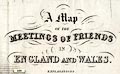
|
|
|
|
|
RAC 1920s
|
|
Road map series, The RAC County Road Map and Gazetteer,
No.6 Cumberland, Westmorland, and Furness, scale about 4
miles to 1 inch, published for the Royal Automobile Club,
RAC, by E J Burrow and Co, Cheltemham, Gloucestershire and
London, late 1920s?
|

|
|
|
|
|
Railway Clearing House 1879
|
|
Railway maps, Airey's Railway Maps, of the Cumberland and
Westmorland Districts, and of the Lancashire and District,
scale 2 miles to 1 inch, by John Airey, engraved by J P and
W R Emslie, published by the John Airey, Railway Clearing
House, London, 1879.
|

|
|
|
|
|
Railway Clearing House
1900s-10s
|
|
Railway maps, Pre Grouping Railway Junction Diagrams,
published by John Airey, Railway Clearing House, London,
1900s-10s?
|

|
|
|
|
|
Ramble 1845
|
|
Maps, Westmoreland, scale about 14 miles to 1 inch, and
Cumberland? lithograph copy of the map by R Miller 1810 or
by T Crabb 1819, published by Darton and Clark, 58 Holborn
Hill, London, 1845; published 1845-50.
|
|
|
|
|
|
Ramsay 1866
|
|
Geological Map of England and Wales, scale about 12 miles
to 1 inch, by Andrew C Ramsay, Director of the Geological
Survey, published by Edward Stanford, Charing Cross, London,
1866.
|
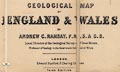
|
|
|
|
|
Ramsey 1737
|
|
Eclipse map, Description of the Passage of the Annular
Penumbra, predicting the annular eclipse 18 February 1737
over the British Isles, scale about 50 miles to 1 inch, by
William Ramsey, published by John Haynes, York, Yorkshire,
1737.
|
|
|
|
|
|
Red Guide 1892 map
|
|
Map, The District of the Lakes, scale about 4 miles to 1
inch, published by Ward, Lock and Co, Warwick House,
Salisbury Square, London, etc, 1892.
|
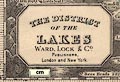
|
|
|
|
|
Redmayne 1676
|
|
Maps, Westmorland? and Cumberland? in a set of playing
cards published by W Redmayne et al, London, 1676.
|
|
|
|
|
|
Reid and Wallis 1820
|
|
Maps, Westmoreland, scale about 14.5 miles to 1 inch, and
Cumberland? printed by James Wallis, Berwick Street, Soho,
published by W H Reid, Charing Cross, London, about
1820.
|

|
|
|
|
|
Religious Tract Society 1860s
map
|
|
Map of the Lake Districts of Cumberland, Westmorland and
Lancashire, scale about 5 miles to 1 inch, published by the
Religious Tract Society, London, 1860s?
|
|
|
|
|
|
Rennie 1792
|
|
Canal map, Plan of the Proposed Lancaster Canal,
Lancashire and Westmorland, scale about 1 miles to 1 inch,
surveyed by John Rennie, 1791-92, engraved by William Faden,
London, 1792.
|
|
|
|
|
|
Reynolds 1848
|
|
Maps, The Lake District, and North Cumberland, each scale
about 8 miles to 1 inch, engraved by John Emslie, published
by James Reynolds, 174 Strand, London, 1848; published
1848-64.
|
|
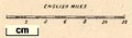
|
|
|
|
Reynolds 1860s
|
|
Geological maps, descriptive text, etc, Reynolds's
Geological Atlas of Great Britain, published by James
Reynolds, 174 Strand, new edition, 1860s?
|
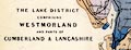
|
|
|
|
|
Reynolds 1920s
|
|
Relief Map of the Lake District, made with plaster of
paris, scale 1 inch to 1 mile, made by Exelby Reynolds,
Shipley, Yorkshire, 1920s-40s.
|
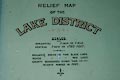
|
|
|
|
|
Richardson 1860s-70s
|
|
Railway map, New Map of the Lake District, scale about 6
miles to 1 inch, published by Joseph Richardson, Vulcan
Steam Printing Works, 79 Duke Street, Barrow-in-Furness,
Lancashire, 1860s-70s.
|
|
|
|
|
|
Roberts c1800
|
|
Jigsaw puzzle map, mahogany, hand coloured engraving,
map, New Map of England, by ?J Roberts, London? about
1800.
|
|
|
|
|
|
Robertson 1911 maps
|
|
Map, of Wordsworthshire, scale about 7 miles to 1 inch,
by G W Bacon and Co, for Eric Robertson, published by Chatto
and Windus, London, 1911.
|
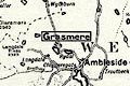
|
|
|
|
|
Robins 1818
|
|
Maps, Westmoreland, scale about 5.5 miles to 1 inch, and
Cumberland? engraved by Neele, Strand, published by J and J
Cundee, Albion Press, London, 1815; published 1815-19.
|
|
|
|
|
|
Rocque 1746
|
|
Maps, Westmorland, scale about 7.5 miles to 1 inch, and
Cumberland, scale about 12 miles to 1 inch, by John Rocque,
published by Thomas Read, London, 1746; published
1746-69.
|
|
|
|
|
|
Rocque 1760s
|
|
Jigsaw puzzle map, wood, Traveller's Companion, or Post
Roads of England and Wales, engraving, scale about 1 to
1100000, say 17 miles to 1 inch, by John Rocque, map maker
died 1762, published by Robert Sayer, 53 Fleet Street,
London, 1786.
|
|
|
|
|
|
Rocque 1771
|
|
Road map, The Traveller's Companion or The Post Roads of
England and Wales, scale about 21 miles to 1 inch, by John
Rocque, published by Robert Sayer, 53 Fleet Street, London,
1771.
|
|
|
|
|
|
Rodwell 1834
|
|
Maps, Westmoreland, and Cumberland? by Mary Martha
Rodwell, published by Longman, Rees, Orme, Brown, Green and
Longman, London, 1834.
|
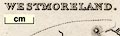
|
|
|
|
|
Rowe 1816
|
|
Maps, Westmorland, scale about 3 miles to 1 inch, and
Cumberland? by Robert Rowe, 19 Bedford Street, London,
engraved by T Barnett, published 1816; published
1816-1829.
|
|
|
|
|
|
Rumney 1899 map
|
|
Map, on Pegamoid cloth, Map of The Lake District of
Cumberland, Westmorland and Lancashire, scale about 4 miles
to 1 inch, by/for A W Rumney, published by George Philip and
Son, 32 Fleet Street, London, and Liverpool, 1899.
|
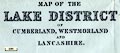
|

|
|
|
|
Ruthven 1855
|
|
Geological Map of the Lake District, scale about 3.5
miles to 1 inch, by John Ruthven, Kendal, published by John
Garnett, Windermere, Westmorland, 1855.
|
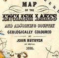
|
|
|
|
|
Sanson 1679
|
|
Map, Ancien Royaume de Northumberland aujourdhuy
Provinces de Nort, ie the Ancient Kingdom of Northumberland
or the Northern Provinces, scale about miles to 1 inch, by
Nicholas Sanson, Paris, France, 1679.
|
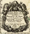
|
|
|
|
|
Saxton 1579
|
|
Map, Westmorlandiae et Cumberlandiae Comitatus ie
Counties of Westmorland and Cumberland, scale about 5 miles
to 1 inch, by Christopher Saxton, London, engraved by
Augustinus Ryther, 1576 and presumably available from that
date, published with other county maps in an atlas 1579;
published 1579-1645.
|

|

|
|
|
|
Sayer 1847 map
|
|
Map of the County of Westmorland, scale about 2.5 miles
to 1 inch, published by W Sayer, Kendal, Westmorland,
1847.
|
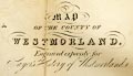
|
|
|
|
|
Scott 1837 map
|
|
Map of the Newcastle and Carlisle Railway shewing its
Junction with the Carlisle and Maryport Railway, by Francis
Giles, railway engineer, engraved by Allan and Ferguson,
Glasgow, published by Hudson Scott, Carlisle, Cumberland,
and by Currie and Bowman, Newcastle upon Tyne,
Northumberland, 1837.
|
|
|
|
|
|
Scott 1858
|
|
Town plan, Plan of Carlisle, scale about 12 inches to 1
mile, published by H Scott, Carlisle, Cumberland, 1858.
|

|
|
|
|
|
Scott c1835 map
|
|
A Map of the Lake Districts, scale about 10.5 miles to 1
inch, engraved by Macmillan, Carlisle, published by Hudson
Scott, Carlisle, Cumberland, about 1835.
|
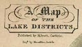
|
|
|
|
|
Seale 1761
|
|
Maps, Westmoreland, scale about 7 miles to 1 inch, and
Cumberland? by R W Seale, 1761.
|
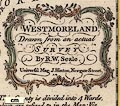
|
|
|
|
|
Sedgwick 1835
|
|
Geological map to accompany an earlier article in
Proceedings of the Geological Society of London, On the
General Structure of the Lake Mountains, by Adam Sedgwick,
published London, 1835.
|
|
|
|
|
|
Seller 1694
|
|
Maps, Westmorland, scale about 8 miles to 1 inch, and
Cumberland, scale about 12 miles to 1 inch, by John Seller,
1694, and in an edition of 1787; published 1694-1787.
|
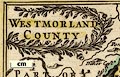
|
|
|
|
|
|
|
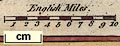
|
|
|
|
|
|
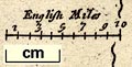
|
|
|
|
|
|
|
|
|
|
Senex 1719-57
|
|
Road book, Survey of all the Principal Roads of England
and Wales, including road strip maps with sections in
Westmorland, Cumberland, etc, scales about 2.5 miles to 1
inch, derived from maps by Ogilby, 1675, by John Senex,
London, 1719; revised 1757; published up to 1780s.
|
|
|
|
|
|
Sharpe 1993
|
|
Map, embroidery, Westmorland, sewn by C Sharpe, 1993.
|
|
|
|
|
|
Shell 1963
|
|
Poster, map and descriptive text, Shell Guide to
Westmorland, by Claud Harrison, and similar poster for
Cumberland, published by Shell, London, 1963.
|
|
|
|
|
|
Simons 1635
|
|
Table of distances and map of Westmerland, scale about 45
miles to 1 inch, and of Cumberland, scale about 41 miles to
1 inch, engraved by Jacob van Langeren, published by Mathew
Simmons, London, 1635-36.
|
|
|
|
|
|
|
|
|
|
|
|
Simpson 1746 map
|
|
Maps, Westmorland, scale about 8 miles to 1 inch, and
Cumberland? printed by R Walker, Fleet Lane, London,
1746.
|
|
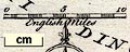
|
|
|
|
Skrine 1801
|
|
Map, rivers in Cumberland, Westmorland, Lancashire and
Cheshire, scale about 23 miles to 1 inch, by Henry Skrine,
published by P Elmsly, London, 1st edn 1801.
|
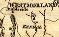
|
|
|
|
|
Smith 1746 map 1
|
|
Map of the Countries Adjacent to Carlisle shewing the
Route of the Rebels, scale about 1 inch to 1 mile, by G
Smith, published in the Gentleman's Magazine, London,
1746.
|
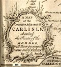
|
|
|
|
|
Smith 1746 map 2
|
|
Town plan, A Plan of the City of Carlisle with the
Position of the Batteries Erected by the Duke of Cumberland,
Cumberland, scale about 12.5 inches to 1 mile, by G Smith,
engraved by T Jefferys, published by E Cave, St Johns Gate,
London, 1746
|
|
|
|
|
|
Smith 1748
|
|
Eclipse map, The Geography of the Great Solar Eclipse of
July 14, 1748, by G Smith, engraved by T Jefferys, published
by the Gentleman's Magazine, London, 1748.
|
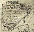
|
|
|
|
|
Smith 1751
|
|
Map of the Black Lead Mines in Cumberland, and area,
scale about 2 miles to 1 inch, by George Smith, published in
the Gentleman's Magazine, 1751.
|
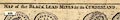
|
|
|
|
|
Smith 1800
|
|
Smith's New and Accurate Map of the Lakes in the Counties
of Cumberland, Westmorland, and Lancashire, scale about 2.5
miles to 1 inch, by Charles Smith, 172 Strand, London,
1800.
|
|
|
|
|
|
Smith 1804
|
|
A New Map of the County of Westmorland, scale about 2.5
miles to 1 inch, engraved by Jones and Smith, Pentonville,
and A New Map of the County of Cumberland, scale about 3.5
miles to 1 inch, published by Charles Smith, 172 Strand,
London, 1804; published 1804-46.
|
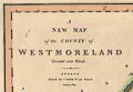
|
|
|
|
|
Smith 1815
|
|
Geological map, Delineation of the Strata of England and
Wales, and accompanying geological memoir, by William Smith,
published by John Cary, Strand, London, 1815.
|
|
|
|
|
|
Smith 1822
|
|
Maps, Westmoreland, scale about 5.5 miles to 1 inch, and
Cumberland? by Charles Smith, engraved by Pickett, published
by Charles Smith, 172 Strand, London, 1822.
|
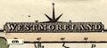
|
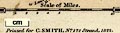
|
|
|
|
Smith 1824
|
|
Geological Maps, Geological Map of Westmoreland, scale
about 2.5 miles to 1 inch, and Geological Map of Cumberland,
scale about 3.5 miles to 1 inch, by William Smith, published
by John Cary, 86 St James's Street, London, 1824.
|
|
|
|
|
|
|

|
|
|
|
|
Smith 1826
|
|
Road book, strip maps with sections in Westmorland,
Cumberland, etc, scales roughly 8 or 9 miles to 1 inch,
engraved by Gardner, published by Charles Smith and Son, 172
Strand, London, 1826.
|

|
|
|
|
|
Smith 1841
|
|
Diocesan map, Carlisle, in Cumberland, Westmorland and
part of Lancashire, scale about 9 miles to 1 inch, engraved
by J Archer, Pentonville, London, published by T Clerc
Smith, 13 Henrietta Street, Covent Garden, London, 1841.
|

|
|
|
|
|
Smith 1878
|
|
Railway map, Map of the Lake District, scale about 5.5
miles to 1 inch, published by Joseph Smith, 85 Fleet Street,
London, 1878.
|
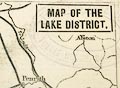
|
|
|
|
|
Smith 1890
|
|
Town plan, City of Carlisle Plan showing the Township and
Ward Boundaries, scale about 6 inches to 1 mile, by W Howard
Smith, Carlisle, Cumberland, 1890.
|
|
|
|
|
|
Society of Antiquaries 1896
|
|
An Archaeological Map of Lancashire, authored by William
Harrison, drawn by Stanford, London, published by the
Society of Antiquaries of London, London, 1896.
|

|
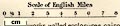
|
|
|
|
Sopwith 1833
|
|
Road map, Plan of the Principal Roads Communicating with
the Mining Districts of Alstonmoor, ..., Cumberland, scale
about 12.5 miles to 1 inch, by T Sopwith, engraved by W
Collard, published by W Davison, Alnwick, Durham, 1833.
|
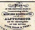
|
|
|
|
|
Speed 1611
|
|
Maps, The Countie Westmorland and Kendale the Cheif
Towne, scale about 3.5 miles to 1 inch, and Cumberland and
the Ancient Citie Carlile, scale about 4 miles to 1 inch, by
John Speed, London, 1611; published 1611-1770.
|
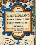
|
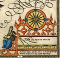
|
|
|
|
|
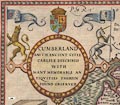
|
|
|
|
|
Speed 1695
|
|
Maps, Countie Westmorland and Kendale the Cheif Towne,
scale about 3.5 miles to 1 inch, and Cumberland and the
Ancient Citie Carlile, scale about 4 miles to 1 inch, by
John Speed, 1611 altered by Christopher Browne, 1695;
altered and published by Henry Overton, London, 1713-43;
published 1713-1770.
|
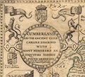
|
|
|
|
|
Stanford 1864
|
|
Geological maps, The Lake District, and North Cumberland,
each scale about 7 miles to 1 inch, by Edward Stanford, Long
Acre, probably published by James Reynolds, 174 Strand,
London, 1864.
|
|
|
|
|
|
Stanford 1880
|
|
Map of the English Lake District, scale about 4 miles to
1 inch, by Edward Stanford, Stanford's Geographical
Establishment, 55 Charing Cross, London, 1880?.
|

|
|
|
|
|
Stanford 1884
|
|
Map to Accompany Jenkinson's Practical Guide to Carlisle,
Gilsland, Roman Wall and Neighbourhood, scale about 3 miles
to 1 inch, published by Edward Stanford, 55 Charing Cross,
London, 1875 edn 1884?
|
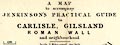
|
|
|
|
|
Stanford 1885
|
|
Maps, Westmorland, Cumberland, both scale about 8 miles
to 1 inch, published by Edward Stanford, Stanford's
Geographical Establishment, 55 Charing Cross, London,
1885.
|
|
|
|
|
|
|
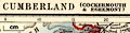
|
|
|
|
|
Stanford 1899
|
|
Map of the English Lake District, scale about 6.5 miles
to 1 inch, made at Stanford's Geographical Establishment,
London, published by Lawrence and Bullen, London, 1899.
|
|
|
|
|
|
Stanford 1904
|
|
Geological maps, Stanford's Geological Atlas of Great
Britain and Ireland, by Horace B Woodward, published by
Edward Stanford, 12-14 Long Acre, London, 3rd edn 1914.
|
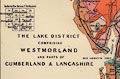
|
|
|
|
|
Stanford 1907
|
|
Maps included in The Counties of England, in the
Ambleside Geography Books series, by Charlotte M Mason,
published by Kegan Paul, Trench, Trubner and Co, Broadway
House, 68-74 Carter Lane, London, edn 1930.
|
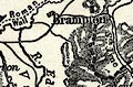
|
|
|
|
|
Stockdale 1795
|
|
Canal map, strip map, Lancaster Canal, engraved by I
Mutlow, published by John Stockdale, Piccadilly, London,
1795.
|
|
|
|
|
|
Stow 1949
|
|
Town plan, County Borough of Carlisle, Cumberland, scale
about 6 inches to 1 mile, by L J A Stow, City Engineer and
Surveyor, 18 Fisher Street, Carlisle, Cumberland, revised
1949.
|
|
|
|
|
|
Stukeley 1723
|
|
Road map, Itinerarium per Britanniam, the Antonine
Itineraries through Britain, scale about 55 miles to 1 inch,
plotted by William Stukeley, 1723, published London,
1724.
|
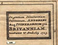
|
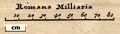
|
|
|
|
Swinburn 1793
|
|
Town plan, manuscript, A Plan of the Town and Harbour of
Workington, Cumberland, from the survey by William Swinburn,
1793, copied 1846.
|
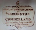
|

|
|
|
|
Symons 1860 maps
|
|
Maps included in a series of annual reports, British
Rainfall 1860 onwards, compiled by G J Symons, published by
Edward Stanford, 6 Charing Cross, and Simpskin, Marshall and
Co, Stationers' Hall Court, London, from 1860 to 1918.
|
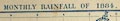
|
|
|
|
|
|
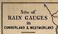
|
|
|
|
|
Tattersall 1836 map
|
|
Map of the Lakes of England, scale about 4 miles to 1
inch, by George Tattersall, engraved by J Nethercliff, 23
King William Street, Strand, published by Sherwood and Co,
23 Paternoster Row, London, about 1836.
|
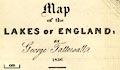
|
|
|
|
|
Taylor 1932 map
|
|
Road map, Esso Pictorial Plan of the North, by Alfred E
Taylor, published by H K McCann Co, for Anglo-American Oil
Co ie Esso, London, about 1932.
|
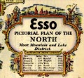
|
|
|
|
|
Teesdale 1830
|
|
Maps, Westmorland, scale about 8 miles to 1 inch, and
Cumberland, scale about 11 miles to 1 inch, by Henry
Teesdale and Co, 302 High Holborn, London, 1830.
|

|
|
|
|
|
|
|
|
|
|
|
The Car 1900s
|
|
Road map, a zigzag map, The Car Route Maps no.2, London
to Edinburgh, West Coast Route, scale about 4 miles to 1
inch, published by The Car Illustrated, 168 Piccadilly,
London, 1900s?
|
|
|
|
|
|
Thomas 1916
|
|
Geological Map of the Lake District, scale about 4 miles
to 1 inch, by H H Thomas, about 1916.
|
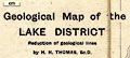
|
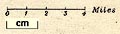
|
|
|
|
Thurnam 1910s-20s map 1
|
|
Relief map, halftone photographic image, physical
features of Cumberland, scale roughly 18 miles to 1 inch, by
E J Arnold and Son, Leeds, Yorkshire, published by Charles
Thurnam and Sons, Carlisle, Cumberland 1910s-20s.
|
|
|
|
|
|
Thurnam 1910s-20s map 2
|
|
Map, Cumberland and Westmorland, scale about 11.5 miles
to 1 inch, by W and A K Johnston, Edinburgh, published by
Charles Thurnam and Sons, Carlisle, Cumberland
1910s-20s.
|
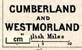
|
|
|
|
|
Thurnam c1923 map
|
|
Town plan, Plan of City of Carlisle, Cumberland,
published by Charles Thurnam and Sons, 11 English Street,
Carlisle, Cumberland, about 1923.
|
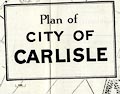
|
|
|
|
|
Tinne 1946 map
|
|
Map, from a pen and ink drawing, The Lakes, scale about 5
miles to 1 inch, by E D Tinne, published by Frederick Warne
and Co, London, 1946.
|
|
|
|
|
|
Tinsley 1877
|
|
Road book, itineraries and strip maps, British High
Roads, North and North Eastern Routes, published by Tinsley
Bros, 8 Catherine Street, Strand, London, 1877.
|
|
|
|
|
|
Tower Press c1957
|
|
Map, Learn while you Play card jigsaw puzzle, Our
Counties, map of England and Wales, made by Tower Press,
London, about 1957.
|

|
|
|
|
|
Trade Card Maps 1860s-90s
|
|
Trade cards of the late 19th century sometimes included a
map, perhaps of an area around the hotel that issued the
card. The same map might be found on more than one card,
possibly with the hotel name overprinted.
|
|
|
|
|
|
Tschudi 1550s
|
|
Map, manuscript on two sheets, England and Scotland, by
Aegidius Tschudi, Switzerlamd, 1550s?
|
|
|
|
|
|
Tymms 1832-43 map
|
|
Maps, Westmorland, and Cumberland, by Samuel Tymms,
published by J B Nichols and Son, 25 Parliament Street,
1837.
|

|
|
|
|
|
|
|
|
|
|
|
Ullswater Steamers 1900s
map
|
|
Railway map, London North Western, Midland, and North
Eastern Railways and their connections, published by the
Ullswater Steam Navigation Co, 2nd edn 1900s?
|
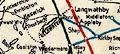
|
|
|
|
|
Unknown 1552
|
|
Map, The Debatable Land, Cumberland and Scotland, with
lines of proposed divisions, 1552; published by Cumberland
and Westmorland Antiquarian and Archaeological Society,
Kendal, Westmorland, 1914.
|
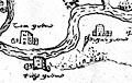
|
|
|
|
|
Unknown 1560s-90s
|
|
Town plan, Civitas Carliolen, the City of Carlisle,
Cumberland, time of Elizabeth I
|

|
|
|
|
|
Unknown 1600s
|
|
Plan of Kirkby Kendall ie Kendal, Westmorland, scale
about 10 inches to 1 mile, perhaps reproduced from a
coloured original of the late 17th century; perhaps a
fake.
|
|
|
|
|
|
Unknown 1607
|
|
Map, Platt of the Forrest of Nicholl and the Mannor of
Liddale, including the Debatable Land, Cumberland and
Scotland, 1607; published by Cumberland and Westmorland
Antiquarian and Archaeological Society, Kendal, Westmorland,
1914.
|
|
|
|
|
|
Unknown 1690
|
|
Town plan, Whitehaven, Cumberland, about 1690.
|
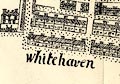
|
|
|
|
|
Unknown 1772
|
|
Accurate Map of Great Britain, scale about 40 miles to 1
inch, for the Complete English Traveller, by Nathaniel
Spencer, published by John Cooke, London, 1772.
|
|
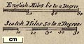
|
|
|
|
Unknown 1790s
|
|
Map, A Plan of the Lancaster Canal, scale about 5 miles
to 1 inch, perhaps published 1790s.
|
|
|
|
|
|
Unknown 1800s
|
|
Map of the Roman Wall, scale about 4 miles to 1 inch,
early 19th century??
|
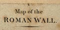
|
|
|
|
|
Unknown 1800s-30s
|
|
Map, Lancashire, scale roughly 9 miles to 1 inch, early
19th century?
|
|
|
|
|
|
Unknown 1814
|
|
Map, Plan of the Lakes of Cumberland, perhaps about
1814.
|
|
|
|
|
|
Unknown 1840s
|
|
Railway and canal map, England and Wales with the Canals,
Navigable Rivers, Railroads &c, scale about 43 miles to 1
inch, published 1840s?.
|

|
|
|
|
|
Unknown 1846
|
|
Railway map, Map of the Lancaster and Carlisle Railway,
scale about 11.5 miles to 1 inch, published about 1846?
|
|
|
|
|
|
Unknown 1900s
|
|
Road map, Sketch of the Roman Roads and Camps for
Guarding the Western Flank of the Roman Wall, scale about
miles to 1 inch, early 20th century?
|
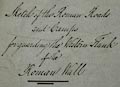
|
|
|
|
|
van der Aa, Pieter
|
|
Map, Comte de Westmorland? and Comte de Cumberland, by
Pieter van der Aa, Leyden, Netherlands, 1714
|
|
|
|
|
|
Victory Jigsaw 1974
|
|
Pictorial map, plywood Victory Jigsaw Puzzle, Industrial
Life of England and Wales, scale about 33 miles to 1 inch,
showing the new county boundaries, made by G J Hayter and
Co, subsidiary of J W Spear and Sons, Bournemouth, Dorset,
1974.
|
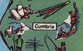
|
|
|
|
|
Visscher 1690
|
|
Map, A New Mapp of the Kingdome of Engalnd, by Nicolas
Visscher, the Sign of the Fisher, on the Dam, Amsterdam,
Netherlands, 1690.
|
|
|
|
|
|
Vista 2005
|
|
Pictorial map, tea towel, colour printed cotton, The Lake
District, Cumbria, made by Vista, 2005.
|
|
|
|
|
|
W H Smith 1890s
|
|
Map, Environs of Keswick, Buttermere, Patterdale and
Grasmere, scale about 1 inch to 1 mile, by John Bartholomew,
Edinburgh, published by W H Smith and Son, London, about
1890s.
|
|
|
|
|
|
W H Smith c1889
|
|
Map, Environs of Windermere and the Lake District, scale
about 4 miles to 1 inch, by John Bartholomew, Edinburgh,
published by W H Smith and Son, London, about 1889.
|

|

|
|
|
|
Wainwright 1990s
|
|
An Antiquarian Map of Cumbria, scale about 5 miles to 1
inch, by Alfred Wainwright, research by John Marsh,
published by the Cumberland and Westmorland Antiquarian and
Archaeological Society, Kendal, 1990s?
|
|
|
|
|
|
Walker 1830
|
|
Map, England No.2, Westmorland, Cumberland, Isle of Man,
etc, scale about 11 miles to 1 inch, engraved by J and C
Walker, about 1830; published 1830-45 or later.
|
|

|
|
|
|
Walker 1831
|
|
Map of Lancashire AD mlxxxvi According to the Doomsday
Survey, scale about 6.5 miles to 1 inch, by Walker, 1831;
reprinted 1843.
|
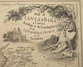
|
|
|
|
|
Walker 1837
|
|
Maps, Westmorland, scale about 3 miles to 1 inch, and
Cumberland, scale about 5 miles to 1 inch, by John and
Charles Walker, derived from the Ordnance Survey and others,
published by Longman, Rees and Co, Paternoster Row, London,
1836; published 1836-70.
|

|

|
|
|
|
|

|

|
|
|
|
Wallace 1861 map
|
|
Map of the Alston Moor and Coal Cleugh Mining Districts,
scale about 2 inches to 1 mile, by William Wallace,
published by Edward Stanford, 6 Charing Cross, London,
1861.
|
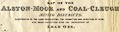
|
|
|
|
|
Wallace 1890 map
|
|
Map of Alston Moor, scale about 1 inch to 1 mile, by
William Wallace, published by Mawson, Swan and Morgan, Grey
Street, Newcastle upon Tyne, Northumberland, 1890
|
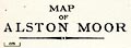
|
|
|
|
|
Wallis 1810
|
|
Map, Westmoreland, scale about 19 miles to 1 inch, and
Cumberland, scale about 16 miles to 1 inch, by James Wallis,
77 Berwick Street, Soho, London, 1810; published
1810-36.
|
|
|
|
|
|
|
|
|
|
|
|
Wallis 1812
|
|
Maps, Westmoreland, scale about 6 miles to 1 inch, and
Cumberland, scale about 8 miles to 1 inch, by James Wallis,
London, 1812.
|

|
|
|
|
|
|

|
|
|
|
|
Wallis 1815
|
|
Jigsaw puzzle map, wood, hand coloured engraving,
Wallis's New Travelling Map of England and Wales, scale
about 3 miles to 1 inch, published by John Wallis, London,
about 1815.
|
|
|
|
|
|
Walton 1679
|
|
Road map, A New Map Containing all the Cities in England
and Wales, by Robert Walton, The Globe, St Paul's
Churchyard, and Robert Morden, The Atlas, Cornhill, London,
1679.
|
|
|
|
|
|
Waters 1860s
|
|
Relief map, Model of the Lake District, scale about 6 ins
to 1 mile, made by George Waters, photographer,
Bowness-on-Windermere, Windermere, Westmorland, 1860s?
|
|
|
|
|
|
West 1784 map
|
|
A Map of the Lakes in Cumberland, Westmorland and
Lancashire, scale about 3.5 miles to 1 inch, engraved by
Paas, 53 Holborn, London, included in the Guide to the Lakes
by Thomas West, published by William Pennington, Kendal,
Westmorland, and in London, from the 3rd edition 1784, to
1821.
|
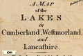
|
|
|
|
|
Whellan 1858
|
|
Geological map, Map of the Counties of Cumberland and
Westmorland ... Geologically Coloured, scale about 3.5 miles
to 1 inch, drawn and engraved by W Banks, Edinburgh,
Lothian, published by William Whellan and Co, 1858.
|
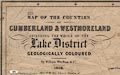
|
|
|
|
|
Whitehaven Steam Co 1828
|
|
Map, and chart, District of the Lakes and Courses of the
Whitehaven Steam Packets, scale about 14 miles to 1inch,
perhaps published by the Whitehaven Steam Co, Whitehaven,
Cumberland, 1828.
|
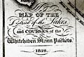
|
|
|
|
|
Whittaker 1821
|
|
Maps, Westmoreland, scale about 9 miles to 1 inch, and
Cumberland? engraved by Neele and Son, 352 Strand, London,
1821, published by G and W B Whittaker, Ave Maria Lane,
London, 1821-23.
|
|
|
|
|
|
Whitworth 1772
|
|
Canal map, Plan of the Proposed Navigable Canal ... to
Kendal, scale about 4 miles to 1 inch, by Robert Whitworth,
published by the Gentleman's Magazine, 1772.
|
|
|
|
|
|
Wilkes 1801-28
|
|
Maps, Westmoreland, scale about 5 miles to 1 inch, and
Cumberland? by John Wilkes, engraved by J Pass, published J
Adlard, Duke Street, West Smithfield, London, 1801-28?
|
|
|
|
|
|
|
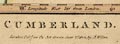
|
|
|
|
|
Willdey 1713
|
|
Road map, The Roads of England According to Mr Ogilby's
Survey, by George Willdey, Great Toy and Print Shop, Ludgate
Street, London, about 1713.
|
|
|
|
|
|
Williams 1838
|
|
Map or maps of The Lakes counties? in an atlas, Visible
Geography, England, by Charles Williams, published by Thomas
Ward and Co, Paternoster Row, London, 1838.
|
|
|
|
|
|
Wood 1820s-30s
|
|
Town plan, uncoloured engraving, Plan of the City of
Carlisle, by John Wood, engraved by Robert Walker,
Edinburgh, published by John Wood, Cannaan, Edinburgh,
1821.
|
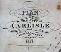
|

|
|
|
|
Woodward 1843
|
|
Geological Map of England and Wales, scale about 28 miles
to 1 inch, by S P Woodward, engraved by J and C Walker,
coloured by T Maltby, published for the Society for the
Diffusion of Useful Knowledge, by Chapman and Hall, 186
Strand, London, 1843
|
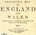
|

|
|
|
|
Woutneel 1603
|
|
Map, Descripsion of the Kingdoms of England, Scotland and
Ireland, etc, by Hans Woutneel, engraved by William Kip,
London, 1603.
|
|
|
|
|
|
Wright 1737
|
|
Eclipse map, The Passage of the Annular Penumbra over
Scotland etc, predicting the track of an annular eclipse of
the sun over Great Britain, 18 February 1737, scale about 41
miles to 1 inch, by Thomas Wright, Durham, published by John
Senex, London, 1737.
|
|
|
|
|
|
Wyld 1847
|
|
Map of the English Lake District, scale about 3 miles to
1 inch, engraved by James Wyld, Charing Cross East, London,
published by T Johnstone, Edinburgh, Lothian, 1847.
|
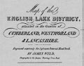
|

|
|
|
|
Yates 1786
|
|
Map, engraving, The County Palatine of Lancaster, scale
about 1 inch to 1 mile, by William Yates, published, London,
1786.
|
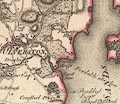
|
|
