 Dix and Darton 1816

|

|
|
|
map type:- Dix and Darton 1816 |
|
|
|
Maps, A New Map of the County of Westmoreland, and A New
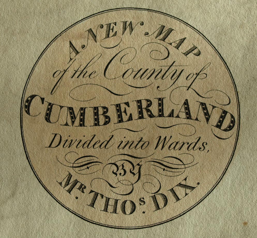
Map of the County of Cumberland, scale about 4.5 miles to 1
inch, by Thomas Dix, North Walsham, Norfolk, published by
William Darton, 58 Holborn Hill, London, from 1816.
Published in '[A Complete Atlas of the English Counties, divided into their respective hundreds, &c on which are carefully marked the whole of the Turnpike and Parish Roads, the situation of towns, villages, parks, and gentlemen's seats, churches, chapels; navigable canals and rivers, and every object tending to illustrate the History and Antiquities of England ... to which is added, various Explanatory Notes ... Commenced by the late Thomas Dix, of North Walsham; carried on and completed by William Darton ... London; William Darton, 58, Holborn Hill. 1822]' |
||
|
(map examples BL Maps 1.l.19)
|
||
| map feature:- | title cartouche & circular cartouche & vignettes (Winander Mere) & descriptive text & market days & compass rose & up is N & scale line & lat and long scales & table of symbols & sea plain & coast line & coast tinted & rivers & lakes & relief & hill hachuring & parks & county & wards (hundreds) & settlements & roads & canals | |
| inscription:- |
Wmd: printed circular cartouche, lower left
NEW MAP / of the County of / WESTMORELAND, / Divided into Wards, / BY / THOMAS DIX. |
|
| inscription:- |
Wmd: printed bottom
London, William Darton, 58, Holborn Hill; Jan. 28. 1820. |
|
| wxh, map:- | 434x348mm | |
| scale line:- | 7+1 miles = 64.9 mm | |
| scale:- | 1 to 190000 ? (1 to 193378 from scale line, assuming a statute mile) | |
| wxh, map:- | 350x447mm | |
| scale line:- | 14+1 miles = 81.9 mm | |
| scale:- | 1 to 290000 ? (1 to 294752 from scale line, assuming a statute mile) | |
| sources:- |
Chubb 1927 (CCCLXXXVII) British Library (Maps 1.l.19) Kendal Library Maps Carlisle Library Maps |
|
| items seen (illustrated items in bold):- | ||

|
Carlisle Library : Map 32 -- map -- New Map of the County of Cumberland | |
|
|
Kendal Library : Map 78 -- map -- New Map of the County of Westmoreland | |