 Linton 1852 map

|

|
|
|
map type:- Linton 1852 map |
|
|
|
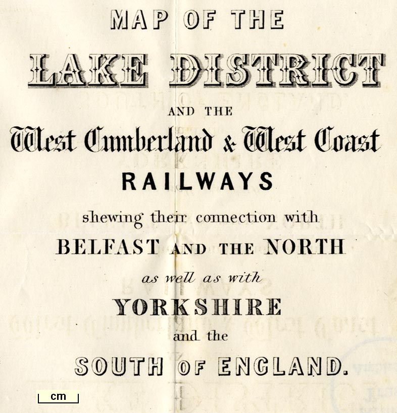
Railway map, Map of the Lake District and the West
Cumberland and West Coast Railways, scale about 6 miles to 1
inch, by ?John Linton, engraved by W H Lizars, Edinburgh,
Scotland, published by Whittaker and Co, London, and by R
Gibson and Son and by Callander and Dixon, Whitehave,
Cumberland, 1852.
Included in A Handbook of the Whitehaven and Furness Railway, by John Linton. |
||
|
(map example AMATL:A1158.1)
|
||
| map feature:- | folded (4x5, zigzag up, zigzag in) & north point & up is NW & scale line & sea plain & coast form lines & rivers & lakes & relief & hill hachuring & parks & settlements & roads & railways | |
| inscription:- |
printed lower right
MAP OF THE / LAKE DISTRICT / AND THE / West Cumberland and West Coast / RAILWAYS / shewing their connections with / BELFAST AND THE NORTH / as well as with / YORKSHIRE / and the / SOUTH OF ENGLAND. |
|
| inscription:- |
printed bottom right
Engd. by W. H. Lizars, Edinr. |
|
| wxh, sheet:- | 36x51.5cm | |
| wxh, map:- | 350x488mm | |
| scaleline:- | 25 miles = 104.1 mm | |
| scale:- | 1 to 390000 ? (1 to 386490 from scale line) | |

|
||
| sources:- |
Armitt Library |
|
| items seen (illustrated items in bold):- | ||

|
Armitt Library : A1082.20 -- map -- Map of the Lake District and the West Cumberland and West Coast Railways | |
|
|
Armitt Library : A1158.1 -- railway map -- Map of the Lake District and the West Cumberland and West Coast Railways | |