 Cumberland and Westmoreland

|

|
|
|
map type:- Harrison 1790 |
|
|
|
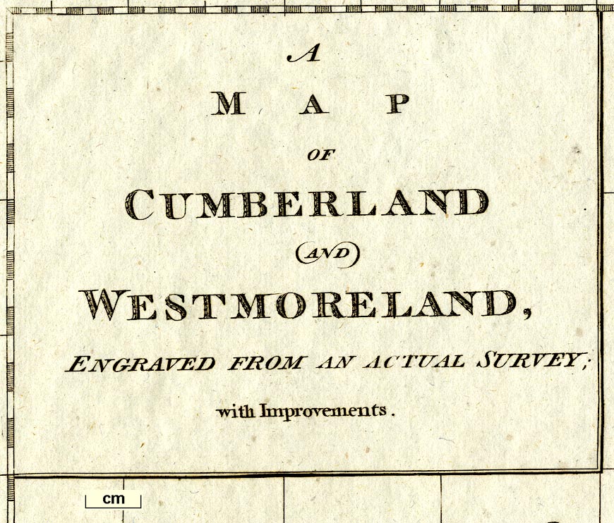
Map, Cumberland and Westmoreland, scale about 6 miles to
1 inch, drafted by Haywood, engraved by Sudlow, 1790
published by John Harrison, 115 Newgate Street, London,
1791; published 1791-92.
Published in 'Maps of the English Counties with the Subdivisions of Hundreds, Wapontakes, Lathes, Wards, Divisions, &c. To which are add two folio pages of Letter-Press, to face each Map; descriptive of the extent, boundaries, rivers, lakes, canals, soil, mines, minerals, curious plants, husbandry, and every curiosity that is nearly connected with the maps. The whole containing the most useful, entertaining, and instructive selection of the kind, that has yet appeared at the price of 3l. 3s. London: Printed by and for John Harrison, No.115, Newgate-Street, M,DCC,XCI.' ie 1791. The has a title page, a list of 'The Distances from Place to Place in Miles, on the Principal and cross Roads in England and Wales; with the Situation of each Gentleman's Seat.'; the atlas size is 20 1/2 x 16 ins. Published in second edition, price 2l. 2s., 1792. Published in a 'General and County Atlas ...', 1815. Harrison earlier published 'The Atlas to Accompany Rapin's History of England', 1784-89, which may have had a map relevant to Westmoreland, Cumberland, etc. |
||
| inscription:- |
printed map
[A / MAP / OF / CUMBERLAND / AND / WESTMORELAND / ENGRAVED FROM AN ACTUAL SURVEY / with Improvements.] |
|
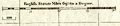
| scale:- | 1 to 3800000 ? (1 to 375467 from scale line assuming a statute mile) | |
| scale line:- | 20 miles = 3 3/8 ins | |
|
||
| references:- |
Harrison, John: 1791 & 1792: Maps of the English Counties:
(London) |
|
| sources:- |
Chubb 1927 (CCXCI) Armitt Library |
|
| items seen (illustrated items in bold):- | ||

|
Armitt Library : ALMC2008.14.99 -- map -- Cumberland and Westmoreland | |