 Lewis 1831

|

|
|
|
map type:- Lewis 1831 |

|
|
|
Maps, Westmorland, scale about 6 miles to 1 inch, and
Cumberland, scale about 6.5 miles to 1 inch, drawn by R
Creighton, engraved by John and Charles Walker, published by
Samuel Lewis and Co, 87 Aldersgate Street, London, 1831;
published 1831-49.
Published in 'A Topographical Dictionary of England, comprising the several counties, cities, boroughs ... illustrated by Maps of the different counties and islands; a Map of England ... and a plan of London ... By Samuel Lewis. In four volumes. London: Published by S. Lewis & Co., 87, Aldersgate-Street, 1831.' Published in 2nd edition 1833 In the 1833 edition the map has a note of places of election and polling places added at the top; wards are shown and named in a table lower right. Published in a 3rd edition 'A Topographical Dictionary of England ... Third edition, With a supplementary volume comprising a representative History of England with plans describing the electoral divisions of the several counties ... By Samuel Lewis ... London ... S. Lewis and Co ... 1835.' The 3rd edition has a supplementary volume with outline maps showing boroughs, places of election, polling places, etc, after the Reform Act 1832. Published in a 4th edition 1840. In the 1840 edition Union boundaries and names are added. Published in a 5th edition 'AN ATLAS, COMPRISING MAPS OF THE SEVERAL COUNTIES, DIVIDED INTO UNIONS, AND OF THE ISLANDS OF GUERNSEY, JERSEY, AND MAN; WITH A MAP OF ENGLAND AND WALES, AND A Plan of London and its Environs. / LONDON: PUBLISHED BY S. LEWIS AND CO., 87, HATTON GARDEN. M.DCCC.XLII.' ie 1842. The 1842 atlas size is 9 1/2 x 12 1/2 ins; the map is the same as the 1840 edition. Published in a 6th edition 1845, 7th edition 1849. In the 6th and 7th editions the map is unchanged. |
||
|
(map example JandMN (54))
|
||
| map feature:- | compass rose & scale line & lat and long scales & coast form lines & rivers & lakes & relief & hill hachuring & county & settlements & roads & canals | |
| inscription:- |
printed lower right
WESTMORLAND |
|
| inscription:- |
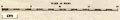
printed bottom left, centre, right
Drawn by R. Creighton / ENGRAVED FOR LEWIS' TOPOGRAPHICAL DICTIONARY. / J. & C. Walker Sculpt. |
|
| wxh, sheet:- | 23.5x30.5cm | |
| wxh, map:- | 174x228mm | |
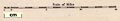
| scale line:- | 15 miles = 64.1 mm | |
| scale:- | 1 to 380000 ? (1 to 376602 from scale line) | |
|
||
|
||
| references:- |
: 1831 & 1833 & 1835 & 1840: Topographical Dictionary of
England: Lewis, Samuel (London) : 1842: Atlas & Topographical Dictionary of England (?): Lewis, Samuel (London) : 1845 & 1849: Topographical Dictionary of England (?): Lewis, Samuel (London) |
|
| sources:- |
Chubb 1927 (CCCCXXX) JandMN Collection Wordsworth Trust Collection Armitt Library Kendal Library Maps |
|
| items seen (illustrated items in bold):- | ||

|
Armitt Library : ALMC2008.14.23 -- map -- Westmorland | |
|
|
Armitt Library : ALMC2008.14.24 -- map -- Westmorland | |
|
|
Dove Cottage : 2007.38.9 -- map -- Westmorland | |
|
|
Dove Cottage : 2007.38.41 -- map -- Westmorland | |
|
|
Dove Cottage : 2007.38.78 -- map -- Cumberland | |
|
|
JandMN (54) -- map -- Westmorland | |
|
|
JandMN (85) -- map -- Cumberland | |
|
|
Kendal Library : Map 4 -- map -- Westmorland | |
|
|
Kendal Library : Map 7 -- map -- Westmorland | |
|
|
Kendal Library : Map 11 -- map -- Westmorland | |
|
|
Kendal Library : Map 50 -- map -- Westmorland | |