 Ambleside and Ullswater Section

|

|
|
|
map type:- Garnett 1850s-60s C |
|
|
|
Maps, 4 sectional maps of The Lakes - Keswick Section,
Ambleside and Ullswater Section, Wastwater Section,
Windermere and Coniston Section, scales about 1.5 and 2
miles to 1 inch, engraved by William Banks, Edinburgh,
published by John Garnett, Windermere, Westmorland, and by
Simpkin, Marshall and Co, London, 2nd edn 1860s?
Folded and tipped into A Guide to the English Lake District, by a Cambridge Man. These sectional maps are not all the same scale and do not fit together in the same way as another sectional map published by John Garnett. |
||
|
(example map JandMN (149_5))
|
||
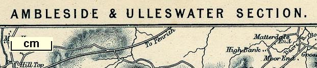
| inscription:- |
printed top
AMBLESIDE & ULLSWATER SECTION. |
|
| inscription:- |
printed bottom
Banks Edinr. |
|
| wxh, sheet:- | 16.5x21.5cm | |
| wxh, map:- | 142x187mm | |
| scale line:- | 8 miles = 104.7 mm | |
| scale:- | 1 to 120000 ? (1 to 122968 from scale line) | |

|
||
| sources:- |
JandMN Collection |
|
| items seen (illustrated items in bold):- | ||

|
JandMN (149_4) -- map -- Windermere and Coniston Section | |
|
|
JandMN (149_5) -- map -- Ambleside and Ullswater Section | |
|
|
JandMN (149_6) -- map -- Wastwater Section | |
|
|
JandMN (149_7) -- map -- Keswick Section | |