 Westmoreland

|

|
|
|
map type:- Letts 1884 |
|
|
|
Maps, Westmoreland, scale about 3 miles to 1 inch, and
Cumberland? published by Letts, Son and Co, London Bridge,
London, 1884.
Published in 'Letts Popular County Atlas', 1884. |
||
|
(map example JandMN (17))
|
||
| map feature:- | title cartouche & plain cartouche & up is N & scale line & table of symbols & sea tinted & coast line & rivers & lakes & relief & hill hachuring & woods & parks & county & electoral data & settlements & roads & railways & canals | |
| inscription:- |
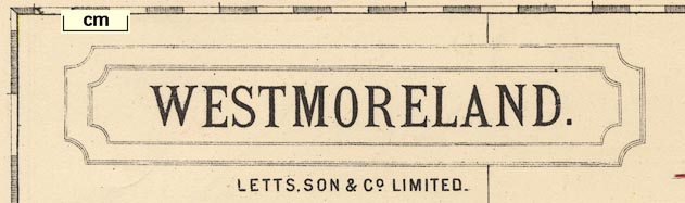
printed upper left
WESTMORELAND. / LETTS, SON & Co. LIMITED. |
|
| inscription:- |
printed bottom
LETTS, SON & Co LIMITED LONDON BRIDGE E.C. |
|
| scale line:- | 10+1 miles = 94.5 mm | |
| scale:- | 1 to 190000 ? (1 to 187331 from scale line) | |
| wxh, map:- | 386x325mm | |

|
||
|
||
| sources:- |
JandMN Collection |
|
| items seen (illustrated items in bold):- | ||

|
JandMN (17) -- map -- Westmoreland | |