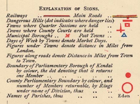
Maps, Westmoreland, scale about 3 miles to 1 inch, and Cumberland? published by Letts, Son and Co, London Bridge, London, 1884. (Letts 1884)
Lakes Guides menu.
 Lakes Guides menu.