 Letts 1884

|

|
|
|
item:- JandMN (17) image:- © see bottom of page |
click to enlarge |
|
|
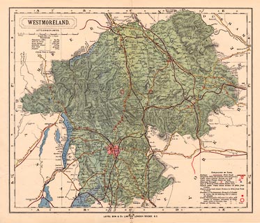
Map, colour printed, Westmoreland ie Westmorland, scale
about 3 miles to 1 inch, published by Letts, Son and Co,
London Bridge, London, 1884.
|
||

|
Letts 1884 | |
| map feature:- | plain cartouche & up is N & scale line & table of symbols & sea tinted & coast line & rivers & lakes & relief & hill hachuring & woods & parks & county & electoral data & settlements & roads & railways & canals | |
| inscription:- |
printed upper left
WESTMORELAND. / LETTS, SON & Co. LIMITED. |
|
| inscription:- |
printed bottom
LETTS, SON & Co LIMITED LONDON BRIDGE E.C. |
|
| scale line:- | 10+1 miles = 94.5 mm | |
| scale:- | 1 to 190000 ? (1 to 187331 from scale line) | |
| wxh, map:- | 386x325mm | |