 Garnett 1850s-60s G

|

|
|
|
map type:- Garnett 1850s-60s G |
|
|
|
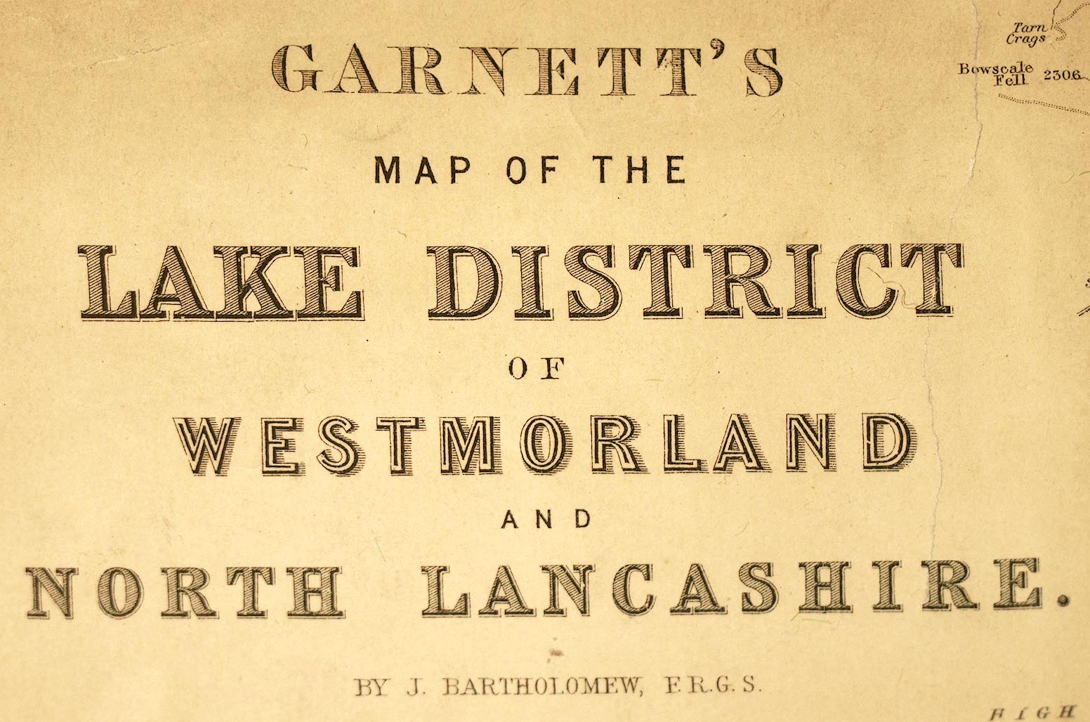
Garnett's Map of the Lake District of Westmorland and
North Lancashire, scale about 2 miles to 1 inch, by John
Bartholomew, Edinburgh, published by J Garnett, Windermere,
Westmorland, and by Simpkin, Marshall and Co, London,
1850s-60s.
|
||
|
(example Carlisle Library (33))
|
||
| map feature:- | compass rose & up is N & scale line & sea tinted & coast line & rivers & lakes & relief & hill hachuring & woods & trees & forests & parks & county & settlements & roads & canals & railways | |
| inscription:- |
printed upper left
GARNETT'S / MAP OF THE / LAKE DISTRICT / OF / WESTMORLAND / AND / NORTH LANCASHIRE. / BY J. BARTHOLOMEW, F.R.G.S. |
|
| wxh, map:- | 301x569mm | |
| inscription:- |
printed with scale line
SCALE 2 MILES TO AN INCH |
|
| scale line:- | 6 miles = 71.5 mm | |
| scale:- | 1 to 140000 ? (1 to 135050 from scale line, assuming a statute mile) | |
| sources:- |
Carlisle Library Maps |
|
| items seen (illustrated items in bold):- | ||

|
Armitt Library : A1187.1 -- map -- Garnett's Map of the Lake District of England | |
|
|
Carlisle Library : Map 81 -- map -- Garnett's Map of the Lake District of Westmorland and North Lancashire | |
|
|
Carlisle Library : Map 82 -- map -- Garnett's Map of the Lake District of Westmorland and North Lancashire | |