 North Eastern Railway

|

|
|
|
map type:- North Eastern Railway c1900 |
|
|
|
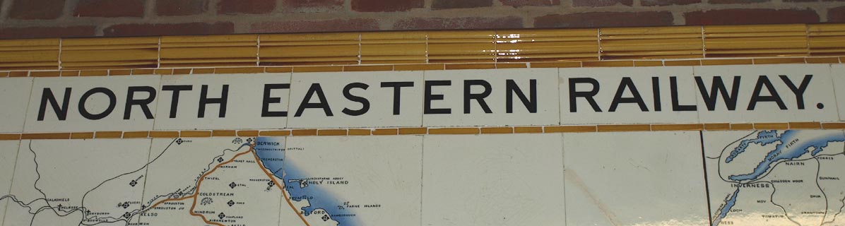
Railway map, station wall map of coloured ceramic tiles,
North Eastern Railway, with parts in Westmorland, Cumberland
etc, scale about 2.5 miles to 1 inch, made by Craven,
Dunnill and Co, Jackfield, Shropshire, about 1900.
23 of these tile maps were made for NER stations. The tiles are about 8 inches square. |
||
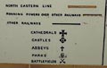
| map feature:- | title cartouche & compass rose & up is N & scale line & table of symbols & sea plain & coast tinted & rivers (few) & lakes & relief & hill hachuring (some) & parks & settlements & railways | |
| map feature:- | ||
| inscription:- |
NORTH EASTERN RAILWAY. top |
|
| inscription:- |
PRODUCED BY / CRAVEN, DUNNILLL & CO LTD. / JACKFIELD lower left |
|
| inscription:- |
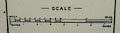
with scale line
SCALE / MILES |
|
| scale line:- | 20 miles = 193 mm | |
| scale:- | 1 to 170000 ? (1 to 166771 from scale line) | |
|
||
|
||
| sources:- |
National Railway Museum |
|
| items seen (illustrated items in bold):- | ||

|
National Railway Museum : 1995-7786 -- railway map -- North Eastern Railway | |