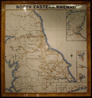
 North Eastern Railway c1900

|

|
|
|
item:- National Railway Museum : 1995-7786 image:- © see bottom of page |
click to enlarge |
|
|
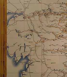
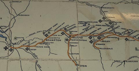
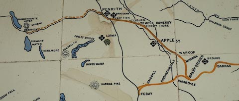
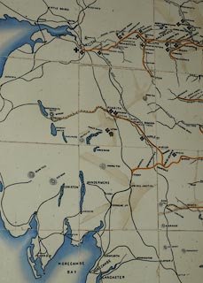
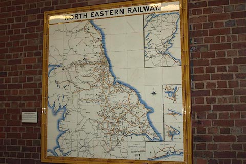
Railway map, wall map of coloured ceramic tiles, North
Eastern Railway, scale about 2.5 miles to 1 inch, made by
Craven, Dunnill and Co, Jackfield, Shropshire, about 1900.
The map is one of 23 tile maps made for NER stations, this example is from Kings Cross Station, London. |
||

|
North Eastern Railway c1900 | |
| map feature:- | plain cartouche & compass rose & up is N & scale line & table of symbols & sea plain & coast tinted & rivers (few) & lakes & relief & hill hachuring (some) & parks & settlements & railways | |
| inscription:- |
NORTH EASTERN RAILWAY. top |
|
| inscription:- |
PRODUCED BY / CRAVEN, DUNNILLL & CO LTD. / JACKFIELD lower left |
|
| inscription:- |
with scale line
SCALE / MILES |
|
| scale line:- | 20 miles = 193 mm | |
| scale:- | 1 to 170000 ? (1 to 166771 from scale line) | |
|
||
|
||
|
||
|
||
|
||
|
|
notes | |