 Historical Atlas of England

|

|
|
|
map type:- Andrews 1797 |
|
|
|
Historical maps, Historical Atlas of England, published
by John Andrews, 211 Piccadilly, London, 1797.
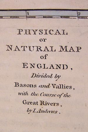
Published as an 'HISTORICAL ATLAS OF ENGLAND; PHYSICAL, POLITICAL, ASTRONOMICAL, CIVIL AND ECCLESIASTICAL, BIOGRAPHICAL, NAVAL, PARLIAMENTARY, AND GEOGRAPHICAL; ANCIENT AND MODERN; FROM THE DELUGE TO THE PRESENT TIME. IN WHICH ARE DESCRIBED ITS MINERALS, CURIOSITIES, INLAND FISHERIES AND NAVIGATION, COMMERCE, PEERAGES, NOBLEMEN AND GENTLEMEN'S SEATS, &c. INTERSPERSED WITH GEOGRAPHICAL NOTES and DATES for the Curious, and EXPLANATIONS to each MAP, in order to enable Persons of every Rank to read, with Advantage, the NATURAL HISTORY, ANTIQUITIES, POETRY, BELLES LETTRES, and GEOGRAPHY OF THIS COUNTRY. TO WHICH ARE ADDED, A PHYSICAL MAP of the TERRESTRIAL GLOBE, To shew the CONNECTION of the great CHAINS of MOUNTAINS, SEAS, and RIVERS, with those of BRITAIN; AND A POLITICAL CHART of EUROPE, To shew the NAVAL and COMMERCIAL INTERCOURSE between this COUNTRY and the CONTINENT. Delineated in a Series of Interesting Maps, the Result of a Variety of Critical Researches. BY JOHN ANDREWS, GEOGRAPHER, LAND-SURVEYOR, MAP-SELLER, AND ENGRAVER. / LONDON; PRINTED BY J. SMEETON: Sold by the Author, No.211, facing AIR STREET, PICCADILLY. (Entered at Stationers Hall.) 1797.' The atlas includes maps of England and Wales, mostly about 35-40 miles to 1 inch, showing particular features, for example:- plate 2 - Summit of the Chain of Mountains and Great Range of Hills of Albion. plate 3 - Physical or Natural Map of England. plate 4 - Map of the Rivers or the Anatomy of England. plate 5 - Map of the Mineral Waters and Bathing Places in England. plate 8 - Map of the Ancient Britons of South Britain, sccording to Stolome. plate 9 - Britannia Romana, based on Ptolemy and the Antonine Itineraries. plate 10 - Saxon England, according to the Anglo Saxon Chronicles. plate 11 - England Divided according to the West Saxons, Danes and Mercians Laws. plate 12 - England Civil and Ecclesiastical, divided into Provinces and Subdivided by Dioceses and Counties shewing the Bishops Sees Archdeaconries & Chancellorships. |
||
|
(atlas example NLS:EU18.H)
|
||
| inscription:- |
printed title page
HISTORICAL / ATLAS / OF / ENGLAND; / PHYSICAL, POLITICAL, ASTRONOMICAL, CIVIL AND ECCLESIASTICAL, / BIOGRAPHICAL, NAVAL, PARLIAMENTARY, AND GEOGRAPHICAL; / ANCIENT AND MODERN; / FROM THE DELUGE TO THE PRESENT TIME. / IN WHICH ARE DESCRIBED ITS / MINERALS, CURIOSITIES, INLAND FISHERIES AND NAVIGATION, COMMERCE, / PEERAGES, NOBLEMEN AND GENTLEMEN'S SEATS, &c. / INTERSPERSED WITH / GEOGRAPHICAL NOTES and DATES for the Curious, and EXPLANATIONS to each MAP, / in order to enable Persons of every Rank to read, with Advantage, the / NATURAL HISTORY, ANTIQUITIES, POETRY, BELLES LETTRES, and GEOGRAPHY OF THIS COUNTRY. / TO WHICH ARE ADDED, / A PHYSICAL MAP of the TERRESTRIAL GLOBE, / To shew the CONNECTION of the great CHAINS of MOUNTAINS, SEAS, and RIVERS, with those of BRITAIN; / AND / A POLITICAL CHART of EUROPE, / To shew the NAVAL and COMMERCIAL INTERCOURSE between this COUNTRY and the CONTINENT. / Delineated in a Series of Interesting Maps, the Result of a Variety of Critical Researches. / BY JOHN ANDREWS, / GEOGRAPHER, LAND-SURVEYOR, MAP-SELLER, AND ENGRAVER. / LONDON; / PRINTED BY J. SMEETON : / Sold by the Author, No.211, facing AIR STREET, PICCADILLY. / (Entered at Stationers Hall.) / 1797. |
|
| wxh, page:- | 36.5x43.5cm | |
| sources:- |
Chubb 1927 (CCCIII) National Library of Scotland (EU18.H) |
|
| items seen (illustrated items in bold):- | ||

|
National Library of Scotland : EU18.H -- atlas -- Historical Atlas of England | |
|
|
National Library of Scotland : EU18.H (2) -- map -- Summit of the Chain of Mountains and Great Range of Hills of Albion | |
|
|
National Library of Scotland : EU18.H (3) -- map -- Physical or Natural Map of England | |
|
|
National Library of Scotland : EU18.H (4) -- map -- Map of the Rivers or the Anatomy of England | |
|
|
National Library of Scotland : EU18.H (5) -- map -- Map of the Mineral Waters and Bathing Places in England | |
|
|
National Library of Scotland : EU18.H (8) -- map -- Map of the Ancient Britons of South Britain | |
|
|
National Library of Scotland : EU18.H (9) -- map -- Britannia Romana | |
|
|
National Library of Scotland : EU18.H (10) -- map -- Saxon England | |
|
|
National Library of Scotland : EU18.H (11) -- map -- England Divided according to the West Saxons, Danes and Mercians Laws | |
|
|
National Library of Scotland : EU18.H (12) -- map -- England Civil and Ecclesiastical | |