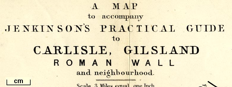
 Map to Accompany Jenkinson's Practical Guide to Carlisle,
Gilsland, Roman Wall and Neighbourhood
Map to Accompany Jenkinson's Practical Guide to Carlisle,
Gilsland, Roman Wall and Neighbourhood

|

|
|
|
map type:- Stanford 1884 |
|
|
|
Map to Accompany Jenkinson's Practical Guide to Carlisle,
Gilsland, Roman Wall and Neighbourhood, scale about 3 miles
to 1 inch, published by Edward Stanford, 55 Charing Cross,
London, 1875 edn 1884?
Folded and tipped in as frontispiece to Jenkinson's Smaller Practical Guide to Carlisle, Gilsland, Roman Wall and Neighbourhood, by Henry Irwin Jenkinson. |
||
|
(example Armitt Library : A1717.1)
|
||
| map feature:- | folded (9x2) & table of symbols (minimal) & up is N & scale line & sea plain & coast line & rivers & lakes & relief & hill hachuring & forests & county & settlements & roads & railways & roman wall & roman sites | |
| inscription:- |
printed upper left
A MAP / to accompany / JENKINSON'S PRACTICAL GUIDE / to / CARLISLE, GILSLAND / ROMAN WALL / and neighbourhood. |
|
| inscription:- |
printed bottom
London : Edward Stanford, 55, Charing Cross, June 3rd. 1884 |
|
| wxh, sheet:- | 74.5x21.5cm | |
| wxh, map:- | 708x180mm | |
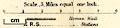
| inscription:- |
printed with scale line
Scale. - 3 Miles equal one Inch. |
|
| scale line:- | 6 miles = 51.5 mm | |
| scale:- | 1 to 190000 ? (1 to 187496 from scale line) | |
|
||

|
||
| sources:- |
Armitt Library |
|
| items seen (illustrated items in bold):- | ||

|
Armitt Library : A1717.1 -- map -- Map to Accompany Jenkinson's Practical Guide to Carlisle, Gilsland, Roman Wall and Neighbourhood | |