 Dunlop Map of the Lake District

|

|
|
|
map type:- Dunlop 1950s |
|
|
|
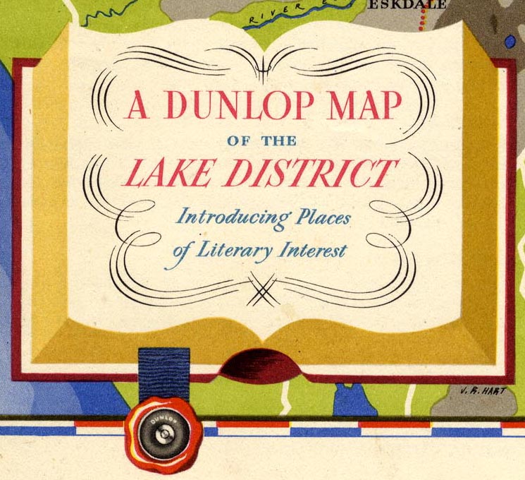
Pictorial map, A Dunlop Map of the Lake District, scale
about 4 miles to 1 inch, by J R Hart, published by Dunlop
Robber Co, about 1950?
The simple map is illustrated with pictures of Cumbian life - walking, shepherding, wrestling, etc, and has vignettes of Wordsworth, Southey, Coleridge, de Quincey, and Ruskin. The map is printed on a fold out leaflet describing and illustrating The Lakes, with short biographies of Wordsworth, Southey and de Quincey. |
||
|
(example JandMN (188))
|
||
| map feature:- | title cartouche & vignettes & compass rose & up is N & sea tinted & coast line & rivers & lakes & relief & layer colouring & county & settlements & roads & descriptive text | |
| inscription:- |
printed title cartouche
A DUNLOP MAP / OF THE / LAKE DISTRICT / Introducing Places / of Literary Interest |
|
| inscription:- |
printed below title
J. R. HART |
|
| wxh, sheet:- | 22.5x24cm | |
| wxh, map:- | 202x215mm | |
| scale:- | 1 to 250000 ? (estimate) | |
| sources:- |
JandMN Collection |
|
| items seen (illustrated items in bold):- | ||

|
JandMN (188) -- map -- Dunlop Map of the Lake District | |