 Cycling Road Map of England and Wales

|

|
|
|
map type:- Bacon 1910s B map |
|
|
|
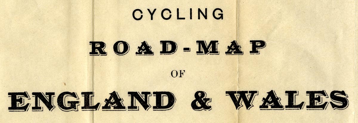
Road map, Cycling Road Map of England and Wales, scale
about 17 miles to 1 inch, published by G W Bacon and Co, 127
Strand, London, 1910s.
Tipped into Bacon's Up-to-date Cycling Pocket Road Book of England and Wales. |
||
|
(example JandMN (428_1))
|
||
| map feature:- | up is N & scale line & lat and long scales & sea plain & coast line & county & settlements & roads & railways | |
| inscription:- |
printed upper right
CYCLING / ROAD-MAP / OF / ENGLAND & WALES |
|
| inscription:- |
printed bottom
G. W. BACON & CO., Ltd., 127, STRAND, LONDON. |
|
| scale line:- | 40 miles = 59.9 mm | |
| wxh, sheet:- | 53x61.5cm | |
| wxh, map:- | 512x562mm | |
| scale:- | 1 to 1000000 ? (1 to 1074687 from scale line) | |

|
||
|
||
| sources:- |
JandMN Collection |
|