 Speed 1695

|

|
|
|
map type:- Speed 1695 |
|
|
|
Maps, Countie Westmorland and Kendale the Cheif Towne,
scale about 3.5 miles to 1 inch, and Cumberland and the
Ancient Citie Carlile, scale about 4 miles to 1 inch, by
John Speed, 1611 altered by Christopher Browne, 1695;
altered and published by Henry Overton, London, 1713-43;
published 1713-1770.
Published in a collection without title page, by Christopher Brown, 1695. The most important addition to the maps are the main roads. Published in 'England Fully Described in a Compleat Sett of Mapps of ye County's of England and Wales, with their Islands, Containing in all 58 Mapps. Printed & Sold by Henry Overton at ye White Horse without Newgate London.' 1713. The 1713 atlas has Speed's title page with the title panel re-engraved, the maps were also sold singly. The atlas was in print from 1713-43. Overton's imprint is in a cartouche below the title. Published again in 'England Fully Described in a Compleat Sett of Mapps of ye County's of England and Wales, with their Islands, Containing in all 58 Mapps by John Speed. Reprinted Anno, 1743. Printed & Sold by Henry Overton at ye White Horse without Newgate London.' 1743. The 1743 atlas has a contents page headed 'A Sett of the Counties of England and Wales, with their Islands, containing Fifty Eight Mapps; each on a Sheet of Royal Paper. By John Speed. Reprinted in the Year, 1743. With additions. Sold either in Compleat Setts, Bound or Single, either Coloured or Plain, by Henry Overton, at the White-Horse, without Newgate, London, ...' The Westmorland map has an imprint upper right 'Sold by Hen. Overton at the White Horse without Newgate, London.' The reverse is plain. The Cumberland map has part of the original imprint 'Performed by Iohn Speed and are to be sould' to which is added 'by Henry Overton at the White Horse without Newgate, London.' The reverse is plain. Published in 'The English Atlas, or a Complete Set of Maps of all the Counties of England and Wales.' C. Dicey & Co.4, in Aldermary Church Yard; London, 1770. The 1770 atlas size is 11 1/2 x 17 1/4 ins; both Westmorland and Cumberland maps now have the imprint of C Dicey and Co., but Cumberland also has Overton's imprint below the title; the map is plain on the reverse. The 1770 atlas includes 'A New Map of the Roads of South Britain ... C. Dicey & Co.', and 'A New Map of the Roads of England and Wales ... Printed and sold by W. Dicey at the printing Office in Bow Church Yard, London, 1770.' |
||

|
Speed 1611 | |
| map feature:- | picture frame cartouche & coat of arms & vignettes (roman altars) & labelled borders & up is N & scale line & sea moire effect & galleons & sea monsters & coast shaded & rivers & bridges & lakes & relief & hillocks & woods & forests & parks & county & settlements & roads & descriptive text & inset map | |
| inscription:- |
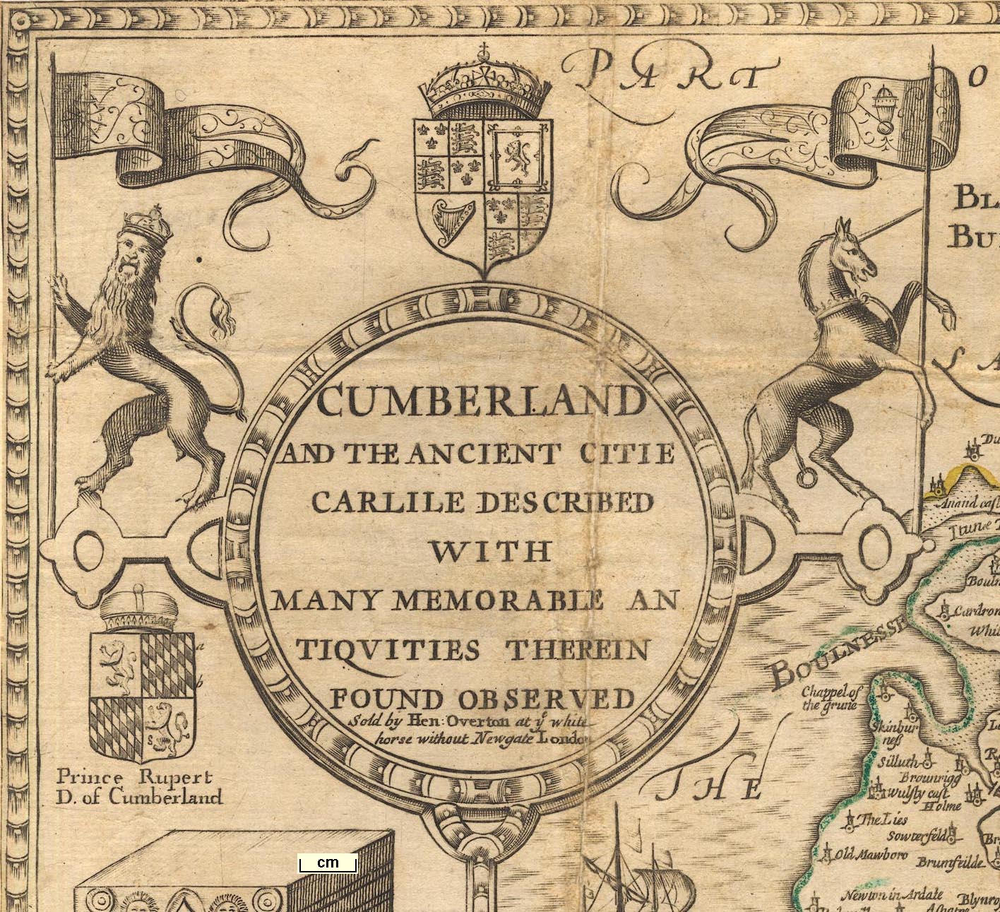
printed title cartouche, upper left
CUMBERLAND / AND THE ANCIENT CITIE / CARLILE DESCRIBED / WITH MANY MEMORABLE AN / TIQUITIES THEREIN / FOUND OBSERVED / Sold by Hen. Overton at ye white / horse without Newgate London |
|
| inscription:- |
printed lower centre
Performed by Iohn Speed and are to be / sould by Henry Overton at the White / Horse without Newgate London altered by HO from original engraving |
|
| wxh, sheet:- | 50.5x38cm | |
| wxh, map:- | 504x382m (roughly) | |
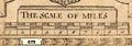
| scale line:- | 10 miles = 64.8 mm | |
| scale 1 to 250000 ? (1 to 248356 from scale line wrongly assuming a statute mile):- | ||
| inscription:- |
[Corrected and sold by Christopher Brown, at the Globe near the West end of S. Paul's Church, London.] 1695 edition |
|
| inscription:- |
[Henry Overton at the White Horse without Newgate, London] |
|
| inscription:- |
[... C. Dicey and Co.] |
|
|
||
| references:- |
Speed, John: 1611: Theatre of the Empire of Great Britaine:
(London) Speed, John: 1713 & 1743: England Fully Described in a Compleat Sett of Mapps of ye County's of England and Wales: Overton, Henry (London) Speed, John: 1770: English Atlas & Complete Set of Maps of all the Counties of England and Wales: Dicey C and Co (London) |
|
| sources:- |
Chubb 1927 (XXX etc) Skelton 1970 Hodson 1984 Wordsworth Trust Collection Carlisle Library Maps |
|
| items seen (illustrated items in bold):- | ||
|
|
Carlisle Library : Map 22 -- map -- Cumberland and the Ancient Citie Carlile Described | |
|
|
Carlisle Library : Map 23 -- map -- Cumberland and the Ancient Citie Carlile Described | |
|
|
Dove Cottage : Lowther.37 -- map -- Cumberland and the Ancient Citie Carlile Described | |