 Map of the Lake Distrtict

|

|
|
|
map type:- Brabant 1902 map |
|
|
|
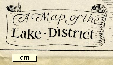
A Map of the Lake District, scale about 8 miles to 1
inch, by B C Boulter, published by Methuen and Co, 36 Essex
Street, Strand, London, 1902.
On the front end papers of The English Lakes, by F G Brabant. The guide book also has nine sectional maps of The Lakes, scale about 1 inch to 1 mile, by John Bartholomew, Edinburgh. and A map of Part of the Duddon Valley, Cumberland and Lancashire, scale about 1 inch to 1 mile, by B C Boulter. |
||
|
(example JandMN (502_1))
|
||
| map feature:- | scroll cartouche & table of symbols & up is N & scale line (vertical) & sea plain & coast shaded & rivers & lakes & relief & hill hachuring & settlements & roads & railways | |
| inscription:- |
printed upper left, right
BCB / 1902 monogram |
|
| inscription:- |
printed title cartouche, lower left
A Map of the / Lake District |
|
| inscription:- |
printed with scale line
Miles |
|
| scale line:- | 20 miles = 62.9 mm | |
| wxh, sheet:- | 19x15.5cm | |
| wxh, map:- | 170x139mm | |
| scale:- | 1 to 510000 ? (1 to 511715 from scale line) | |
| sources:- |
JandMN Collection |
|
| items seen (illustrated items in bold):- | ||

|
JandMN (502_1) -- map -- Map of the Lake Distrtict | |
|
|
JandMN (502_3) -- map -- Windermere and Esthwaite Water | |
|
|
JandMN (502_5) -- map -- Ambleside, Grasmere, Rydal, and Helvellyn | |
|
|
JandMN (502_6) -- map -- Longdale and Borrowdale | |
|
|
JandMN (502_8) -- map -- Coniston Water and Upper Duddondale | |
|
|
JandMN (502_13) -- map -- Ullswater | |
|
|
JandMN (502_16) -- map -- Haweswater, Katmere and Troutbeck | |
|
|
JandMN (502_17) -- map -- Derwentwater and Thirlmere | |
|
|
JandMN (502_20) -- map -- Buttermere, Crummock Water, and Ennerdale Water | |
|
|
JandMN (502_22) -- map -- Wastwater, Ennerdale, and Esk Dale | |
|
|
JandMN (502_24) -- map -- Part of the Duddon Valley | |