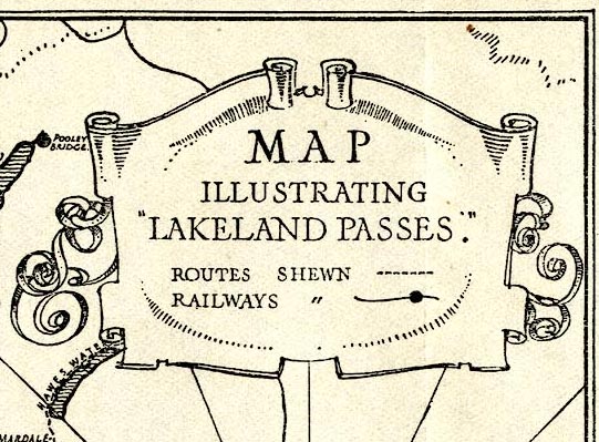
 Map Illustrating Lakeland Passes

|

|
|
|
map type:- Barber and Atkinson 1927 map |
|
|
|
Map Illustrating Lakeland Passes, scale about 5.5 miles
to 1 inch, published by James Atkinson, Caxton Printing
Works, Ulverston, Lancashire, 1928.
Tipped in at the front of Lakeland Passes, by John B Barber and George Atkinson, 1927, 3rd edn 1928. |
||
|
(example JandMN (350_1))
|
||
| map feature:- | scroll cartouche & table of symbols (minimal) & vignettes (The Thee Lakes from Honister Crags) & compass rose & up is N & sea shaded (wavy lines) & galleons & coast form lines (artistic) & rivers & lakes & relief & hill hachuring & settlements & roads (and tracks) & railways | |
| inscription:- |
printed lower right
JWP monogram |
|
| inscription:- |
printed bottom right
PUBLISHED BY JAMES ATKINSON. ULVERSTON. 1928 |
|
| wxh, sheet:- | 24.5x18.5cm | |
| wxh, map:- | 228x171mm | |
| scale:- | 1 to 360000 ? (estimate) | |
| sources:- |
JandMN Collection |
|
| items seen (illustrated items in bold):- | ||

|
JandMN (350_1) -- map -- Map Illustrating Lakeland Passes | |