 Cruchley's Travelling Railway Map of England and
Wales
Cruchley's Travelling Railway Map of England and
Wales

|

|
|
|
map type:- Cruchley 1870s |
|
|
|
Railway map, Cruchley's Travelling Railway Map of England
and Wales, scale about 20 miles to 1 inch, by George F
Cruchley, published by Gall and Inglis, Edinburgh, Lothian,
1870s.
|
||
|
(map example JandMN : JIG116)
|
||
| map feature:- | up is N & scale line & lat and long scales & lat and long grid & table of symbols & sea plain & coast shaded & rivers & lakes & county & settlements & roads & railways & canals & telegraphs | |
| jigsaw feature:- | hand coloured & paper backed & hand cut & 90 piece & big piece & non interlocking pieces & interlocking border & picture pieces (counties) & sliding lid box & companion picture (on box label) | |
| inscription:- |
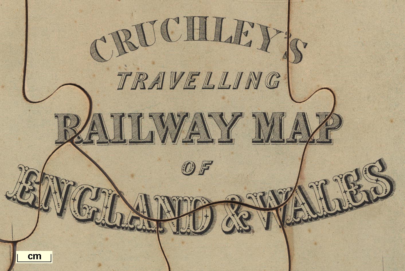
printed upper right
CRUCHLEY'S / TRAVELLING / RAILWAY MAP / OF / ENGLAND AND WALES |
|
| inscription:- |
printed
PUBLISHED BY GALL & INGLIS, EDINBURGH |
|
| inscription:- |
printed label on jigsaw box
SUPERIOR / DISSECTED / MAPS / BY / W. PEACOCK. / ENGLAND & WALES |
|
| inscription:- |
printed label on jigsaw box
MAN PUB BY WILLIAM PEACOCK, LONDON |
|
| inscription:- |
printed label on underside of jigsaw box
CHARLES HENRY / 22 KING ST. / MANCHESTER garter |
|
| wxh:- | 50.5x59.5cm | |
| scale line:- | 70 miles = 91.4 mm (approx) | |
| scale:- | 1 to 1200000 ? (1 to 1232539 from scale) | |

|
||
| sources:- |
JandMN Collection |
|
| items seen (illustrated items in bold):- | ||

|
JandMN : JIG116 -- railway map -- Cruchley's Travelling Railway Map of England and Wales | |