 Cruchley 1870s

|

|
|
|
item:- JandMN : JIG116 image:- © see bottom of page |
click to enlarge |
|
|
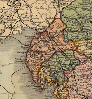
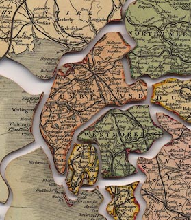
Railway map, ?mahogany jigsaw puzzle, Cruchley's
Travelling Railway Map of England and Wales, scale about 20
miles to 1 inch, by George F Cruchley, published by Gall and
Inglis, Edinburgh, Lothian, jigsaw made by William Peacock,
London, 1870s.
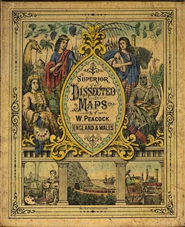
The map is cut out county by county, fairly true to the printed borders, note that Yorkshire is cut in two with an interlocking join; the counties have a coloured line round the edge and are tinted, four colours are used, of course. The companion picture on the box label has female figures of Europe, Asia, America and Africa, and small scenes of a gentleman's study with globe, palette, retort, bust, clock, book, etc, a scene of a train entering a tunnel by the sea, with a steam and sail coaster, and a quayside scene with locomotives, anchor, goods, etc. ?Sold by Charles Henry, 22 King Street, Manchester, Lancashire. The railways shown suggest a date in the late 1870s. |
||

|
Cruchley 1870s | |
| map feature:- | up is N & scale line & lat and long scales & lat and long grid & table of symbols & sea plain & coast shaded & rivers & lakes & county & settlements & roads & railways & canals & electric telegraph | |
| jigsaw feature:- | hand coloured & paper backed & hand cut & 90 piece & big piece & non interlocking pieces & interlocking border & picture pieces (counties) & sliding lid box & companion picture (on box label) | |
| inscription:- |
printed jigsaw
CRUCHLEY'S / TRAVELLING / RAILWAY MAP / OF / ENGLAND AND WALES |
|
| inscription:- |
printed jigsaw
PUBLISHED BY GALL & INGLIS, EDINBURGH |
|
| inscription:- |
printed label on box
SUPERIOR / DISSECTED / MAPS / BY / W. PEACOCK. / ENGLAND & WALES |
|
| inscription:- |
printed label on box
MAN PUB BY WILLIAM PEACOCK, LONDON |
|
| inscription:- |
printed label on underside of box
CHARLES HENRY / 22 KING ST. / MANCHESTER garter |
|
| scale line:- | 70 miles = 94.1 mm (approx) | |
| wxh:- | 50.5x59.5cm | |
| scale:- | 1 to 1200000 ? (1 to 1232539 from scale line) | |
|
||
|
||
|
|
notes | |