 Map of Furness and Cartmel

|

|
|
|
map type:- Jopling 1843 map |
|
|
|
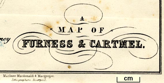
A Map of Furness and Cartmel, Lancashire, and A
Geological Map of Furness and Cartmel, litho by Maclure,
Macdonald and Macgregor, Liverpool, published by Whittaker
and Co, Ave Maria Lane, London and by Stephen Soulby,
Ulverston, Cumberland, 1843.
Folded and tipped into a Sketch of Furness and Cartmel, by Charles M Jopling. |
||
|
(example Armitt Library : A1636.2)
|
||
| map feature:- | north point & up is N & sea plain & coast form lines & rivers & lakes & relief & hill hachuring & settlements & roads & canals & sands roads | |
| inscription:- |
printed lower right
A / MAP OF / FURNESS & CARTMEL. |
|
| inscription:- |
printed bottom
Maclure, Macdonald & Macgregor. / Lithographers, Liverpool. |
|
| wxh, sheet:- | 16x20.5cm | |
| wxh, map:- | 121x187mm | |
|
||
| sources:- |
Armitt Library |
|
| items seen (illustrated items in bold):- | ||

|
Armitt Library : A1636.2 -- map -- Map of Furness and Cartmel | |
|
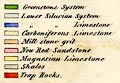
|
Armitt Library : A1636.14 -- map -- Geological Map of Furness and Cartmel | |