 Lowes c1800

|

|
|
|
map type:- Lowes c1800 |
|
|
|
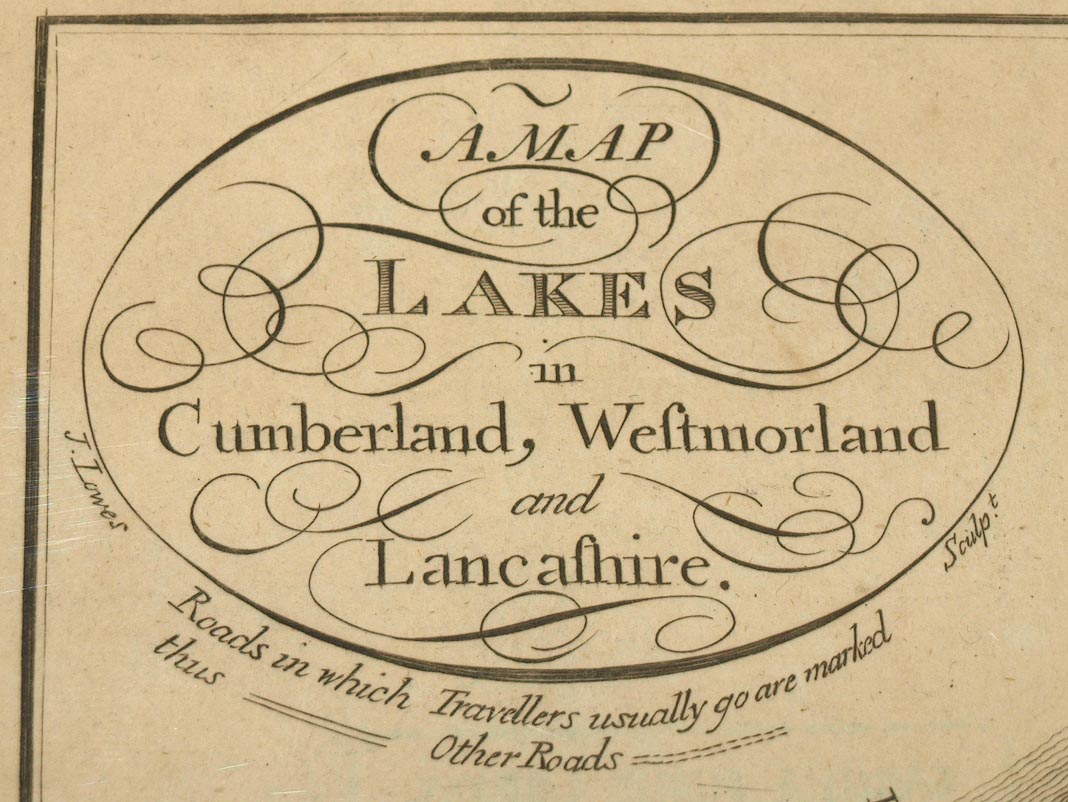
Map of the Lakes in Cumberland, Westmorland and
Lancashire, engraved by J Lowes, scale about 7.5 miles to 1
inch, probably about 1800.
The table of symbols distinguishes 'Roads in which Travellers usually go [double line, solid] Other Roads [double line, dotted]'. Taken from a guide book, A Descriptive Tour, and Guide to the Lakes, Caves and Mountains, by John Housman, 1800 or later edn. |
||
|
(example Carlisle Library : ZD912.1)
|
||
| map feature:- | oval cartouche & table of symbols & compass rose & up is N & scale line & sea plain & coast form lines & rivers & lakes & forests & county & settlements & roads | |
| inscription:- |
printed upper left
A MAP / of the / LAKES / in / Cumberland, Westmorland / and / Lancashire. / J. Lowes Sculpt. |
|
| wxh, sheet:- | 22x18.5cm | |
| wxh, map:- | 197x161mm | |
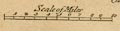
| inscription:- |
printed with scale line
Scale of Miles |
|
| scale line:- | 10 miles = 34.2 mm | |
| scale:- | 1 to 470000 ? (1 to 470568 from scale line) | |
|
||
| sources:- |
Carlisle Library Maps |
|
| items seen (illustrated items in bold):- | ||

|
Armitt Library : A1189.1 -- map -- Map of the Lakes in Cumberland, Westmorland and Lancashire | |
|
|
Carlisle Library : Map 352 -- map -- Map of the Lakes in Cumberland, Westmorland and Lancashire | |