 Dugdale 1835

|

|
|
|
map type:- Dugdale 1835 |
|
|
|
Maps, Westmoreland, scale about 5.5 miles to 1 inch, and
Cumberland, scale about 8.5 miles to 1 inch, by J Archer,
Pentonville, London, about 1835.
Published in 'Curiosities of Great Britain. England and Wales Delineated. Historical, Entertaining & Commercial. Alphabetically arranged. By Thomas Dugdale, Antiquarian assisted by William Burnett, Civil Engineer.' vol.1 published by 'Tallis and Co, Green Arbor Court, Old Bailey, 1835.' vol.2 by 'John Tallis, 15, St. John's Lane, Smithfield.' vol.3 by 'L. Tallis, 3, Jewin Street, City.' The book has many topographical views and the maps; its size is 5 1/8 x 7 1/4 ins. There is also a map of England and Wales with its Railroads and Canals, scale about 48 miles to 1 inch; and another showing turnpike roads, scale about 47 miles to 1 inch. Published other editions 1843 and 1848. Published in 'Dugdale's England and Wales Delineated, edited by E. L. Blanchard. London: L. Tallis, 21, Warwick Square, Paternoster Row.' 1854-60 The Blanchard edition was issued in fifty parts over the period 1854-60; the map is the same as the 1835 edition with additions to railways. |
||
|
(map example Dove Cottage : 2007.38.40)
|
||
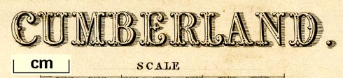
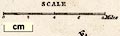
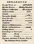
| map feature:- | table of symbols & up is N & scale line & lat and long scales (West of Greenwich) & coast shaded & rivers & lakes & relief & hill hachuring & forests & parks & county & wards (hundreds) & table of wards (hundreds) & settlements & roads & canals | |
| inscription:- |
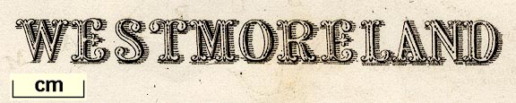
printed upper left
WESTMORELAND |
|
| inscription:- |
printed bottom right
Drawn & Engraved by J. Archer Pentonville London. |
|
| inscription:- |
printed bottom
Engraved for Dugdale's England and Wales Delineated. |
|
| wxh, sheet:- | 27x22cm | |
| wxh, map:- | 236x180mm | |
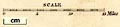
| scale line:- | 6 miles = 31.0 mm (approx) | |
| scale:- | 1 to 310000 ? (1 to 311486 from scale line) | |
|
||
|
||
|
||
| references:- |
Dugdale, Thomas & Burnett, William: 1835 & 1843 & 1848:
Curiosities of Great Britain & England and Wales Delineated:
Tallis (London) Dugdale, William & Burnett, William & Blanchard, E L (ed): 1860 (?): Dugdale's England and Wales Delineated: Tallis, L (London) |
|
| sources:- |
Chubb 1927 (CCCCLXV) private collection JandMN Collection Wordsworth Trust Collection Armitt Library Kendal Library Maps Carlisle Library Maps |
|
| items seen (illustrated items in bold):- | ||

|
Armitt Library : ALMC2008.14.60 -- map -- Westmoreland | |
|
|
Armitt Library : ALMC2008.14.61 -- map -- Westmoreland | |
|
|
Armitt Library : ALMC2008.14.62 -- map -- Westmoreland | |
|
|
Carlisle Library : Map 151 -- map -- Cumberland | |
|
|
Carlisle Library : Map 154 -- map -- Cumberland | |
|
|
Carlisle Library : Map 160 -- map -- Cumberland | |
|
|
Carlisle Library : Map 195 -- map -- Westmoreland | |
|
|
Carlisle Library : Map 198 -- map -- Westmoreland | |
|
|
Dove Cottage : 2007.38.40 -- map -- Westmoreland | |
|
|
Dove Cottage : 2007.38.43 -- map -- Westmoreland | |
|
|
Dove Cottage : 2009.81.9 -- map -- Cumberland | |
|
|
JandMN (118) -- map -- England and Wales with its Railroads and Canals | |
|
|
JandMN (119) -- map -- England and Wales | |
|
|
JandMN (216) -- map -- Westmoreland | |
|
|
JandMN (217) -- map -- Westmoreland | |
|
|
JandMN (218) -- map -- Cumberland | |
|
|
JandMN (318) -- map -- Westmoreland | |
|
|
Kendal Library : Map 21 -- map -- Westmoreland | |
|
|
Kendal Library : Map 51 -- map -- Westmoreland | |
|
|
Kendal Library : Map 52 -- map -- Westmoreland | |
|
|
private collection (47) -- map -- Westmoreland | |
|
|
private collection (93) -- map -- Lancashire | |
|
|
private collection (283) -- map -- Yorkshire Part of the North Riding etc | |
|
|
private collection (285) -- road map -- England and Wales | |