 Cary 1787

|

|
|
|
map type:- Cary 1787 |
|
|
|
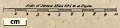
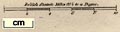
Maps, Westmoreland, scale about 5 miles to 1 inch, and
Cumberland, scale about 6.5 miles to 1 inch, in Cary's New
and Correct English Atlas, by John Cary, 188 Strand, London,
1787; published as one part of a monthly series, 1787-89;
published 1787-93; and re-engraved from 1809.
Published in 'CARY'S NEW and CORRECT ENGLISH ATLAS: BEING A New Set of County Maps FROM ACTUAL SURVEYS. EXHIBITING All the Direct & principal Cross Roads, Cities, Towns, and most considerable Villages, Parks, Rivers, NAVIGABLE CANALS &c. Preceded by a General MAP of South Britain, SHEWING The Connexion of one Map with another. ALSO A General Description of each County, AND Directions for the junction of the Roads from one County to ANOTHER. / LONDON. Printed for JOHN CARY, Engraver, Map and Print-seller, the corner of Arundel Street, Strand. Published as the Act directs Septr. 1st 1787.' The Westmorland map appeared in part 5, January 1788. The atlas has title page, dedication, list of subscribers, contents, each county has a page of text; at the end is text for 'Directions for the junction of the Roads', a list of 'The Market and Borough Towns' and 'A List of the Principal Post and Sub-Post-Towns with their Receiving Houses'; the atlas pays attention to routes; as well as the features described in the title page there is a text description of 52 major routes, indexed to the county maps.; the atlas size is 10 x 13 ins The Monthly Review, December 1786: 'Mr Cary's Surveys are, without question, the most accurate and elegant of any that have appeared since the days of Roque.'; John Cary was born 23 February 1755 at Corsley, near Warminster, Wiltshire; it is significant the atlas is dedicated to Thomas 3rd Viscount Weymouth, Baron Thynne of Warminster, later 1st Marquess of Bath. A notice in the English Review, December 1789, '... the purchaser of Cary's Atlas will find that the work itself contains much more useful matter than is announced in the title-page ... Works of this kind derive their great value from the accuracy of their execution. Without strict attention to this, they are worse than nothing; they pretend to instruct, they inspire confidence, and they deceive. We have examined this publication with some attention, have compared it with many of the best county maps on a large scale, and do not find that it suffers by the comparison. The author appears to have exerted himself to merit that approbation, which everyone who ventures before the public tribunal should endeavour to deserve; and it gives us pleasure to see, by the long list of subscribers that precedes the work, that he has not laboured in vain. ... The neatness of the engraving is highly to be commended, as, besides its general pleasing effect, it renders these maps less fatiguing to the eye than those on a much larger scale, which are executed, as maps too commonly are, in a slovenly manner.' Published in another edition '... London. Printed for John Cary, Engraver & Map-seller, No.181, near Norfolk Street, Strand. Published as the Act directs Jany. 1st. 1793.' The map has a facing page of text; the map probably has a letters engraved where each road leaves the county, to correspond with the same letter on the adjoining county sheet, embryonic road numbering. Published in a re-engraved edition 1809 onwards, qv. There were several reissues of the 1793 edition in which the map is dated 1793; it may have slight additions? |
||

|
Cary 1809 | |
|
(map example Hampshire Museums : FA1999.56.15)
|
||
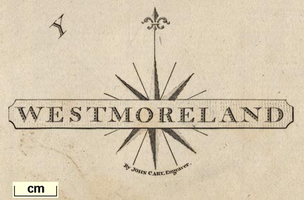
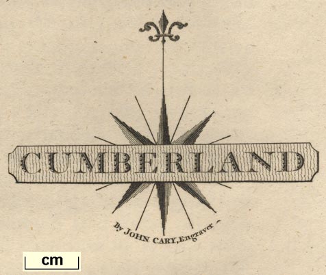
| map feature:- | title cartouche & compass rose & scale line & lat and long scales & county & rivers & parks & woods & settlements & roads & canals | |
| inscription:- |
printed bottom
London : Published as the Act directs Sepr. 1st. 1787 by J. Cary, Engraver, Map & Print seller the corner of Arundel Street Strand. |
|
| scale line:- | 10 miles = 50.3 mm | |
| scale:- | 1 to 320000 ? (1 to 319949 from scale line) | |
|
||
|
||
| sources:- |
Chubb 1927 (CCLX) Hodson 1984 HMCMS Map Collection Wordsworth Trust Collection Armitt Library Kendal Library Maps |
|
| items seen (illustrated items in bold):- | ||
|
|
Armitt Library : ALMC2008.14.54 -- map -- Westmoreland | |
|
|
Armitt Library : ALMC2008.14.55 -- map -- Westmoreland | |
|
|
Carlisle Library : Map 168 -- map -- Westmoreland | |
|
|
Carlisle Library : Map 169 -- map -- Westmoreland | |
|
|
Carlisle Library : Map 170 -- map -- Westmoreland | |
|
|
Carlisle Library : Map 171 -- map -- Westmoreland | |
|
|
Carlisle Library : Map 172 -- map -- Westmoreland | |
|
|
Carlisle Library : Map 256 -- map -- Cumberland | |
|
|
Carlisle Library : Map 257 -- map -- Cumberland | |
|
|
Dove Cottage : 2007.38.77 -- map -- Westmoreland | |
|
|
Dove Cottage : 2007.38.130 -- descriptive text -- Westmoreland | |
|
|
Dove Cottage : 2007.38.131 -- descriptive text -- Cumberland | |
|
|
Dove Cottage : 2007.38.132 -- descriptive text -- Cumberland | |
|
|
Dove Cottage : Lowther.39 -- map -- Cumberland | |
|
|
Hampshire Museums : FA1999.56.8 -- map -- Cumberland | |
|
|
Hampshire Museums : FA1999.56.12 -- map -- Durham | |
|
|
Hampshire Museums : FA1999.56.15 -- map -- Westmoreland | |
|
|
Hampshire Museums : FA1999.56.20 -- map -- Lancashire | |
|
|
Hampshire Museums : FA1999.56.27 -- map -- Northumberland | |
|
|
Hampshire Museums : FA1999.56.42 -- map -- North Riding of Yorkshire | |
|
|
Hampshire Museums : FA1999.56.45 -- map -- West Riding of Yorkshire | |
|
|
Kendal Library : Map 3 -- map -- Westmoreland | |
|
|
Kendal Library : Map 5 -- map -- Westmoreland | |
|
|
Kendal Library : Map 13 -- map -- Westmoreland | |
|
|
Kendal Library : Map 62 -- map -- Westmoreland | |
|
|
private collection (177) -- map -- North Riding of Yorkshire | |
|
|
private collection (178) -- map -- Yorkshire | |
|
|
private collection (288) -- map -- Cumberland | |