 Cary 1787

|

|
|
|
item:- Hampshire Museums : FA1999.56.12 image:- © see bottom of page |
click to enlarge |
|
|
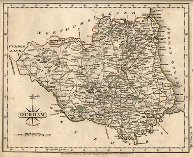
Map, hand coloured engraving, Durham, scale about 5 miles
to 1 inch, by John Cary, 188 Strand, London, 1787.
Included in Cary's New and Correct English Atlas. |
||

|
Cary 1787 | |
| map feature:- | compass rose cartouche & compass rose & scale line & lat and long scales & county & rivers & relief & hill hachuring & parks & woods & settlements & roads & canals | |
| inscription:- |
printed title cartouche, lower left
DURHAM |
|
| inscription:- |
printed bottom
London : Published as the Act directs Sepr. 1st. 1787 by J. Cary, Engraver, Map & Print seller No.188 the corner of Arundel Street, Strand. |
|
| scale line:- | 10 miles = 50.3 mm | |
| scale:- | 1 to 320000 ? (from scale line) | |