 Gough Map of Great Britain

|

|
|
|
map type:- Gough 1350s-60s |
|
|
|
Reproduction of the Gough Map of Great Britain, reduced
size, published by the Ordnance Survey, Southampton,
Hampshire, 1875; and a full size line reproduction, with
added transcriptions of placenames, 1935.
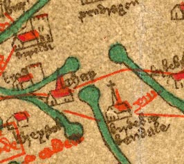
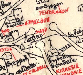
The map shows a number of settlements in Westmorland, Cumberland and Lancashire, now Cumbria, and road routes across the counties; religious houses are an important feature of the map. The original manuscript map, discovered by Richard Gough, is in the Bodleian Library, Oxford. |
||
| references:- |
Parsons, E J S & Stenton, Frank, Sir: 1958 & 1996 (reprint):
Map of Great Britain circa AD1360 known as the Gough Map:
Bodleian Library (Oxford, Oxfordshire):: ISBN 1 85124 041
1 |
|
| sources:- |
JandMN Collection www.qub.ac.uk/urban_mapping/gough_map/ |
|
| items seen (illustrated items in bold):- | ||

|
JandMN (33) -- map -- Gough Map of Great Britain | |
|
|
JandMN (34) -- map -- Gough Map of Great Britain | |