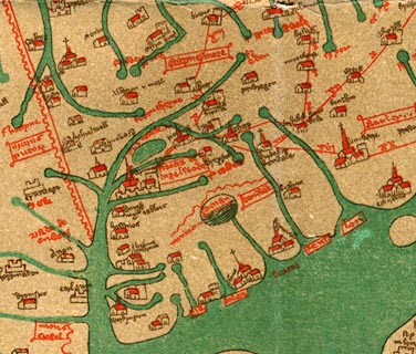
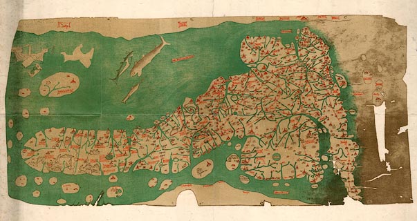
 Gough 1350s-60s

|

|
|
|
item:- JandMN (33) image:- © see bottom of page |
click to enlarge |
|
|
Map, colour photozincograph copy, reduced size facsimile,
Gough Map of Britain, scale about 28.5 miles to 1 inch,
published by the Ordnance Survey, Southampton, Hampshire,
1875.
The original manuscript map, discovered by Richard Gough, is in the Bodleian Library, Oxford, Oxfordshire. |
||

|
Gough 1350s-60s | |
| wxh, sheet:- | 75x43cm | |
| wxh, map:- | 67x31.5cm | |
| scale:- | 1 to 1800000 ? (from town positions using DISTAB.exe) | |
|
||