 Rowe 1816

|

|
|
|
map type:- Rowe 1816 |
|
|
|
Maps, Westmorland, scale about 3 miles to 1 inch, and
Cumberland? by Robert Rowe, 19 Bedford Street, London,
engraved by T Barnett, published 1816; published 1816-1829.
Published in 'The English Atlas. Being a new & complete Set of County Maps, divided into hundreds, exhibiting the direct and cross Roads, Cities, Towns, Villages, Parks, Rivers and navigable Canals, with the distances marked between the towns and from London. Preceded by a general map of England and Wales, shewing the connection of the respective maps. By Robert Rowe, Geographer. London: Printed for R. Rowe, 19, Bedford Street, Bedford Row, 1816. Printed by Joyce Gold, 103, Shoe Lane, Fleet Street.' The atlas size is 11 x 17 ins. Published in 'New British Atlas, Containing a Complete set of County Maps, on which are delineated all the principal Cross Roads, Cities, Towns, & most considerable Villages, Parks, Rivers, Navigable Canals & Railways, preceded by General Maps of England, Ireland, Scotland, North & South Wales. The whole carefully revised and corrected to the year, 1829. London: Published by Henry Teesdale & Co., 302, Holborn.' 1829. The atlas has title page, 40 maps of counties, and general maps; its size is 14 1/2 x 18 1/2 ins; there are not a lot of railways in 1829. Published in another edition 'NEW British Atlas, Containing a Complete Set of County Maps, ON WHICH ARE DELINEATED ALL THE PRINCIPAL CROSS ROADS, Cities Towns and most considerable Villages, PARKS, RIVERS, NAVIGABLE CANALS & RAILWAYS, preceded by General Maps OF England, Ireland, Scotland, NORTH & SOUTH Wales. THE WHOLE CAREFULLY REVISED & CORRECTED TO THE YEAR 1830. ...' Published other editions 1831, 1832, 1833, 1835 and 1840; possibly revised and corrected. |
||
|
(example map)
|
||
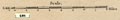
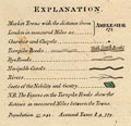
| map feature:- | table of symbols & compass rose & scale line & lat and long scales & sea plain & coast line & rivers & lakes & relief & hill hachuring & woods & trees & forests & parks & county & electoral data & settlements & roads & canals | |
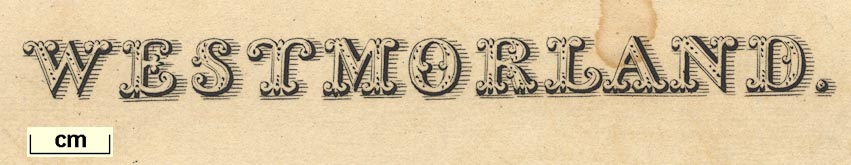
| inscription:- |
printed upper left
WESTMORLAND fancy font |
|
| inscription:- |
printed bottom
London, Published by Henry Teesdale & Co. 302 Holborn. |
|
| wxh, sheet:- | 46x37.5cm | |
| wxh, plate:- | 438x366mm | |
| wxh, map:- | 416x343mm | |
| scale line:- | 8+1 miles = 75.5 mm | |
| scale:- | 1 to 190000 ? (1 to 191842 from scale line) | |
|
||
|
||
| references:- |
Rowe, Robert: 1816: English Atlas: (London) Teesdale, Henry and Co: 1829 & 1830 & 1831 & 1832 & 1833 & 1835 & 1840: New British Atlas: (London) |
|
| sources:- |
Chubb 1927 (CCCLIVa) Armitt Library private collection Carlisle Library Maps Kendal Library Maps |
|
| items seen (illustrated items in bold):- | ||

|
Armitt Library : ALMC2008.14.93 -- map -- Westmorland | |
|
|
Carlisle Library : Map 189 -- map -- Westmorland | |
|
|
JandMN (440) -- map -- Yorkshire (?) | |
|
|
Kendal Library : Map 126 -- map -- Westmorland | |
|
|
private collection (69) -- map -- Westmorland | |