 Rowe 1816

|

|
|
|
item:- JandMN (440) image:- © see bottom of page |
click to enlarge |
|
|
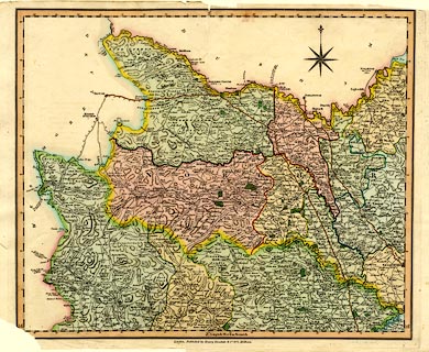
Map, hand coloured engraving, Yorkshire, scale about
miles to 1 inch, by Robert Rowe, published by Henry Teesdale
and Co, 302 Holborn, London, 1829-31.
The is only the north part of the county, a scale line etc might be on the next sheet. |
||

|
Rowe 1816 | |
| map feature:- | compass rose & up is N & lat and long scales (rectangualr projection; Longitude West from Greenwich) & rivers & lakes & relief & hill hachuring & woods & forests & parks & county & hundreds (wapontakes) & electoral data & settlements & roads & turnpike roads & post roads & road distances & distances from London | |
| inscription:- |
printed bottom
London, Published by Henry Teesdale & Co. 302 Holborn. |
|
| wxh, sheet:- | 47x36.5cm | |
| wxh, map:- | 417x346mm | |