 Map of the Newcastle and Carlisle Railway

|

|
|
|
map type:- Giles 1837 |
|
|
|
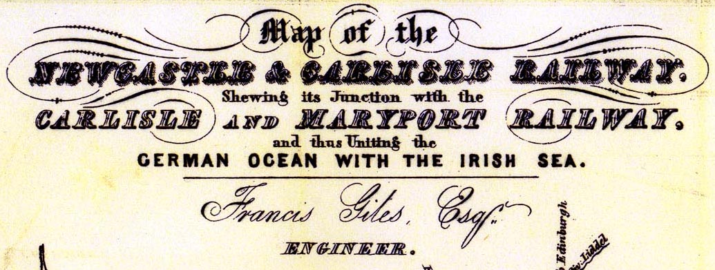
Railway map, Map of the Newcastle and Carlisle Railway,
and Maryport and Carlisle Railway, scale about 6.5 miles to
1 inch, by Francis Giles, engineer, published by Hudson
Scott, Carlisle, Cumberland, and by Currie and Bowman,
Newcastle upon Tyne, Northumberland, 1837.
Folded and tipped in as frontispiece to a guide book, Scott's Railway Companion. |
||
|
(example Carlisle Library (6_1))
|
||
| map feature:- | folded (5x2) & north point & up is N (slightly off) & scale line & sea plain & coast line & rivers & lakes & relief (sectional diagram of route) & county & settlements & roads & railways & canals & geology | |
| inscription:- |
printed upper left
Map of the / NEWCASTLE & CARLISLE RAILWAY, / Shewing the Junction with the / MARYPORT AND CARLISLE RAILWAY, / and thus Uniting the / GERMAN OCEAN WITH THE IRISH SEA. / Francis Giles, Esq., / ENGINEER. |
|
| wxh, sheet:- | 37.5x26.5cm | |
| wxh, map:- | 354x242mm | |
| inscription:- |
printed with scale line
SCALE OF MILES |
|
| scale line:- | 20+1/4 miles = 77.1 mm | |
| scale:- | 1 to 420000 ? (1 to 422688 from scale line) | |

|
||
| items seen (illustrated items in bold):- | ||

|
Carlisle Library (6_1) -- railway map -- Map of the Newcastle and Carlisle Railway | |