 Map of the Lake District Mining Field

|

|
|
|
map type:- Postlethwaite 1877 map 2 |
|
|
|
Map of the Lake District Mining Field, scale about 5
miles to 1 inch, by John Postlethwaite, 1877.
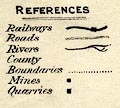
Included in Mines and Mining in the English Lake District, by John Postlethwaite, published by W H Moss and Sons, Whitehaven, Cumberland now Cumbria, 1877; published 1877-1913. Mines, quarries and railways are shown. |
||
|
(map example )
|
||
| map feature:- | up is N & scale line & table of symbols & sea plain & coast form lines & rivers & lakes & relief & hill hachuring & county & settlements & railways & roads & mines | |
| inscription:- |
printed upper left
Map / OF THE / LAKE DISTRICT / MINING FIELD / SHOWING THE POSITION / OF MINES, QUARRIES, ETC. |
|
| inscription:- |
printed bottom left
W. H. Moss & Sons Ltd. Whitehaven & Workington. |
|
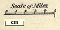
| scale line:- | 5 miles = 26.5 mm | |
| scale:- | 1 to 300000 ? (1 to 303650 from scale line) | |
| wxh, sheet:- | 27.5x32cm | |
| wxh, map:- | 254x288mm | |
|
||
|
||
| references:- |
: 1975: Postlethwaite's Mines and Mining in the English Lake
District: Moon, Michael (Beckermet, Cumbria):: ISBN 0 904131
10 6 |
|
| sources:- |
Armitt Library JandMN Collection |
|
| items seen (illustrated items in bold):- | ||

|
JandMN (162_2) -- map -- Map of the Lake District Mining Field | |