 Windermere

|

|
|
|
map type:- Gilpin 1786 map |
|
|
|
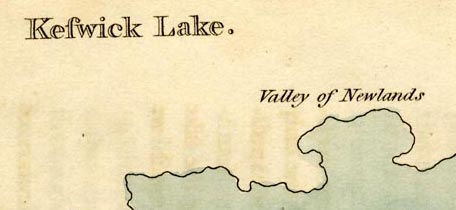
Sketch maps, Windermere lake, Keswick Lake ie Derwent
Water, and Ulleswater, Westmorland and Cumberland, by
William Gilpin, 1772-74, published by R Blamire, Strand,
London, 1786.
Included in Observations on Several Parts of England, Particularly the Mountains and Lakes of Cumberland Westmoreland, Relative Chiefly to Picturesque Beauty. The preface notes, for example, that 'XVII. This plan of Ulleswater, like the others, is not very exact; but enough so, to give an idea of it's general shape, and the relative situation of the several places on it's shores. Page 51.' Published in a 2nd edn, 1788. Published in a 3rd edn, 1792. Published in a 4th edn, by T Cadell and W Davies, Strand, London, 1808. Published in translations into French and perhaps German, 1789-98. |
||
|
(example map Armitt Library : A918.17)
|
||
| map feature:- | north point & up is SE & rivers & lakes & settlements | |
| inscription:- |
printed
Ulleswater. |
|
| wxh, page:- | 14x22cm (roughly) | |
| sources:- |
Bicknell 1990 Armitt Library |
|
| items seen (illustrated items in bold):- | ||

|
Armitt Library : A918.8 -- sketch map -- Windermere | |
|
|
Armitt Library : A918.12 -- sketch map -- Keswick Lake | |
|
|
Armitt Library : A918.17 -- sketch map -- Ulleswater | |