 Map of the Post Roads of England and Wales

|

|
|
|
map type:- Post Office 1770 |
|
|
|
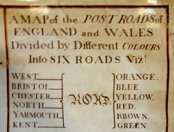
Map of the Post Roads of England and Wales, a General
Post Office Circulation Map for England and Wales, General
Post Office, London, 1770.
Only a poor reproduction has been seen. |
||
|
(example map)
|
||
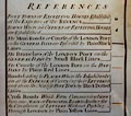
| map feature:- | up is N & table of symbols & settlements & post roads | |
|
||
| sources:- |
British Postal Museum and Archive |
|
| items seen (illustrated items in bold):- | ||

|
British Postal Museum and Archive (1) -- post road map -- Map of the Post Roads of England and Wales -- General Post Office Circulation Map for England and Wales | |