 Cooke 1802

|

|
|
|
map type:- Cooke 1802 |
|
|
|
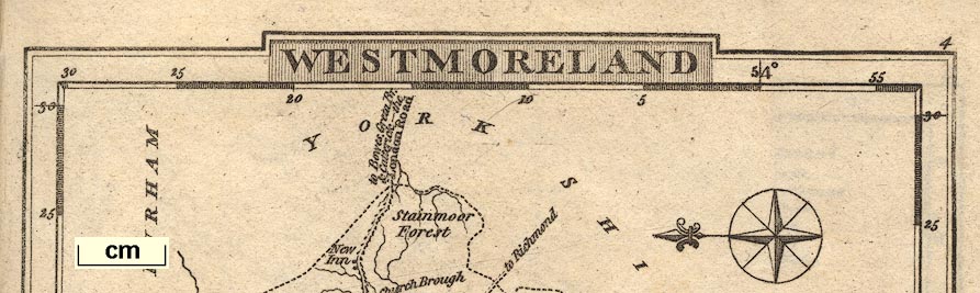
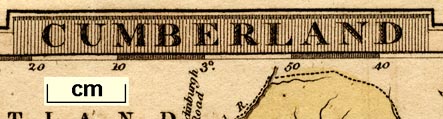
Maps, Westmoreland, scale about 12 miles to 1 inch, and
Cumberland, scale about 15.5 miles to 1 inch, Lancashire,
scale about 18 miles to 1 inch, and The Lakes, scale about
8.5 miles to 1 inch, by George Alexander Cooke, London,
1802-10; published 1802-24.
There are also a maps of adjacent counties and of England and Wales. It is not possible to be certain, but we would guess the main source for these maps is the set of maps by Cary 1787; some of the odder spellings of placenames match. Published in one of a series of volumes 'The Modern British Traveller: or, Tourist's Pocket Directory. Being an accurate and comprehensive History and Description of all the Counties in England, Scotland, and Wales; as also the adjacent Islands ... By G. A. Cooke ... illustrated with maps of the Counties, forming a complete British Atlas. London: Printed for C. Cooke, No.17 Paternoster Row, by Brimmer and Co., Upper Mary-le-bone Street, and sold by all the Booksellers in the United Kingdom.' issued volume at a time 1802-10. Each volume has a heading 'A Copious Travelling Guide; Exhibiting The Direct & principal Cross Roads Inns & Distance of Stages, Noblemen's & Gentlemen's Seats. Forming a Complete County Itinerary'. The volumes include maps for Westmorland, Cumberland, Lancashire etc, but not The Lakes which is, however, included in Gray's road book, 1824. Published in an edition about 1822. Published, perhaps, in an edition about 1830. The map would have been in '[Topographical and Statistical Description of the County of ..., containing an account of its Situation, Extent ... Civil and Ecclesiastical Jurisdictions, &c. To which is prefixed a copious Travelling Guide ... forming a Complete County Itinerary. As also a list of the Markets and Fairs ...]' the pattern of the subtitle varied from county to county. Published again in 'GRAY'S NEW BOOK OF ROADS. THE TRAVELLER'S GUIDE TO THE ROADS OF ENGLAND AND WALES, AND PART OF SCOTLAND, ON AN ENTIRELY NEW PLAN, WHEREBY THE DIFFERENT LINES OF ROUTE LEADING TO ANY REQUIRED POINT OF DISTANCE ARE BROUGHT UNDER NOTICE AT ONE REFERENCE, AND THE VARIATION SHOWN IN THE MARGIN: THE GREAT ROADS, EACH DISTINCTLY GIVEN, IN A CONTINUOUS LINE, FROM ONE EXTREME POINT TO ANOTHER, AND THE CROSS ROADS SO ARRANGED THAT THE ROUTE FROM ANY ONE PART OF THE KINGDOM TO ANOTHER MAY BE TRACED WITH THE GREATEST FACILITY: WITH A VERY COPIOUS GENERAL INDEX, AND SEPARATE LOCAL INDICES TO THE PRINCIPAL TOWNS AND WATERING PLACES: FORMING, ALTOGETHER, A COMPREHENSIVE, USEFUL, AND PERSPICUOUS ITINERARY. BY GEORGE CARRINGTON GRAY. / LONDON: PRINTED FOR SHERWOOD, JONES, AND CO. PATERNOSTER ROW. 1824.' The 1824 atlas has a half title page, horsemen paying at a toll gate, adverts, lists of routes etc; its size is 4 1/2 x 5 3/4 ins; the map is now numbered top right. |
||
|
(example map JandMN (150))
|
||
| map feature:- | plain cartouche & up is N & scale line & sea plain & coast shaded & rivers & lakes & relief & hillocks & county & settlements & roads | |
| inscription:- |
printed top left, title,cartouche
5 |
|
| inscription:- |
printed upper left
THE LAKES |
|
| inscription:- |
printed bottom right
Neele & Son sc Strand |
|
| wxh, sheet:- | 12x14.5cm | |
| wxh, map:- | 116x127mm | |
| scale line:- | 10 miles = 30.1 mm | |
| scale:- | 1 to 530000 ? (1 to 534666 from scale line) | |
|
||
|
||
| references:- |
Cooke, George Alexander: 1802 (?): Modern British Traveller
& Tourist's Pocket Directory: Cooke, C (London) Gray, George Carrington: 1824: Gray's New Book of Roads & Tourists and Traveller's Guide to the Roads of England and Wales: Sherwood, Jones and Co (London) |
|
| sources:- |
Chubb 1927 (CCCV) Fordham 1924 HMCMS Map Collection Armitt Library Wordsworth Trust Collection Kendal Library Maps |
|
| items seen (illustrated items in bold):- | ||

|
Armitt Library : A1121.5 -- map -- Lakes, The | |
|
|
Armitt Library : A1367.1 -- road map -- Westmoreland | |
|
|
Armitt Library : A1711.2 -- map -- Cumberland | |
|
|
Armitt Library : A1711.3 -- map -- Lakes, The | |
|
|
Armitt Library : ALMC2008.14.77 -- map -- Westmoreland | |
|
|
Armitt Library : ALMC2008.14.78 -- map -- Westmoreland | |
|
|
Dove Cottage : 2007.38.57 -- map -- Cumberland -- Gray's New Book of Roads | |
|
|
Hampshire Museums : FA2000.62.0 -- map -- England and Wales -- Gray's New Book of Roads | |
|
|
Hampshire Museums : FA2000.62.2 -- map -- Cumberland -- Gray's New Book of Roads | |
| see:- | Hampshire Museums : FA2000.62.3 -- map -- Northumberland -- Gray's New Book of Roads | |
|
|
Hampshire Museums : FA2000.62.4 -- map -- Westmoreland | |
|
|
Hampshire Museums : FA2000.62.5 -- map -- Lakes, The | |
|
|
Hampshire Museums : FA2000.62.6 -- map -- Lancashire -- Gray's New Book of Roads | |
|
|
Hampshire Museums : FA2000.62.9 -- map -- Durham -- Gray's New Book of Roads | |
|
|
Hampshire Museums : FA2000.62.11 -- map -- North Riding of Yorkshire -- Gray's New Book of Roads | |
|
|
Hampshire Museums : FA2000.62.12 -- map -- West Riding of Yorkshire -- Gray's New Book of Roads | |
|
|
JandMN (148) -- map -- Lakes, The | |
|
|
JandMN (150) -- map -- Lakes, The | |
|
|
Kendal Library : Map 8 -- map -- Westmoreland | |