 Map of the West Riding and Ainsty of the County of
York
Map of the West Riding and Ainsty of the County of
York

|

|
|
|
map type:- Baines 1822 |
|
|
|
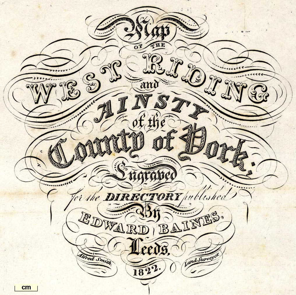
Map of the West Riding and Ainsty of the County of York,
scale about 5.5 miles to 1 inch, by Alfred Smith, published
by Edward Baines, Leeds, Yorkshire, 1822.
Included in a History, Directory and Gazetter of the County of York. The area of Yorkshire around Sedbergh is now in Cumbria. |
||
|
(example private collection (155))
|
||
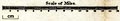
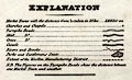
| map feature:- | folded (3x2) & table of symbols & up is N & scale line & lat and long scales & rivers & lakes & relief & hill hachuring & table of heights & parks & county & hundreds (wapontakes) & table of hundreds & settlements & roads & turnpike roads & post roads & road distances & distances from London & markets & canals | |
| inscription:- |
printed title, upper right
Map / OF THE / WEST RIDING / and AINSTY / of the / County of York; / Engraved / for the DIRECTORY published / By / EDWARD BAINES, / Leeds. / 1822. / Alfred Smith Land Surveyor. |
|
| wxh, sheet:- | 55.5x44.5cm | |
| wxh, map:- | 540x421mm | |
| inscription:- |
printed with scale line
Scale of Miles. |
|
| scale line:- | 16 miles = 72.8 mm | |
| scale:- | 1 to 350000 ? (1 to 353702 from scale line) | |
|
||
|
||
| items seen (illustrated items in bold):- | ||

|
private collection (155) -- map -- Map of the West Riding and Ainsty of the County of York | |
|
|
private collection (156) -- map -- Map of the East and North Ridings of the County of York | |