 Bartholomew 1899

|

|
|
|
map type:- Bartholomew 1899 |
|
|
|
Maps, The Royal Atlas of England and Wales, scale about 4
miles to 1 inch and other scales, by John Bartholomew,
Edinburgh, Lothian, 1899-1900.
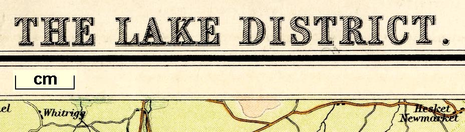
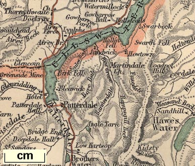
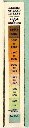
Plate 9 'Orographical Features, section 1' scale about 10 miles to 1 inch, shows relief, by layer colouring, for the north west of England. Plate 18 'Carlisle', includes all of Cumberland, and parts of Northumberland, Durham, North Yorkshire, and Westmorland. Plate 20 'Morecambe', includes parts of Cumberland, Westmorland, and Lancashire; and an inset map of the Isle of Man. Plate 21 'The Lake District', scale about 3 miles to 1 inch, relief by contours and layer colouring. |
||
|
(map example JandMN (23_18))
|
||
| map feature:- | up is N & scale line & lat and long scales & lat and long grid & index grid & sea tinted & coast line & rivers & lakes & relief & hill hachuring & parks & county & settlements & roads & railways | |
| inscription:- |
printed top, left, centre and right
ROYAL ATLAS OF ENGLAND & WALES / SECTION II. CARLISLE / PLATE 18 |
|
| inscription:- |
printed bottom right
John Bartholomew & Co. Edinr. |
|
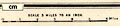
| scale line:- | 12 miles = 75.2 mm | |
| scale:- | 1 to 260000 ? (1 to 256810 from scale line) | |
| wxh, sheet:- | 45.5x35.5cm | |
| wxh, map:- | 424x321mm | |
|
||
|
||
|
||
| sources:- |
JandMN Collection |
|
| items seen (illustrated items in bold):- | ||

|
JandMN (23_9) -- map -- Orographical Features, section 1 | |
|
|
JandMN (23_18) -- map -- Carlisle | |
|
|
JandMN (23_20) -- map -- Morecambe | |
|
|
JandMN (319) -- map -- Lake District, The | |