 Map of the Settle Carlisle Line

|

|
|
|
map type:- Houghton 1948 |
|
|
|
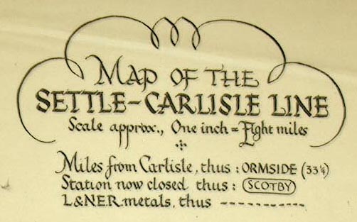
Railway map, Map of the Settle Carlisle Line, scale about
8 miles to 1 inch, by Frederick W Houghton, published by
Norman Arch Publications, Bradford, Yorkshire, 1948.
Tipped in at the back of The Story of the Settle Carlisle Line, by Frederick W Houghton and W Hubert Foster. |
||
|
(example Kendal Library (26))
|
||
| map feature:- | title cartouche & compass rose & up is N & settlements & railways | |
| inscription:- |
printed upper right
MAP OF THE / SETTLE-CARLISLE LINE / Scale approx., One inch = Eight miles. |
|
| scale:- | 1 to 5000000 ? (nominal, approximate) | |
| sources:- |
Kendal Library Maps |
|
| items seen (illustrated items in bold):- | ||

|
Kendal Library (26) -- railway map -- Map of the Settle Carlisle Line | |