 Wood 1821

|

|
|
|
map type:- Wood 1820s-30s |
|
|
|
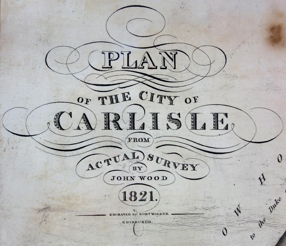
Town plan, uncoloured engraving, Plan of the City of
Carlisle, by John Wood, engraved by Robert Walker,
Edinburgh, published by John Wood, Cannaan, Edinburgh, 1821.
Although only this town map has been seen as yet, other maps have been reported:- Cockemouth - no data; Kendal - reproduction available from Kendal Record Office. Penrith - copy in Carlisle Record Office. Wigton 1832 - illustrated in a New Illustrated History of Wigton by J Higham, published by Bookcase, Carlisle, 1993; |
||
|
(example map)
|
||
| inscription:- |
printed title
PLAN / OF THE CITY OF / CARLISLE / FROM / ACTUAL SURVEY / BY / JOHN WOOD / 1821. / ENGRAVED BY ROBT. WALKER / EDINBURGH |
|
| inscription:- |
printed bottom
Published as the Act Directs, by John Woof, Canaan, Edinburgh |
|

|
||
| sources:- |
British Postal Museum and Archive |
|
| items seen (illustrated items in bold):- | ||

|
British Postal Museum and Archive (11) -- street map -- Plan of the City of Carlisle | |
|
|
KendalRO (4) -- street map -- Plan of Kendal | |