 Skrine 1801

|

|
|
|
map type:- Skrine 1801 |
|
|
|
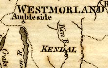
Map, rivers in Cumberland, Westmorland, Lancashire and
Cheshire, scale about 23 miles to 1 inch, by Henry Skrine,
published by P Elmsly, London, 1st edn 1801.
Included in A General Account of all the Rivers of Note in Great Britain, with their several courses, their peculiar characters, the countries through which they flow, and the entire sea coast of our island ... |
||
|
(example JandMN (421))
|
||
| map feature:- | north point & up is N & scale line & sea plain & coast shaded & rivers & lakes & county & settlements | |
| wxh, sheet:- | 14x2.5cm | |
| wxh, map:- | 102x182mm | |
| inscription:- |
printed with scale line
British Miles |
|
| scale line:- | 30 miles = 33.4 mm | |
| scale:- | 1 to 1400000 ? (1 to 1445519 from scale line) | |
| sources:- |
JandMN Collection |
|
| items seen (illustrated items in bold):- | ||

|
JandMN (421) -- map | |