 Smith 1804

|

|
|
|
map type:- Smith 1804 |
|
|
|
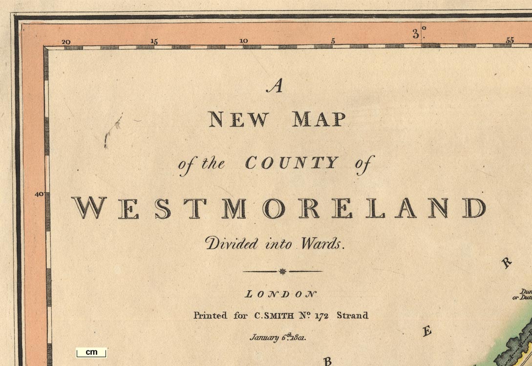
A New Map of the County of Westmorland, scale about 2.5
miles to 1 inch, engraved by Jones and Smith, Pentonville,
and A New Map of the County of Cumberland, scale about 3.5
miles to 1 inch, published by Charles Smith, 172 Strand,
London, 1804; published 1804-46.
Published in 'Smith's New English Atlas being a Complete Set of County maps, Divided into Hundreds. On which are delineated all the Direct and Cross Roads, Part of which are from actual Measurement, Cities, Towns, and most considerable Villages, Parks, Gentlemen's Seats, Rivers, and Navigable Canals: Preceded by a General Map of England and Wales. On which the principal Roads are carefully described, for the purpose of facilitating the Connection of the respective Maps. The whole accompanied by an Index Villaris, containing upwards of Forty Thousand Names of Places mentioned in the Work, with Reference to their Situation. London. Printed for C. Smith, Mapseller, No.172 (Corner of Surrey Street) Strand. 1804. ...' The first edition of the map is dated 1801. The atlas has title page, contents list, an explanation, index and list of subscribers; its size is 13 x 20 1/2 ins. Published in an edition 1808. The date is corrected to 1804, with '2nd Edition Corrected to 1808' added below. Published in editions 1818, 1821, 1827. The date to which the map has been corrected is given. Published in an edition '... Printed for C. Smith, Mapseller extraordinary to His Majesty. No.172, Strand, 1834.' Published in an edition 1846? The date to which it is corrected is 1846, but this might apply to single maps, not the atlas. |
||
|
(map example Kendal Library (1))
|
||
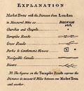
| map feature:- | compass rose & up is N & scale line & lat and long scales & coast form lines & rivers & lakes & relief & hill hachuring & forests & trees & parks & county & wards (hundreds) & settlements & roads & turnpike roads & distances from London & canals & table of symbols & table of wards (hundreds) | |
| inscription:- |
printed
A / NEW MAP / of the COUNTY of / WESTMORLAND / Divided into Wards. / LONDON / Printed for C. SMITH No.172 Strand. / January 6th. 1804. |
|
| wxh, sheet:- | 59.5x50cm | |
| wxh, plate:- | 540x485mm | |
| wxh, map:- | 502x451mm | |
| scale:- | 1 to 150000 ? (1 to 147948 from scale line assuming a statute mile) | |
| scale line:- | 8+1 miles = 97.9 mm | |
| inscription:- |
[... 1804 ... 2nd Edition Corrected to 1808.] 1808 edition |
|
| inscription:- |
[... 1804 ... 3rd Edition. Corrected to 1818.] 1818 edition |
|
| inscription:- |
[Corrected to 1827.] 1827 edition |
|
| inscription:- |
[Corrected to 1834.] 1834 edition |
|
| inscription:- |
[Corrected to 1846.] 1846 edition |
|
|
||
|
||
| references:- |
Smith, Charles: 1804 & 1808 & 1818 & 1821 & 1827 & 1834 &
1846: Smith's New English Atlas: (London) |
|
| sources:- |
Chubb 1927 (CCCXI) JandMN Collection Armitt Library Carlisle Library Maps Kendal Library Maps |
|
| items seen (illustrated items in bold):- | ||

|
Armitt Library : ALMC2008.14.70 -- map -- Westmoreland | |
|
|
Carlisle Library : Map 31 -- map -- New Map of the County of Cumberland | |
|
|
Carlisle Library : Map 173 -- map -- Westmoreland | |
|
|
Carlisle Library : Map 174 -- map -- Westmoreland | |
|
|
Carlisle Library : Map 179 -- map -- Westmoreland | |
|
|
JandMN (72) -- map -- Westmoreland | |
|
|
Kendal Library : Map 102 -- map -- Westmorland | |
|
|
Kendal Library : Map 103 -- map -- Westmorland | |
|
|
Kendal Library : Map 104 -- map -- Westmorland | |
|
|
Kendal Library : Map 105 -- map -- Westmorland | |