 Map of the Lakes in the Counties of Lancashire, Westmoreland
and Cumberland
Map of the Lakes in the Counties of Lancashire, Westmoreland
and Cumberland

|

|
|
|
map type:- Hebert 1816 |
|
|
|
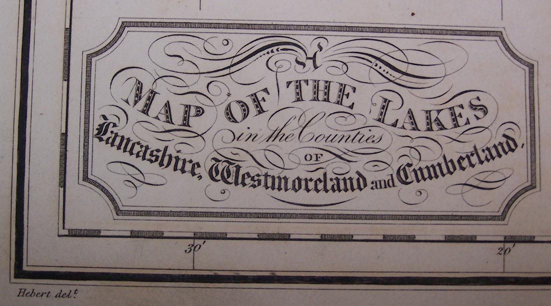
Map of the Lakes in the Counties of Lancashire,
Westmoreland and Cumberland, scale about 3 miles to 1 inch,
drawn by Hebert, engraved by H Mutlow, published by T
Cadell, and W Davies, Strand, London, 1816.
A copy is tipped in with a set of prints, The Lakes of Lancashire, Westmorland, and Cumberland, from drawings by Jospeph Farington. |
||
|
(map example Armitt Library : ALMA359.44)
|
||
| map feature:- | title cartouche & up is N & lat and long scales & lat and long grid & sea plain & coast form lines & rivers & lakes & forests & parks & county & settlements & roads & canals | |
| inscription:- |
printed title cartouche, lower left
A MAP OF THE LAKES / in the Counties / OF / Lancashire, Westmoreland and Cumberland. |
|
| inscription:- |
printed bottom left, right, centre
Hebert delt. / H. Mutlow Sculp. / London. Published by T. Cadell & W. Davis, Strand. |
|
| wxh, sheet:- | 38.5x53cm | |
| wxh, map:- | 301x502mm | |
| scale:- | 1 to 190000 ? (1 to 193462 from latitude scale) | |
| sources:- |
Armitt Library |
|
| items seen (illustrated items in bold):- | ||

|
Armitt Library : 1959.193 -- map -- Map of the Lakes in the Counties of Lancashire, Westmoreland and Cumberland | |
|
|
Armitt Library : ALMA359.44 -- map -- Map of the Lakes in the Counties of Lancashire, Westmoreland and Cumberland | |