 Pearson's Map to the Lake District

|

|
|
|
map type:- Pearson 1900s map |

|
|
|
Pearson's Map to the Lake District, two sheets, Northern
Section and Southern Section, Westmorland, Cumberland etc,
scale about 4 miles to 1 inch, by George Philip and Son,
London, published by C Arthur Pearson, Henrietta Street,
London, 1900s.
Folded and tipped in before the text of Pearson's Gossipy Guide to the English Lakes and Neighbouring Districts. The guide book also includes 6 small maps of areas around lakes, showing the roads for an excursion - Buttermere, Crummock Water and Loweswater; From Windermere to Rydal Water and Grasmere; Round Thirlmere; Round Ullswater; Round Derwent Water; and Round Windermere Lake and Esthwaite Water. |
||
|
(example Armitt Library : A1188.2)
|
||
| map featuire:- | folded (4x2) & up is N & scale line & sea tinted & sandbanks & coast line & foreshore & rivers & lakes & relief & hill hachuring & spot heights & forests & parks & county & settlements & roads & railways & canals & sands roads | |
| inscription:- |
printed top, N section
PEARSON'S MAP TO THE LAKE DISTRICT (NORTHERN SECTION). |
|
| inscription:- |
printed top, S section
PEARSON'S MAP TO THE LAKE DISTRICT (SOUTHERN SECTION). |
|
| inscription:- |
printed bottom left, right, centre
Copyright / George Philip & Son, London & Liverpool / C. ARTHUR PEARSON, LIMITED, LONDON, W.C. |
|
| wxh, N sheet:- | 33x23.5cm | |
| wxh, S sheet:- | 33x24.5cm | |
| wxh, N map:- | 308x206mm | |
| wxh, S map:- | 312x205mm | |
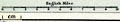
| inscription:- |
printed with scale line
English Miles. |
|
| scale line:- | 10 miles = 62.0 mm | |
| scale:- | 1 to 260000 ? (1 to 259572 from scale line) | |
|
||
| items seen (illustrated items in bold):- | ||

|
Armitt Library : A1188.2 -- map -- Pearson's Map to the Lake District | |
|
|
Armitt Library : A1188.3 -- map -- Buttermere, Crummock Water and Loweswater | |
|
|
Armitt Library : A1188.4 -- map -- From Windermere to Rydal Water and Grasmere | |
|
|
Armitt Library : A1188.5 -- map -- Round Thirlmere | |
|
|
Armitt Library : A1188.6 -- map -- Round Ullswater | |
|
|
Armitt Library : A1188.7 -- map -- Round Derwent Water | |
|
|
Armitt Library : A1188.8 -- map -- Round Windermere Lake and Esthwaite Water | |