 Britannia Antiqua

|

|
|
|
map type:- Horsley 1732 |
|
|
|
Map, Britannia Antiqua, roman Britain, scale about 50
miles to 1 inch, by John Horsley, perhaps 1732.
DATA UNCERTAIN Published in Britannia Romana, 1732? Published, perhaps, as 'Materials for History of Northumberland' in 'Unedited Contributions', 1869. John Horsley 1685-1732, archaeologist, graduated from Edinburgh University 1701. |
||
|
(map example private collection (49))
|
||
| map feature:- | title cartouche & up is N & scale line & scale lines & lat and long scales (trapezoid) & lat and long grid & sea shaded & coast line & rivers & relief & hill hachuring & tribal areas & settlements | |
| inscription:- |
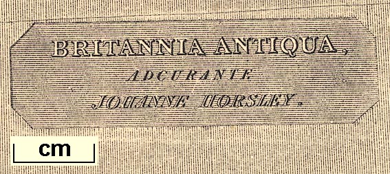
printed title cartouche, upper right
BRITANNIA ANTIQUA, / ADCURANTE / JOHNANNE HORSLEY. |
|
| wxh, sheet:- | 25x24.5cm | |
| wxh, map:- | 185x234mm | |
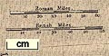
| scale line:- | 60 miles = 30.8 mm | |
| scale:- | 1 to 3100000 ? (1 to 3135086 from scale line) | |
|
||
| sources:- |
JandMN Collection |
|
| items seen (illustrated items in bold):- | ||

|
JandMN (429) -- map -- Britannia Antiqua | |