 Baker 1791-95

|

|
|
|
map type:- Baker 1791-95 |
|
|
|
Maps, Westmoreland, scale about 5.5 miles to 1 inch, and
Cumberland, scale about 8 miles to 1 inch, engraved by
Benjamin Baker, Islington, London, about 1795 and 1791.
Westmoreland was included opposite p.337 in the Universal Magazine of Knowledge and Pleasure, 2nd issue 1795. Cumberland was included opposite p.201 in the Universal Magazine of Knowledge and Pleasure, 2nd issue 1791. Published again, amended, in '[Laurie and Whittle's New and Improved English Atlas, Divided into Counties: shewing Their Respective Situations, Boundaries, and Extent ... Together with An Alphabetical List of the most remarkable Antiquites, Monasteries, Castles, Seats, and Parks ... London: Printed and Published by Robert Lauries and James Whittle, No.53, Fleet-Street, 1807].' A ?compass rose is added to the title panel, obscuring the engraver's name; the imprint of Lauries and Whittle is added at the bottom, dated 1806; there are additional maps to the original series; each map has descriptive text. |
||
|
(map example JandMN (140))
|
||
| map feature:- | title cartouche & oval cartouche & up is N & scale line & lat and long scales (rectangular projection) & coast form lines & rivers & lakes & relief & hill hachuring & woods & trees & forests & parks & county & settlements & roads | |
| inscription:- |
printed shaded oval cartouche, lower right
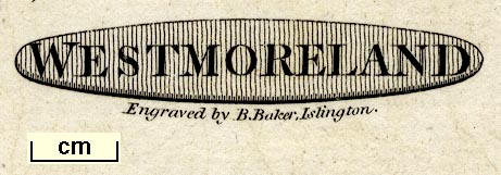
WESTMORELAND |
|
| inscription:- |
printed below title cartouche
Engraved by B. Baker, Islington. |
|
| wxh, sheet:- | 27x21cm | |
| wxh, plate:- | 243x193mm (?) | |
| wxh, map:- | 229x184mm | |
| inscription:- |
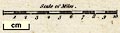
printed above scale line
Scale of Miles |
|
| scale line:- | 10 miles = 44.8 mm | |
| scale:- | 1 to 360000 ? (1 to 359228 from scale line) | |
|
||
| sources:- |
Chubb (CCXCIII and CCXCIV) JandMN Collection Armitt Library Carlisle Library |
|
| items seen (illustrated items in bold):- | ||

|
Armitt Library : ALMC2008.14.22 -- map -- Westmoreland | |
|
|
Carlisle Library : Map 111 -- map -- Cumberland | |
|
|
JandMN (140) -- map -- Westmoreland | |