 Rocque 1746

|

|
|
|
map type:- Rocque 1746 |
|
|
|
Maps, Westmorland, scale about 7.5 miles to 1 inch, and
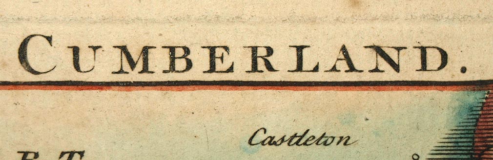
Cumberland, scale about 12 miles to 1 inch, by John Rocque,
published by Thomas Read, London, 1746; published 1746-69.
Published in 'The English Traveller: Giving A Description Of those Parts of Great-Britain Called England and Wales. Containing I. A particular Survey, both Geographical and Historical of every County in the Same. II. An Ample and Accurate Account of all the Cities, Borough,s, market-Towns, Villages, Rivers, Royal-Palaces, Noblemen's and Gentlemen's Seats. III. The Fairs, Trade, Commerce, and Product of each County; of the Rarities both natural and artificial; of the eminent persons born, or who have resided in them, and of the extraordinary Events that have happened in the same. IV. A Map of every County, from the best and latest Observations; wherein are marked the Number of measured Miles, and the usual Roads from one Post-Town to another, after the designs of Herman Moll. V. Of the Isles of Wight, Mana, Jersey, Guernsey, and other British Isles, with the Maps of the same. Vol.[ ] London: Printed for T. Read, in Dogwell Court, White-Fryars, Fleet-street. MDCCXLVI.' ie 1746. the map and description might have been published in a weekly series a little before 1746. Published in 'The Small British Atlas: Being a new Set of Maps of all the Counties of England and Wales: to which is added a general Map, with Tables of Length, Breadth, Area, Cities, Boroughs and Parishes in each County. Likewise a Parliamentary map of England, with Tables of the Produce of the Land-Tax. A Scheme of the Proportion the several Counties paid to the three Shilling Aid, 1699, compared with the Number of Members they send to Parliament. Publish'd according to Act of Parliament, by John Rocque, Chorographer to His Royal Highness the Prince of Wales, near Old Round Court in the Strand.' and on the facing title page 'Le Petit Atlas Britannique: Ou receuil des Provinces d'Angleterre & de la principaute de Galles ... Publie par Jean Rocque, Chorographe de son Altesse Roiale Monseigneur le Prince de Galles, dans le Strand, a Londres.' about 1753. The map is revised by John Rocque, in particular the roads are thickened and the scale line revised. Published in another edition 'The Small British Atlas ... London Published according to Act of Parliamt. 1753. By John Rocque ... near Old Round Court in the Strand.' and a title page in French 'Le Petit Atlas Britannique ...'. Published in another edition 'The Small British Atlas ... London Published according to Act of Parliamt. 1753. By John Rocque ... near Old Round Court in the Strand, and Robert Sayer, Map and Printseller, at the Golden buck, opposite Fetter Lane, Fleet-Street.' and a title page in French. The map is unchanged in the later 1753 editions. Published in 'The Small British Atlas ... Published according to Act of Parliamt. By John Rocque ... near Old Round Court in the Strand 1762.' The atlas is published by John's widow Mary Rocque; the map now has plate number 47 outside the border top right. Published in 'The Small British Atlas ... Published according to Act of Parliamt. By John Rocque ... near Old Round Court in the Strand 1764.' The atlas is published by Mary Rocque; the map now has plate number 14 outside the border top right. Published in 'England Displayed. Being a New, Complete, and Accurate Survey and Description of the Kingdom of England, and Principality of Wales. Containing, I. A full and ample Account of whatever is remarkable in every County, City, Town, Village, hamlet, and Parish in England and Wales. II. Description of the various Manufactures and other useful Arts established in different Parts of this Kingdom. III. Accounts of the Nature and Produce of the various Kinds of Land, with a complete History of the modern Improvements in Agriculture, Gardening, &c. IV. An historical Account of all the Forts, Castles, Roman Military Ways, Docks, Harbours, Creeks, Bays, &c. with the Particulars of their ancient and present State. V. A full Description of all the natural and artificial Curiosities of this Kingdom; such as Rocks, Mines, Caverns, Lakes, Grottos, Fossils, Minerals, Abbeys, Cathedrals, Churches, Palaces, and the Seats of the Nobility and Gentry. VI. A faithfull Narrative of all Improvements made in the Roads, Rivers, and canals of this Kingdom. for the Convenience of Travelling, and the Benefit of Inland Navigation. The whole forming such an accurate and comprehensive Account of this Country, as has never yet been published, and will be equally entertaining and instructive. By a Society of Gentlemen: Each of whom has undertaken that Part for which his Study and Inclination has more immediately qualified him. The Particulars respecting England, revised, corrected, and improved, By P. Russell, Esq.; and those relating to Wales, By Mr. Owen Price. ... London: Printed for the Authors, by Adlard and Browne, Fleet-Street: And sold by S. Bladon, No.28. T. Evans, No.54, and J. Coote, No.16, in Pater-noster Row; W. Domville, and F. Blythe, at the Royal Exchange. MDCCLXIX.' ie 1769. The topography has title page, preface and 3-400 pages of text in each of two volumes, it was first issued in weekly parts from 1769; its size is 8 1/2 x 14 1/4 ins; the text for a county is placed with its map. |
||

|
Moll 1724 | |
|
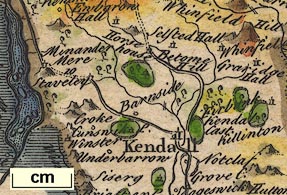
(map example, Wmd, JandMN (11))
|
||
| map feature:- | compass rose & up is N & scale line & sea plain & coast shaded & rivers & relief & hillocks & parks & county & settlements & roads | |
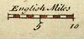
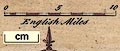
| scale line:- | 10 miles = 33.1 mm | |
| scale:- | 1 to 490000 ? (1 to 486207 from scale line) | |
| wxh, sheet:- | 26.5x18.5cm | |
| wxh, map:- | 196x158mm | |
|
||
|
||
| references:- |
Rocque, John (?): 1746: English Traveller: Read, Thomas
(London) Rocque, John (?): 1753: Small British Atlas & Petit Atlas Britannique: Rocque, John (London) Rocque, John (?): 1762 & 1764: Small British Atlas: Rocque, Mary (London) Russell, P & Price, Owen (et al): 1769: England Displayed: Bladon, S & Evans, T & Coote, J & Domville, W & Blythe, F (London) |
|
| sources:- |
Chubb 1927 (CLXXXV) Chubb 1927 (CCVII) Hodson 1984 JandMN Collection Armitt Library Wordsworth Trust Collection Kendal Library Maps Carlisle Library Maps |
|
| items seen (illustrated items in bold):- | ||
|
|
Armitt Library : ALMC2008.14.18 -- map -- Westmorland | |
|
|
Carlisle Library : Map 320 -- map -- Cumberland | |
|
|
Carlisle Library : Map 331 -- map -- Cumberland | |
|
|
Dove Cottage : 2007.38.38 -- map -- Westmorland | |
|
|
JandMN (11) -- map -- Westmorland | |
|
|
Kendal Library : Map 9 -- map -- Westmorland | |
|
|
Kendal Library : Map 57 -- map -- Westmorland | |