 Rocque 1746

|

|
|
|
item:- JandMN (11) image:- © see bottom of page |
click to enlarge |
|
|
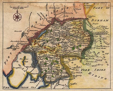
Map, hand coloured engraving, Westmorland, scale about
miles 7.5 to 1 inch, by John Rocque, 1746, published Strand,
London, 1753.
Published in The Small British Atlas: Being a new Set of Maps of all the Counties of England and Wales, about 1753. |
||

|
Rocque 1746 | |
| map feature:- | compass rose & up is N & scale line & sea plain & coast shaded & rivers & relief & hillocks & parks & county & settlements & roads | |
| scale line:- | 10 miles = 33.1 mm | |
| scale:- | 1 to 490000 ? (1 to 486207 from scale line) | |
| wxh, sheet:- | 26.5x18.5cm | |
| wxh, map:- | 196x158mm | |
|
|
notes | |