 England and Wales

|

|
|
|
map type:- Kitchin 1784 |
|
|
|
Map of Great Britain, England and Wales, scale about 27
miles to 1 inch, surveyed by Thomas Kitchin, published in
the New and Complete British Traveller, Walpoole, 1784.
|
||
|
(map example HMCMS:FA1997.116)
|
||
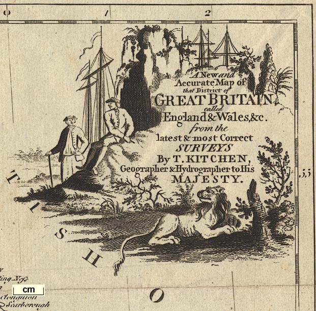
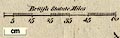
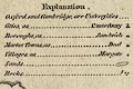
| map feature:- | title cartouche & compass rose (fairly plain, north indicated by fleur de lys, east by a cross) & scale line (statute miles) & lat and long scales & lat and long grid & table of symbols (different sizes of settlement, sand and rocks) | |
| inscription:- |
printed title cartouche
A New and / Accurate Map of / that District of / GREAT BRITAIN, / called England & Wales. &c. / from the / latest & most Correct / SURVEYS / by T. KITCHEN, / Geographer & hydrographer to His / MAJESTY. landscape with ships, travellers, and a lion! |
|
| inscription:- |
printed top/bottom
Engraved for WALPOOLE's New & Complete BRITISH TRAVELLER. / N.B. The New & Correct MAPS of SCOTLAND, IRELAND, &c. will be given COMPLETE in the Course of the Publication. |
|
| wxh, plate:- | 34.5x39cm | |
| scale:- | 1 to 1700000 ? (estimated) | |
|
||
|
||
| references:- |
Walpoole: 1784: New and Complete British Traveller |
|
| sources:- |
HMCMS Map Collection private collection |
|
| items seen (illustrated items in bold):- | ||

|
private collection (48) -- map -- Great Britain, England and Wales -- New and Complete British Traveller | |