 Stanford 1885

|

|
|
|
map type:- Stanford 1885 |
|
|
|
Maps, Westmorland, Cumberland, both scale about 8 miles
to 1 inch, published by Edward Stanford, Stanford's
Geographical Establishment, 55 Charing Cross, London, 1885.
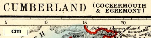
Included in Stanford's Parliamentary County Atlas of England and Wales, constructed on the basis of the Ordnance Survey and the Census; produced by lithographic transfer from Stanford's Library Map of England and Wales, 1881? Page 31 or X.40b, Cumberland, Cockermouth and Egremont. Page 30 or X.40a, Cumberland, Eskdale and Penrith. Page 68 or X.41, Westmorland. An unusual feature is that 'A scale of miles is engraved around the borders of all the County maps, ...'. |
||
|
(example JandMN (312))
|
||
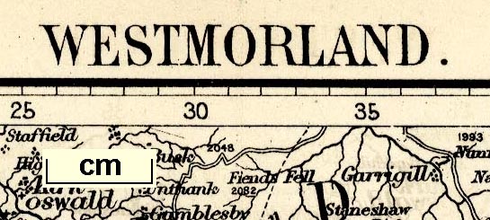
| map feature:- | up is N & scale line (all borders are graduated in miles) & lat and long grid (?) & sea plain & coast tinted & rivers & lakes & forests & county & settlements & roads & railways & canals | |
| inscription:- |
printed top right
68 / X.41. sheet numbers |
|
| inscription:- |
printed top
WESTMORLAND. |
|
| inscription:- |
printed bottom right, centre
Stanford's Geographical Estabt. / London : Edward Stanford, 55 Charing Cross. |
|
| inscription:- |
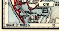
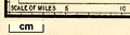
printed border scale line
SCALE OF MILES |
|
| scale line (bottom border):- | 62 miles = 202.1 mm | |
|
||
|
||
| sources:- |
Smith 1985 (LIII) JandMN Collection |
|
| items seen (illustrated items in bold):- | ||

|
JandMN (310) -- map -- Cumberland, Eskdale and Penrith | |
|
|
JandMN (311) -- map -- Cumberland, Cockermouth and Egremont | |
|
|
JandMN (312) -- map -- Westmorland | |