 Plan of Solway Moss

|

|
|
|
map type:- Bowen 1779 |
|
|
|
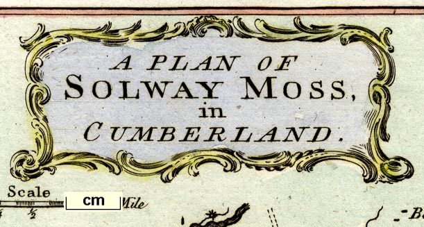
A Plan of Solway Moss, scale about 1 inch to 1 mile, by
Thomas Bowen, published by D Henry, St John's Gate, London,
February 1779.
Tipped in opposite p.65 of the Gentleman's Magazine, by Sylvanus Urban. The map accompanies a report of the eruption of the moss, November 1771, by JF. |
||
|
(example Carlisle Library (142))
|
||
| map feature:- | title cartouche & scroll cartouche & north point & up is NW (WNW) & scale line & rivers & settlements & roads | |
| inscription:- |
printed scroll cartouche, upper middle
A PLAN OF / SOLWAY MOSS, / in / CUMBERLAND. |
|
| inscription:- |
printed bottom right
T. Bowen Sculpt. |
|
| wxh, sheet:- | 13x21cm | |
| wxh, map:- | 104x127mm | |
| inscription:- |
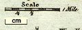
printed with scale line
Scale / 1 Mile |
|
| scale line:- | 1 mile = 24.7 mm | |
| scale:- | 1 to 65000 ? (1 to 65156 from scale line, assuming a statute mile) | |
|
||
| sources:- |
Wordsworth Trust Collection Carlisle Library Maps |
|
| items seen (illustrated items in bold):- | ||

|
Carlisle Library : Map 46 -- map -- Plan of Solway Moss | |
|
|
Dove Cottage : 2009.81.2 -- map -- Plan of Solway Moss | |